Enable Location

We need your location to show you interesting places around you

Discover nearby places

Find interesting locations and hidden gems around you

Precise directions

Get accurate directions and distances to places

Your location is never shared with other users. It's only used when you tap the location button.

Rừng Sác Road

Log in to your account

Start exploring — it's free

Trusted by 61,463 travelers worldwide

Continue with Google
Continue with Apple
or

We will send you a code to connect

By continuing, you accept our Terms and Conditions and our Privacy Policy

Check your inbox

We've sent a pincode in your inbox. Please enter the code below.

Rừng Sác Road

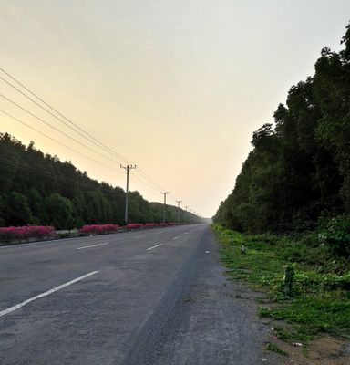
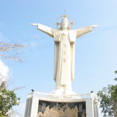
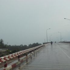
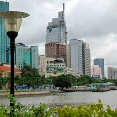
Rừng Sác Road, Military road through mangrove forests in Can Gio, Vietnam.

Description

Rừng Sác Road connects Ho Chi Minh City to the coastal district of Cần Giờ, stretching through dense mangrove forests with numerous water channels for several kilometers. The route is relatively narrow with water on both sides and scattered settlements adapted to the natural surroundings.

History

The route served as a vital supply line during the Vietnam War from 1960 to 1975, linking military positions to outposts within the mangrove region. After the war, the route was gradually reopened for civilian use and reshaped into a connection for local communities.

Culture

Fishing families have long used this route to reach their daily catch and live in simple homes built directly over the water. The way people move along the path and work the channels reflects rhythms tied to tides and seasons that have shaped life here for generations.

Practical

The best time to visit is from November to April when conditions are drier and roads are more passable. Organized tours are the most practical way to explore the area since local guides know the water routes and points of interest.

Did you know?

A short boat trip from the road leads to Monkey Island, where wild primates live within the mangrove landscape. Visitors can often spot these animals in their natural setting, offering a rare glimpse into local wildlife.

Location
Location
GPS coordinates
10.40786,106.89834
Latest update
December 12, 2025 09:03

AroundUs brings together thousands of curated places, local tips, and hidden gems, enriched daily by 60,000 contributors worldwide. Discover all places nearby (Ho Chi Minh City).

« Rừng Sác Road - Military road through mangrove forests in Can Gio, Vietnam » is provided by Around Us (aroundus.com). Images and texts are derived from Wikimedia project under a Creative Commons license. You are allowed to copy, distribute, and modify copies of this page, under the conditions set by the license, as long as this note is clearly visible.

Discover hidden gems everywhere you go!

From secret cafés to breathtaking viewpoints, skip the crowded tourist spots and find places that match your style. Our app makes it easy with voice search, smart filtering, route optimization, and insider tips from travelers worldwide. Download now for the complete mobile experience.

Around Us App Screenshot

A unique approach to discovering new places

Le Figaro

All the places worth exploring

France Info

A tailor-made excursion in just a few clicks

20 Minutes

Around Us
Travel Guide & Maps
Download

Send to your phone

QR Code
1

Open the camera app on your mobile.

2

Point at the QR code with your camera. A notification will appear.

3

Tap the notification to open the link.