Enable Location

We need your location to show you interesting places around you

Discover nearby places

Find interesting locations and hidden gems around you

Precise directions

Get accurate directions and distances to places

Your location is never shared with other users. It's only used when you tap the location button.

Wallanlage

Log in to your account

Start exploring — it's free

Trusted by 61,339 travelers worldwide

Continue with Google
Continue with Apple
or

We will send you a code to connect

By continuing, you accept our Terms and Conditions and our Privacy Policy

Check your inbox

We've sent a pincode in your inbox. Please enter the code below.

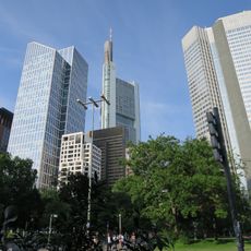
Wallanlage, Medieval fortification structure in Frankfurt, Germany

Description

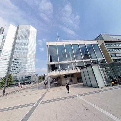
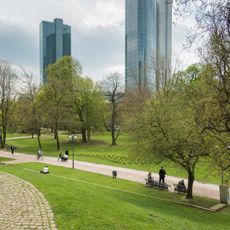
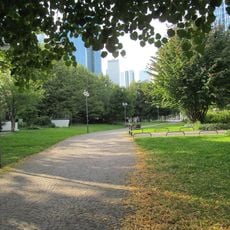
Wallanlage is a circular green belt that encircles Frankfurt's inner city, made up of seven named sections that follow the path of the former city wall. The route links different parks and open spaces into one continuous route around the historic center.

History

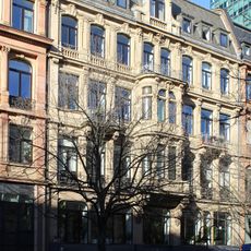
The fortifications began as defensive walls built after 1333 when Frankfurt was allowed to expand its boundaries. In the early 1800s, military authorities cleared these structures and created a public green space, marking a shift in how cities used their urban edges.

Culture

The seven sections are named after the former city gates that once controlled entry into Frankfurt's medieval center. Today, people use this green strip as a place to walk, rest, and meet neighbors in their daily routines.

Practical

Multiple entry points make it easy to access any section without having to walk the entire circuit. It is best to visit during daylight hours, as the path becomes less clear and less comfortable when dusk falls.

Did you know?

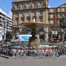
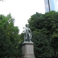
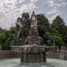
Few visitors notice the artworks scattered along the route, including sculptures by known artists and fountains from different eras. These pieces tell stories about Frankfurt's past and add layers of interest to what might seem like a simple walk.

Location
Address
GallusanlageTaunustorKaiserstraße
GPS coordinates
50.10947,8.67303
Latest update
December 6, 2025 17:46

AroundUs brings together thousands of curated places, local tips, and hidden gems, enriched daily by 60,000 contributors worldwide. Discover all places nearby (Frankfurt).

Photography spots in Frankfurt

Frankfurt places you between centuries of history and one of Europe's tallest skylines. Medieval half-timbered houses at the Römer share the horizon with glass and steel towers that define the financial district. The Main Tower's observation deck shows you this contrast from above, while bridges...

« Wallanlage - Medieval fortification structure in Frankfurt, Germany » is provided by Around Us (aroundus.com). Images and texts are derived from Wikimedia project under a Creative Commons license. You are allowed to copy, distribute, and modify copies of this page, under the conditions set by the license, as long as this note is clearly visible.

Discover hidden gems everywhere you go!

From secret cafés to breathtaking viewpoints, skip the crowded tourist spots and find places that match your style. Our app makes it easy with voice search, smart filtering, route optimization, and insider tips from travelers worldwide. Download now for the complete mobile experience.

Around Us App Screenshot

A unique approach to discovering new places

Le Figaro

All the places worth exploring

France Info

A tailor-made excursion in just a few clicks

20 Minutes

Around Us
Travel Guide & Maps
Download

Send to your phone

QR Code
1

Open the camera app on your mobile.

2

Point at the QR code with your camera. A notification will appear.

3

Tap the notification to open the link.