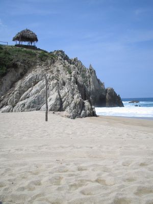
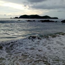
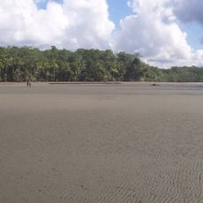
Playa Maruata, Pacific beach in Maruata, Mexico
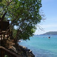
Playa Maruata consists of three distinct beach sections, each with different water conditions: an eastern area with calm waves, a middle part featuring caves, and a western zone where currents are stronger. This diversity creates different experiences along the shoreline.
This coastal area has long served fishing communities as a source of food and income for their survival and development. The region's connection to the Pacific has shaped settlement patterns and economic activity in Michoacán for a long time.
Local fishing families depend on these waters for their livelihood, maintaining practices passed down through generations. The beach remains central to how the community sustains itself daily.
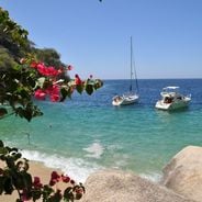
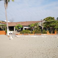
Basic facilities are available in the town center, including seafood restaurants, shops, and accommodations from camping to cabañas. Plan according to which beach section you want to visit, as conditions vary significantly and each area requires different preparation.
Green sea turtles arrive between July and December to lay their eggs along the protected shoreline. This makes it an important nesting ground for these remarkable marine animals.
Location: Maruata
GPS coordinates: 18.27120,-103.34359
Latest update: December 6, 2025 19:06
Mexico has beaches that stay away from the crowds of common tourist spots. They stretch from the sheltered bays of Quintana Roo, where sea turtles come to lay eggs, to the quiet coasts of Baja California Sur. These places keep their natural feel: clear waters, coral reefs filled with colorful fish, and the daily rhythm of local fishermen. To get to many of these beaches, you need to take a boat or walk along a trail, making them places only the truly curious travel to. In the south of the country, near Jalisco and Guerrero, other beaches remain wild. They offer white or gray sandy shores lined with limestone rocks or rainforests. Small fishing villages along the coast stay authentic: the residents sell their catch directly on the sand, and seafood restaurants serve fresh catches. There are no large hotel complexes or busy coastal roads. Most visitors here are looking for quiet and nature, away from the busy seaside resorts.
Parícutin
178.2 km
Nevado de Colima National Park
134.8 km
Pico de Tancítaro
167 km
Barranca del Cupatitzio National Park
185.3 km
La Campana
118 km
Salto La Tzaráracua
179.6 km
Estadio Olímpico Universitario de Colima
114.9 km
St. Joseph Cathedral, Ciudad Guzmán
159.9 km
Plaza de toros Alberto Balderas
198.4 km
Cathedral Basilica of Our Lady of Guadalupe
115.5 km
Holy Trinity Cathedral, Autlán
198.7 km
Immaculate Conception Cathedral, Apatzingán
138.3 km
Estadio Colima
114.7 km
Museo Universitario de Artes Populares María Teresa Pomar
115.9 km
Mansión del Cupatitzio
185.8 km
Santiago Apóstol Temple
200.1 km
Museo Regional de Historia de Colima
115.5 km
Porto de Manzanillo
134.5 km
Museo Comunitario de la Sal
106.2 km
Playa Quieta
192.1 km
Museo Arqueológico de la Costa Grande
202 km
Playa Las Gatas
203.1 km
Playa la Llorona
17.5 km
Puente del Diablo, Buenavista
137.6 km
Church of San Juan Parangaricutiro
181.8 km
Capilla de Nuestra Señora del Refugio de Nogueras
124.4 km
Barra del Capire
161.2 km
Teatro Hidalgo
115.7 kmVisited this place? Tap the stars to rate it and share your experience / photos with the community! Try now! You can cancel it anytime.
Discover hidden gems everywhere you go!
From secret cafés to breathtaking viewpoints, skip the crowded tourist spots and find places that match your style. Our app makes it easy with voice search, smart filtering, route optimization, and insider tips from travelers worldwide. Download now for the complete mobile experience.
A unique approach to discovering new places❞
— Le Figaro
All the places worth exploring❞
— France Info
A tailor-made excursion in just a few clicks❞
— 20 Minutes