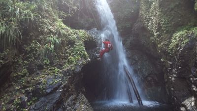
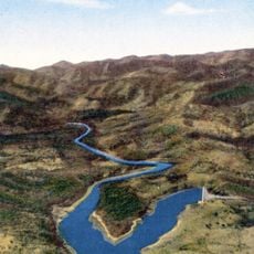
Salto Fino, 305-meter waterfall in Baracoa, Cuba.
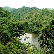
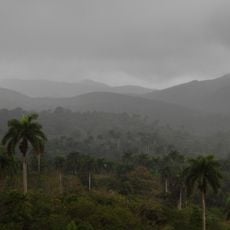
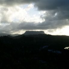
The waterfall consists of multiple cascades dropping through steep inclines, forming part of the Arroyo del Infierno stream in northeastern Guantanamo.
Dr. Núñez Jiménez documented the waterfall in 1966 through vertical photographs taken from a helicopter during initial exploration missions.
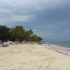
The waterfall forms an integral part of the Quiviján-Duaba-Yunque de Baracoa Ecological Reserve, which maintains the natural heritage of the region.
Reaching Salto Fino requires transportation from Havana to Guantanamo by train, followed by a local vehicle to access the hiking trails.
The water originates at 600 meters elevation and flows through eight primary cascades before joining twenty smaller drops along the Quibiján River.
Location: Baracoa
GPS coordinates: 20.29895,-74.65106
Latest update: May 12, 2025 00:15
Cuba combines colonial architecture, tropical landscapes and centuries-old fortifications. From the tobacco fields of Viñales Valley to the colonial towns of Trinidad and Havana, and the waterfalls of Soroa, the island displays its history and natural diversity. The Spanish colonial period left behind fortresses, palaces and cobblestone streets in historic centers. National parks protect karst formations, rainforests and coastal areas. Along the coast lie beaches with turquoise waters and coral reefs. The route passes through different regions of the island, from the mountains of Sierra Maestra to the cayos off the northern coast. Each location shows a different aspect of Cuban culture and nature, whether in the streets of Santiago de Cuba or in the caves of Bellamar.
Santa Ifigenia Cemetery
127.7 km
Castillo de San Pedro de la Roca
132.6 km
Guardalavaca
153.3 km
Alexander von Humboldt National Park
31.4 km
Baconao
88.5 km
Sierra Cristal National Park
90.2 km
El Yunque, Cuba
9.9 km
El Chorro de Maita
149.5 km
Cathedral Basilica of Our Lady of the Assumption, Santiago de Cuba
127 km
Cuchillas del Toa
5.9 km
Archaeological Landscape of the First Coffee Plantations in the South-East of Cuba
83 km
St. Catherine of Ricci Cathedral, Guantánamo
60.2 km
Jardín de los Helechos de Santiago de Cuba
125.8 km
Punta Maisí Lighthouse
53.4 km
Parque Céspedes
127 km
Windward Point Light
70.1 km
Phare de l'île de la Tortue
177.8 km
Reserva Ecológica Baitiquirí
37.8 km
Great Inagua Lighthouse
123.9 km
Morro Santiago de Cuba Lighthouse
132.5 km
Cabo Lucrecia Lighthouse
132.6 km
Playa Daiquirí
111.8 km
Playa de Toa
16.1 km
Museo Municipal Emilio Bacardi Moreau
126.8 km
Las Salinas Baitiquirí
36.2 km
Playa Damajayabo
113.1 km
Charco Mono reservoir
143.2 km
Playa Siboney
116.2 kmReviews
Visited this place? Tap the stars to rate it and share your experience / photos with the community! Try now! You can cancel it anytime.
Discover hidden gems everywhere you go!
From secret cafés to breathtaking viewpoints, skip the crowded tourist spots and find places that match your style. Our app makes it easy with voice search, smart filtering, route optimization, and insider tips from travelers worldwide. Download now for the complete mobile experience.
A unique approach to discovering new places❞
— Le Figaro
All the places worth exploring❞
— France Info
A tailor-made excursion in just a few clicks❞
— 20 Minutes