Enable Location

We need your location to show you interesting places around you

Discover nearby places

Find interesting locations and hidden gems around you

Precise directions

Get accurate directions and distances to places

Your location is never shared with other users. It's only used when you tap the location button.

Trailhead: Gunung Datuk

Log in to your account

Start exploring — it's free

Trusted by 62,464 travelers worldwide

Continue with Google
Continue with Apple
or

We will send you a code to connect

By continuing, you accept our Terms and Conditions and our Privacy Policy

Check your inbox

We've sent a pincode in your inbox. Please enter the code below.

Trailhead: Gunung Datuk

Trailhead: Gunung Datuk

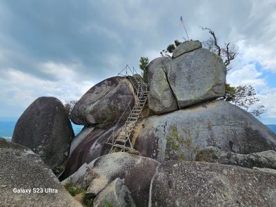
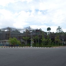
Trailhead: Gunung Datuk is a starting point for climbing a mountain in Rembau, Negeri Sembilan, which rises to about 855 meters and features a distinctive rock formation at its summit. The route begins at the base, winds through thick forest with red and yellow trail markers, then becomes steeper with boulders, roots, and occasional wooden steps or ropes for assistance.

The mountain was named after a gathering held here in 1372 by Dato' Perpatih Nan Sebatang, a significant historical leader. This event established the mountain's place in the region's early administrative history.

The mountain takes its name from Dato' Perpatih Nan Sebatang, a historical leader who held a significant gathering here in 1372. This origins continues to shape how locals view and value the place today.

Start very early in the morning, around 4am, to catch the sunrise and have plenty of daylight for the hike. Wear sturdy footwear with good grip, bring ample water, and be prepared for sudden weather changes as wet rocks become slippery.

A famous footprint-shaped impression on a boulder at the summit is said to have been made by Hang Tuah, a legendary local hero. This striking detail often goes unnoticed by visitors but adds a layer of legend to the place.

The community of curious travelers

AroundUs brings together thousands of curated places, local tips, and hidden gems, enriched daily by 60,000 contributors worldwide.

Start exploring
Location
Address
71350 Kota, Negeri Sembilan, Malaysia
GPS coordinates
2.54310,102.16923
Latest update
February 9, 2026 08:22
« Trailhead: Gunung Datuk » is provided by Around Us (aroundus.com). Images and texts are derived from Wikimedia project under a Creative Commons license. You are allowed to copy, distribute, and modify copies of this page, under the conditions set by the license, as long as this note is clearly visible.

Discover hidden gems everywhere you go!

From secret cafés to breathtaking viewpoints, skip the crowded tourist spots and find places that match your style. Our app makes it easy with voice search, smart filtering, route optimization, and insider tips from travelers worldwide. Download now for the complete mobile experience.

Around Us App Screenshot

A unique approach to discovering new places

Le Figaro

All the places worth exploring

France Info

A tailor-made excursion in just a few clicks

20 Minutes

Around Us
Travel Guide & Maps
Download

Send to your phone

QR Code
1

Open the camera app on your mobile.

2

Point at the QR code with your camera. A notification will appear.

3

Tap the notification to open the link.