Enable Location

We need your location to show you interesting places around you

Discover nearby places

Find interesting locations and hidden gems around you

Precise directions

Get accurate directions and distances to places

Your location is never shared with other users. It's only used when you tap the location button.

Mushroom Rock

Log in to your account

Start exploring — it's free

Trusted by 61,364 travelers worldwide

Continue with Google
Continue with Apple
or

We will send you a code to connect

By continuing, you accept our Terms and Conditions and our Privacy Policy

Check your inbox

We've sent a pincode in your inbox. Please enter the code below.

Mushroom Rock

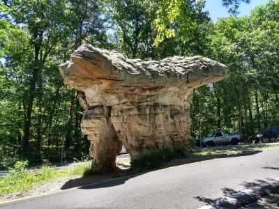
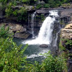
Mushroom Rock, Natural rock formation in DeKalb County, Alabama.

Description

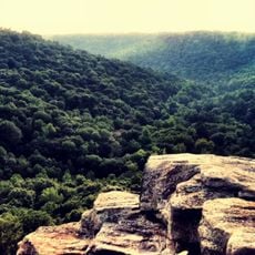
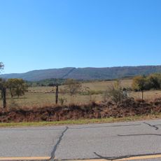
This distinctive geological formation stands prominently along the Little River Canyon Parkway, displaying a mushroom-like silhouette created by thousands of years of natural erosion processes that carved away softer rock layers while preserving the more resistant stone cap.

History

The formation was preserved during the construction of the original scenic drive when road crews chose not to blast it away, instead building the roadway around this natural landmark to maintain it for future generations of visitors to appreciate.

Culture

Local communities have embraced Mushroom Rock as a popular destination for outdoor recreation activities including hiking, photography, and nature observation, making it an integral part of regional eco-tourism and educational programs about Appalachian geology.

Practical

Visitors can access the formation via designated parking areas along Highway 176 with well-marked trails leading to optimal viewing spots, and authorities recommend visiting during morning or late afternoon hours for the best lighting conditions and photography opportunities.

Did you know?

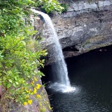
The rock formation is also known locally as Needle Eye Rock due to a distinctive narrow slot at its base, which creates an unusual visual effect and serves as a testament to the complex erosional processes that shaped this natural sculpture over geological time periods.

Location
Address
County Rd 176, Fort Payne, AL 35967, USA
Phone
GPS coordinates
34.37431,-85.63156
Latest update
July 24, 2025 12:47

AroundUs brings together thousands of curated places, local tips, and hidden gems, enriched daily by 60,000 contributors worldwide. Discover all places nearby (DeKalb County).

Around this place
Berry College
United States of America

Berry College

39.1 km
Weiss Lake
United States of America

Weiss Lake

19.4 km
DeSoto State Park
United States of America

DeSoto State Park

13.5 km
Buck's Pocket State Park
United States of America

Buck's Pocket State Park

39.9 km
DeSoto Falls
United States of America

DeSoto Falls

19.8 km
James H. Floyd State Park
United States of America

James H. Floyd State Park

28 km
King Archaeological Site
United States of America

King Archaeological Site

29.6 km
Little River Falls
United States of America

Little River Falls

2.4 km
Cherokee Plantation
United States of America

Cherokee Plantation

13.1 km
Old Union Crossing Covered Bridge
United States of America

Old Union Crossing Covered Bridge

18.1 km
W. B. Davis Hosiery Mill
United States of America

W. B. Davis Hosiery Mill

11.1 km
McLemore Cove
United States of America

McLemore Cove

31.7 km
Winston Place
United States of America

Winston Place

21.7 km
Fort Payne Opera House
United States of America

Fort Payne Opera House

11.1 km
High Falls Park
United States of America

High Falls Park

40 km
Dr. J.A. Gorman House
United States of America

Dr. J.A. Gorman House

22.9 km
Sardis Presbyterian Church and Cemetery
United States of America

Sardis Presbyterian Church and Cemetery

26.3 km
Vance C. Larmore House
United States of America

Vance C. Larmore House

17.5 km
Fort Payne Main Street Historic District
United States of America

Fort Payne Main Street Historic District

11.2 km
Fort Payne Boom Town Historic District
United States of America

Fort Payne Boom Town Historic District

11.2 km
Chattooga County Courthouse
United States of America

Chattooga County Courthouse

28.5 km
Fort Payne Residential Historic District
United States of America

Fort Payne Residential Historic District

11.4 km
United States of America

Penn Place

33.8 km
Pirates Bay Waterpark
United States of America

Pirates Bay Waterpark

19.9 km
Summerville Commercial Historic District
United States of America

Summerville Commercial Historic District

28.5 km
Cave Spring Commercial Historic District
United States of America

Cave Spring Commercial Historic District

40.2 km
William D. Cowdry Plantation
United States of America

William D. Cowdry Plantation

39.5 km
Duke's Alley
United States of America

Duke's Alley

25.1 km
Show the full map
« Mushroom Rock - Natural rock formation in DeKalb County, Alabama » is provided by Around Us (aroundus.com). Images and texts are derived from Wikimedia project under a Creative Commons license. You are allowed to copy, distribute, and modify copies of this page, under the conditions set by the license, as long as this note is clearly visible.

Discover hidden gems everywhere you go!

From secret cafés to breathtaking viewpoints, skip the crowded tourist spots and find places that match your style. Our app makes it easy with voice search, smart filtering, route optimization, and insider tips from travelers worldwide. Download now for the complete mobile experience.

Around Us App Screenshot

A unique approach to discovering new places

Le Figaro

All the places worth exploring

France Info

A tailor-made excursion in just a few clicks

20 Minutes

Around Us
Travel Guide & Maps
Download

Send to your phone

QR Code
1

Open the camera app on your mobile.

2

Point at the QR code with your camera. A notification will appear.

3

Tap the notification to open the link.