James H. Floyd State Park

Log in to your account

AroundUs is a community-driven map of interesting places, built by curious explorers like you. It grows with every review, story, and photo you share.
Connect to save your favorite spots, contribute locations, and create personalized routes.
Continue with Google
Continue with Apple
Continue with X
Continue with Facebook
Continue with email
By continuing, you accept our Terms and Conditions and our Privacy Policy
Create an account
Add to collection
Map
Suggest a change
Share

James H. Floyd State Park, State park in Summerville, United States.

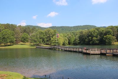
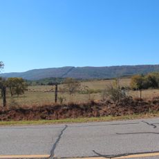
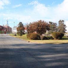
James H. Floyd State Park is a 561-acre park in Summerville featuring two lakes nestled against Taylor Ridge with forest surrounding the open areas. The property includes camping facilities, cabins, picnic zones, and a network of walking trails throughout the grounds.

The area served as a marble quarry during the 1800s before being transformed into a public fishing destination when it opened in 1966. The site received its current name in 1973 when it became an official state park.

The park is named after James H. Floyd, a Georgia House Representative whose name became tied to this area where locals have long gathered for fishing and recreation. Visitors walking through the grounds will notice how the place remains a gathering spot for the community.

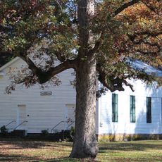
The park has 25 camping sites with electrical and water connections as well as four log cabins and several picnic areas throughout the grounds. Walking trails vary in difficulty and terrain, so visitors should choose routes based on their comfort level and the season.

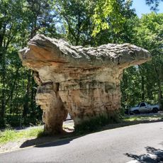
The Marble Mine Trail leads to an abandoned quarry entrance where remnants of the old mining operation remain visible along the path. This quiet spot offers visitors a glimpse into the area's industrial past.

Location: Summerville

Address: 2800 Sloppy Floyd Lake Road Summerville, GA 30747

Phone: +17068570826

Website: https://gastateparks.org/JamesHFloyd

GPS coordinates: 34.43993,-85.33725

Latest update: December 10, 2025 16:26

Photos
Around this place
Berry College
United States of America

Berry College

18.6 km
United States of America

Ellison's Cave

25.2 km
United States of America

Petty John's Cave

25.1 km
DeSoto State Park
United States of America

DeSoto State Park

26.6 km
DeSoto Falls
United States of America

DeSoto Falls

26.2 km
Oak Hill & The Martha Berry Museum
United States of America

Oak Hill & The Martha Berry Museum

23.2 km
King Archaeological Site
United States of America

King Archaeological Site

28.2 km
Little River Falls
United States of America

Little River Falls

27.1 km
Chieftains Museum
United States of America

Chieftains Museum

23.8 km
Marshall Forest
United States of America

Marshall Forest

24.8 km
Clock Tower
United States of America

Clock Tower

25.9 km
Old Union Crossing Covered Bridge
United States of America

Old Union Crossing Covered Bridge

26.2 km
Forum Civic Center
United States of America

Forum Civic Center

25.6 km
McLemore Cove
United States of America

McLemore Cove

22.4 km
Winston Place
United States of America

Winston Place

29.1 km
United States of America

Jackson Hill

25.1 km
Lumpkin Hill
United States of America

Lumpkin Hill

25.5 km
DeSoto Theatre
United States of America

DeSoto Theatre

25.7 km
United States Post Office and Courthouse
United States of America

United States Post Office and Courthouse

25.7 km
Old Shorter Hill
United States of America

Old Shorter Hill

26 km
Dr. J.A. Gorman House
United States of America

Dr. J.A. Gorman House

28.1 km
Blossom Hill
United States of America

Blossom Hill

24.9 km
Sardis Presbyterian Church and Cemetery
United States of America

Sardis Presbyterian Church and Cemetery

19.8 km
Between the Rivers Historic District
United States of America

Between the Rivers Historic District

26 km
Chattooga County Courthouse
United States of America

Chattooga County Courthouse

4.6 km
United States of America

Penn Place

9 km
Summerville Commercial Historic District
United States of America

Summerville Commercial Historic District

4.6 km
Mushroom Rock
United States of America

Mushroom Rock

28 km
Show the full map
Reviews

Visited this place? Tap the stars to rate it and share your experience / photos with the community! Try now! You can cancel it anytime.

« James H. Floyd State Park - State park in Summerville, United States » is provided by Around Us (aroundus.com). Images and texts are derived from Wikimedia project under a Creative Commons license. You are allowed to copy, distribute, and modify copies of this page, under the conditions set by the license, as long as this note is clearly visible.

Discover hidden gems everywhere you go!

From secret cafés to breathtaking viewpoints, skip the crowded tourist spots and find places that match your style. Our app makes it easy with voice search, smart filtering, route optimization, and insider tips from travelers worldwide. Download now for the complete mobile experience.

Around Us App Screenshot

A unique approach to discovering new places

Le Figaro

All the places worth exploring

France Info

A tailor-made excursion in just a few clicks

20 Minutes