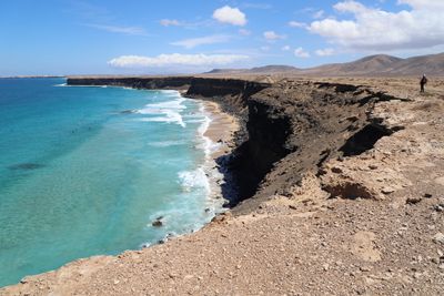
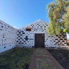
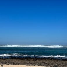
Playa del Águila, Beach in La Gomera, Spain.
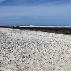
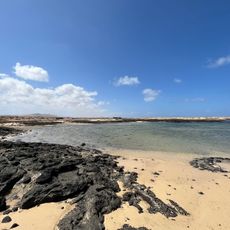
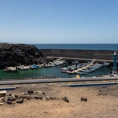
Playa del Águila is a beach on the eastern coast of La Gomera featuring dark volcanic sand, scattered rock formations, and clear waters. The shoreline stretches approximately 650 meters and is framed by steep cliffs that give it a rugged appearance.
The name comes from eagles that once nested in the surrounding cliffs, making the area a natural sanctuary for these birds of prey. Over time, the beach became known for this association with the island's wildlife.
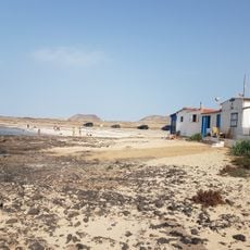
Local fishermen continue their daily work in these waters, using traditional methods that connect them to generations of island seafaring. Their presence shapes how the beach feels and functions as a working community space.
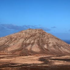
Reaching the beach requires either a 1.5-kilometer hike from Puntallana viewpoint or a drive along an unpaved road with a suitable vehicle. Sturdy footwear is advisable for either route, as the terrain can be uneven and rough.
The beach sits exactly on the boundary between two municipalities: Hermigua and San Sebastián de La Gomera, serving as a natural dividing line. This administrative division is not immediately obvious but shapes how the place is managed locally.
Address: Playa del Águila, Spain
GPS coordinates: 28.64845,-14.02150
Latest update: December 6, 2025 19:02
Fuerteventura, the second largest island in the Canary Islands, is characterized by its diverse landscapes and notable geological features. The island houses spectacular formations such as the white dunes of Corralejo Natural Park, extending over more than 10 kilometers, the 70-million-year-old Ajuy...
Montaña de Tindaya
7.3 km
Calderón Hondo
11.3 km
Casa de los Coroneles
10.5 km
Acua Water Park
17.2 km
Torre del Tostón
3.7 km
Ecomuseo La Alcogida
14.3 km
El Cotillo Beach
4.6 km
Iglesia de Nuestra Señora de la Candelaria
10 km
Tostón Lighthouse
7.5 km
Playa del Castillo
3 km
Playa del Bajo de la Burra
16.6 km
Playa del Majanicho
13 km
Malpaís de la Arena
9.1 km
Hermitage of Nuestra Señora de la Caridad
8.1 km
La Cilla, Museo del Grano
9.9 km
Caleta del Rio
6.9 km
Montaña de Tindaya
9 km
Barranco de los Encantados
3.8 km
Windmill in Tefia
13.8 km
Southeastern windmill on La Montañeta
10.9 km
Windmill in El Cotillo
4 km
Northwestern windmill on La Montañeta
10.7 km
El Cotillo lime kilns
3.7 km
Windmill of Lajares
8.3 km
Ermita de San Antonio de Padua
8.3 km
Punta Blanca
10.5 km
Port of El Cotillo
3.8 km
Ziphius cavirostris skeletal mount in El Cotillo
3.6 kmVisited this place? Tap the stars to rate it and share your experience / photos with the community! Try now! You can cancel it anytime.
Discover hidden gems everywhere you go!
From secret cafés to breathtaking viewpoints, skip the crowded tourist spots and find places that match your style. Our app makes it easy with voice search, smart filtering, route optimization, and insider tips from travelers worldwide. Download now for the complete mobile experience.
A unique approach to discovering new places❞
— Le Figaro
All the places worth exploring❞
— France Info
A tailor-made excursion in just a few clicks❞
— 20 Minutes