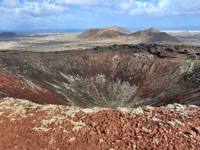
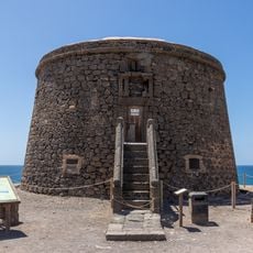
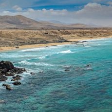
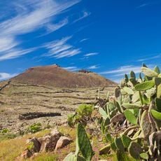
Calderón Hondo, Volcanic crater in Fuerteventura, Spain.
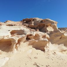
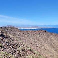
Calderón Hondo is a volcanic crater on Fuerteventura that rises about 278 meters above the northern landscape and stands out for its symmetrical rim. A hiking trail circles the dark cone, allowing visitors to explore its structure from different angles.
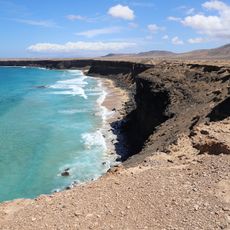
The crater formed roughly 50,000 years ago during a period of intense volcanic activity that shaped the Canary Islands. This era left behind several geological features that characterize the region even today.
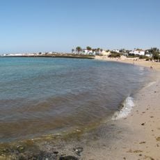
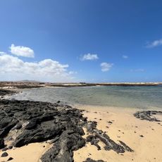
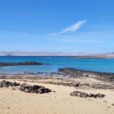
The name refers to the deep hollow that locals recognize as a defining landmark in the terrain. Visitors can observe how the geological features shape the way people interact with the surrounding landscape today.
The hike starts from the parking area at Los Lajares village and follows a circular route to the summit, taking around 45 minutes. Wear sturdy shoes and be prepared for sun exposure, as the trail offers little shade.
The interior walls display yellow sulfur deposits and contain a cavity roughly 70 meters deep that reveals the volcano's geological makeup. These visible mineral formations turn the interior into a window into the island's volcanic processes.
Location: Canary Islands
Elevation above the sea: 278 m
Address: 35650 La Oliva, Las Palmas, Spain
GPS coordinates: 28.69858,-13.92086
Latest update: December 6, 2025 17:42
Fuerteventura, the second largest island in the Canary Islands, is characterized by its diverse landscapes and notable geological features. The island houses spectacular formations such as the white dunes of Corralejo Natural Park, extending over more than 10 kilometers, the 70-million-year-old Ajuy caves, and accessible volcanoes like Calderon Hondo with its 70-meter-deep crater. The coastline offers expansive beaches like the one in Cofete, 12 kilometers long and backed by the Jandía mountains, as well as Lobos Island, a volcanic nature reserve with black sand beaches. Beyond its natural assets, Fuerteventura offers cultural experiences such as the Grain Museum, which traces the island's agricultural history, and activities suitable for all ages with Oasis Park with 3,000 animals or Aqua Water Park in Corralejo. The island's climate allows visits year-round, with mild temperatures and ample sunshine promoting exploration of its natural parks, historical sites, and preserved coastline.
Corralejo Natural Park
7.1 km
Casa de los Coroneles
10.3 km
Acua Water Park
5.9 km
Torre del Tostón
9 km
El Cotillo Beach
9 km
Iglesia de Nuestra Señora de la Candelaria
9.8 km
Tostón Lighthouse
9.3 km
Playa del Castillo
9 km
Playa del Bajo de la Burra
6.3 km
Playa del Majanicho
4.8 km
Malpaís de la Arena
6.6 km
Playa de la Goleta
6.6 km
Playa del Águila
11.3 km
La Cilla, Museo del Grano
9.7 km
Caleta del Rio
9.4 km
Barranco de los Encantados
9.3 km
Windmill in El Cotillo
8.1 km
Southeastern windmill on La Montañeta
8.5 km
Northwestern windmill on La Montañeta
8.4 km
Corralejo Port
7.3 km
El Cotillo lime kilns
9 km
Windmill of Lajares
3.5 km
Ermita de San Antonio de Padua
3.6 km
Playa de la Concha
10.3 km
Punta Blanca
6.1 km
Caldera de Lobos
10.6 km
Port of El Cotillo
9.2 km
Ziphius cavirostris skeletal mount in El Cotillo
9 kmVisited this place? Tap the stars to rate it and share your experience / photos with the community! Try now! You can cancel it anytime.
Discover hidden gems everywhere you go!
From secret cafés to breathtaking viewpoints, skip the crowded tourist spots and find places that match your style. Our app makes it easy with voice search, smart filtering, route optimization, and insider tips from travelers worldwide. Download now for the complete mobile experience.
A unique approach to discovering new places❞
— Le Figaro
All the places worth exploring❞
— France Info
A tailor-made excursion in just a few clicks❞
— 20 Minutes