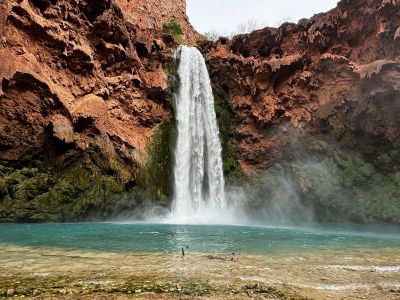
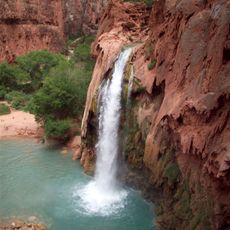
Mooney Falls, Waterfall in Coconino County, US
Mooney Falls is a waterfall in the Arizona canyon country where spring water drops roughly 190 feet into a mineral-rich pool below. The canyon walls show travertine formations that have built up over time as water flowed and deposited minerals.
The waterfall takes its name from D.W. James Mooney, a prospector who died in 1883 attempting to reach the base with inadequate rope. This tragic event marked a turning point in how people began accessing the location.
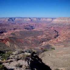
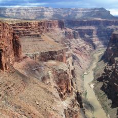
The waterfall sits within Havasupai tribal lands, where the Indigenous community has shaped how the place is visited and cared for over many generations. Their stewardship remains visible in how access is managed and the natural features are protected.
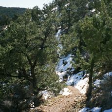
Reach this location by obtaining permission from the Havasupai Tribe, then hiking about 11 miles from the upper parking area down into the canyon system. The final descent involves chains and wooden ladders secured to the rocks, requiring care and comfort with steep terrain.
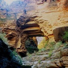
Two passages were blasted through the travertine walls in 1883 to create a route to the base, an impressive early engineering effort that remains part of the descent path today. Visitors walk through these hand-made tunnels as part of their approach to the waterfall.
Location: Coconino County
Address: Supai, AZ 86435, USA
Phone: +19284482121
Website: http://grandcanyon.net/havasupai
GPS coordinates: 36.26318,-112.70858
Latest update: December 14, 2025 20:22
Waterfalls draw you in through your senses. You hear the roar of falling water, feel the mist on your skin, and watch light dance across the spray. Many of the most powerful examples are found in places that stay relatively untouched, where reaching them is half the reward. These destinations give...
Havasu Falls
1.3 km
Isis Temple
53.1 km
Shiva Temple
50.8 km
Toroweap Overlook
31.8 km
Hermit's Rest
50 km
Hermit Trail
50 km
Mount Trumbull Wilderness
40.9 km
Kanab Creek Wilderness
35.9 km
Holy Grail Temple
36.3 km
Lava Falls Trail
34.6 km
Mount Logan Wilderness
44.9 km
Kanab Creek Trail
16 km
South Bass Trail
31.1 km
Tuckup Trail
31.7 km
Royal Arch Route
24.6 km
North Bass Trail
33.4 km
Osiris Temple
48.6 km
Horus Temple
49.7 km
Hermit Canyon
49.5 km
Big Springs Lookout Tower
49.7 km
Brow Monument and Brow Monument Trail
45.9 km
Masonic Temple
32.6 km
Tuna Canyon
41.7 km
Big Springs Ranger Station
49.7 km
Topaz Canyon
45.3 km
Cocopa Point
45.9 km
North Rim Entrance Station
53.7 km
Cameron's Hotel
52.7 kmVisited this place? Tap the stars to rate it and share your experience / photos with the community! Try now! You can cancel it anytime.
Discover hidden gems everywhere you go!
From secret cafés to breathtaking viewpoints, skip the crowded tourist spots and find places that match your style. Our app makes it easy with voice search, smart filtering, route optimization, and insider tips from travelers worldwide. Download now for the complete mobile experience.
A unique approach to discovering new places❞
— Le Figaro
All the places worth exploring❞
— France Info
A tailor-made excursion in just a few clicks❞
— 20 Minutes