Enable Location

We need your location to show you interesting places around you

Discover nearby places

Find interesting locations and hidden gems around you

Precise directions

Get accurate directions and distances to places

Your location is never shared with other users. It's only used when you tap the location button.

Mount Trumbull Wilderness

Log in to your account

Start exploring — it's free

Trusted by 61,996 travelers worldwide

Continue with Google
Continue with Apple
or

We will send you a code to connect

By continuing, you accept our Terms and Conditions and our Privacy Policy

Check your inbox

We've sent a pincode in your inbox. Please enter the code below.

Mount Trumbull Wilderness

Mount Trumbull Wilderness, Protected wilderness area in Mohave County, Arizona.

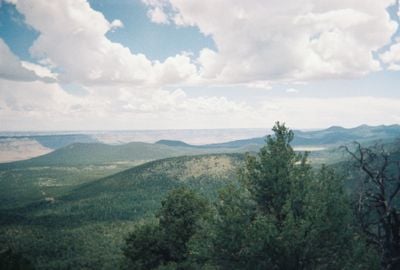
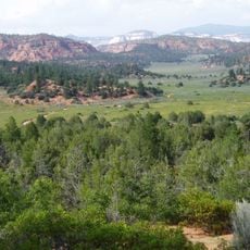
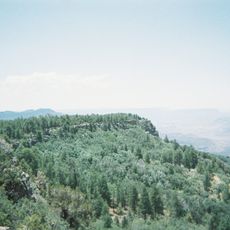
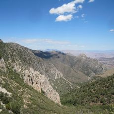
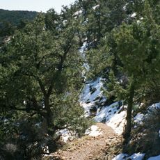
Mount Trumbull Wilderness is a protected area on the Uinkaret Plateau covering roughly 7,880 acres of forest. The slopes support a mix of pinyon pine, juniper, and ponderosa pine trees that create dense woodland throughout the region.

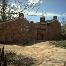
Ancestral Puebloan peoples established settlements in this area centuries ago, leaving behind structures and artifacts. In the 1800s, Mormon settlers arrived and harvested timber from portions of the forest for building and trade.

Native American communities built settlements throughout this area, leaving behind structures and sites visible to those who explore carefully. Walking through the forest, visitors encounter these remnants and understand how people lived here before modern times.

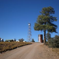
The area is reached via Mount Trumbull Road, which branches off from Arizona Highway 389 and leads to the main entrance. Nixon Spring Campground nearby offers a base for camping if you plan to spend the night.

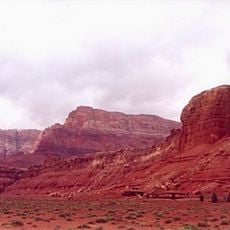
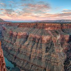
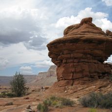
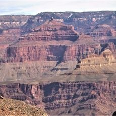
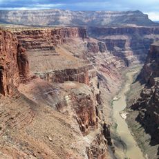
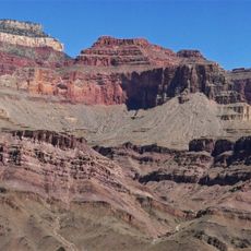
The land rests on a basalt lava flow that erupted roughly 3.6 million years ago, representing one of the first volcanic events in the Uinkaret volcanic field. This ancient volcanic ground shapes the terrain and soil composition visible throughout the area.

The community of curious travelers

AroundUs brings together thousands of curated places, local tips, and hidden gems, enriched daily by 60,000 contributors worldwide.

Start exploring
Location
GPS coordinates
36.40800,-113.12800
Latest update
December 11, 2025 18:09
Around this place
Havasu Falls
United States of America

Havasu Falls

42.2 km
Colin Grand Canyon Skywalk
United States of America

Colin Grand Canyon Skywalk

75.5 km
Coral Pink Sand Dunes State Park
United States of America

Coral Pink Sand Dunes State Park

79 km
Vermilion Cliffs
United States of America

Vermilion Cliffs

63 km
Pipe Spring National Monument
United States of America

Pipe Spring National Monument

61.4 km
Toroweap Overlook
United States of America

Toroweap Overlook

22.5 km
Canaan Mountain Wilderness
United States of America

Canaan Mountain Wilderness

76.2 km
Kanab Creek Wilderness
United States of America

Kanab Creek Wilderness

53 km
United States of America

Black Rock

78.5 km
Holy Grail Temple
United States of America

Holy Grail Temple

75.3 km
Lava Falls Trail
United States of America

Lava Falls Trail

21.2 km
Mount Logan Wilderness
United States of America

Mount Logan Wilderness

12.1 km
Big House
United States of America

Big House

64.8 km
Kanab Creek Trail
United States of America

Kanab Creek Trail

44.7 km
Paiute Wilderness
United States of America

Paiute Wilderness

76 km
South Bass Trail
United States of America

South Bass Trail

71.9 km
Tuckup Trail
United States of America

Tuckup Trail

19.7 km
Royal Arch Route
United States of America

Royal Arch Route

65.5 km
North Bass Trail
United States of America

North Bass Trail

70.4 km
Big Springs Lookout Tower
United States of America

Big Springs Lookout Tower

73.9 km
Brow Monument and Brow Monument Trail
United States of America

Brow Monument and Brow Monument Trail

68.4 km
Masonic Temple
United States of America

Masonic Temple

71.7 km
Horse Valley Ranch
United States of America

Horse Valley Ranch

46.6 km
Big Springs Ranger Station
United States of America

Big Springs Ranger Station

73 km
Thornton Lookout Tower
United States of America

Thornton Lookout Tower

62.8 km
Dry Park Lookout
United States of America

Dry Park Lookout

79.8 km
Pipe Spring National Monument Visitor Center
United States of America

Pipe Spring National Monument Visitor Center

61.5 km
Tuweep Campground
United States of America

Tuweep Campground

21.4 km
Show the full map
« Mount Trumbull Wilderness - Protected wilderness area in Mohave County, Arizona » is provided by Around Us (aroundus.com). Images and texts are derived from Wikimedia project under a Creative Commons license. You are allowed to copy, distribute, and modify copies of this page, under the conditions set by the license, as long as this note is clearly visible.

Discover hidden gems everywhere you go!

From secret cafés to breathtaking viewpoints, skip the crowded tourist spots and find places that match your style. Our app makes it easy with voice search, smart filtering, route optimization, and insider tips from travelers worldwide. Download now for the complete mobile experience.

Around Us App Screenshot

A unique approach to discovering new places

Le Figaro

All the places worth exploring

France Info

A tailor-made excursion in just a few clicks

20 Minutes

Around Us
Travel Guide & Maps
Download

Send to your phone

QR Code
1

Open the camera app on your mobile.

2

Point at the QR code with your camera. A notification will appear.

3

Tap the notification to open the link.