Vermilion Cliffs

Log in to your account

AroundUs is a community-driven map of interesting places, built by curious explorers like you. It grows with every review, story, and photo you share.
Connect to save your favorite spots, contribute locations, and create personalized routes.
By continuing, you accept our Terms and Conditions and our Privacy Policy

Vermilion Cliffs

Add to collection
Map
Suggest a change
Share

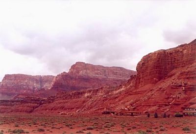
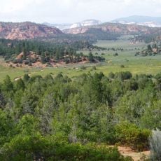
Vermilion Cliffs, Red cliffs in northern Arizona and southern Utah, United States.

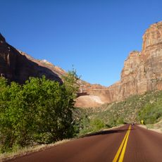
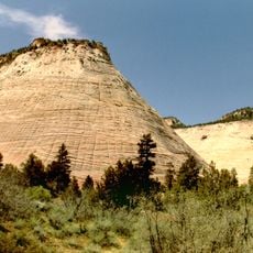
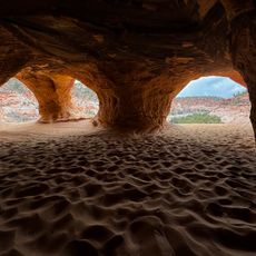
The Vermilion Cliffs stretch along the Colorado Plateau with red and orange sandstone layers stacked above each other rising into the air. The walls show horizontal bands of rock shaped by wind and water over long periods of time.

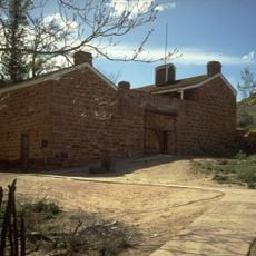
The federal government protected large portions of this terrain in the 1980s as wilderness to limit development and preserve natural processes. Before that, ranchers used the land for grazing while earlier inhabitants left traces in the form of rock art.

The colored rock faces draw photographers who walk out before dawn to capture light shifting across stone layers and sand. Many visitors carry water containers and navigation tools, as routes cross open ground without marked trails.

Visitors should start early to avoid extreme heat and carry several liters of water per person. Some areas require permits with limited daily quotas, so planning ahead is necessary.

Biologists release young condors hatched in captivity here and monitor their movements with transmitters. The large birds circle above the rock faces and use warm updrafts to glide through the air.
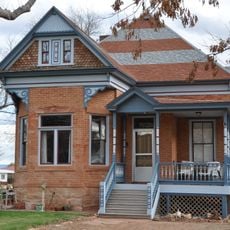
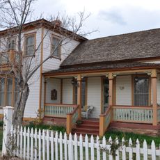
Location: Mohave County

Location: Coconino County

Location: Kane County

Location: Washington County

Elevation above the sea: 1,707 m

GPS coordinates: 36.92528,-112.84194

Latest update: December 5, 2025 22:28

Photos
Natural areas and historic sites in Arizona

Arizona contains geological formations spanning millions of years alongside evidence of Spanish colonial settlement and prehistoric cultures. The landscape includes sandstone canyons such as Antelope Canyon X and Canyon de Chelly National Monument, extensive desert areas with saguaro and organ pipe...

Around this place
Coral Pink Sand Dunes State Park
United States of America

Coral Pink Sand Dunes State Park

16.6 km
Zion Canyon
United States of America

Zion Canyon

30.7 km
Pipe Spring National Monument
United States of America

Pipe Spring National Monument

11.4 km
Zion – Mount Carmel Highway
United States of America

Zion – Mount Carmel Highway

34 km
Moqui Cave
United States of America

Moqui Cave

32.9 km
Checkerboard Mesa
United States of America

Checkerboard Mesa

32.6 km
Canaan Mountain Wilderness
United States of America

Canaan Mountain Wilderness

21.5 km
Big House
United States of America

Big House

7.5 km
Parry Lodge
United States of America

Parry Lodge

31.2 km
Kanab Lodge
United States of America

Kanab Lodge

30.7 km
Rockville Bridge (Rockville, Utah)
United States of America

Rockville Bridge (Rockville, Utah)

31.2 km
Moqui Caverns
United States of America

Moqui Caverns

32.9 km
Rider-Pugh House
United States of America

Rider-Pugh House

31 km
Bowman-Chamberlain House
United States of America

Bowman-Chamberlain House

31.1 km
Chuckwagon Cookout
United States of America

Chuckwagon Cookout

30.6 km
William Derby Johnson, Jr., House
United States of America

William Derby Johnson, Jr., House

31 km
Stewart-Woolley House
United States of America

Stewart-Woolley House

31 km
Canyon Overlook Trail
United States of America

Canyon Overlook Trail

33.6 km
South Campground Comfort Station
United States of America

South Campground Comfort Station

33.4 km
South Campground Amphitheater
United States of America

South Campground Amphitheater

33.4 km
South Entrance Sign
United States of America

South Entrance Sign

33.4 km
Zion Human History Museum
United States of America

Zion Human History Museum

33.9 km
Zion Nature Center-Zion Inn
United States of America

Zion Nature Center-Zion Inn

33.6 km
Zion Canyon Visitor Center
United States of America

Zion Canyon Visitor Center

33.2 km
Pipe Spring National Monument Visitor Center
United States of America

Pipe Spring National Monument Visitor Center

11.6 km
Watchman Campground Amphitheater
United States of America

Watchman Campground Amphitheater

32.9 km
Upper Pine Creek Bridge
United States of America

Upper Pine Creek Bridge

33.2 km
Herbert & Lillian Christensen House
United States of America

Herbert & Lillian Christensen House

32.5 km
Show the full map
Reviews

Visited this place? Tap the stars to rate it and share your experience / photos with the community! Try now! You can cancel it anytime.

« Vermilion Cliffs - Red cliffs in northern Arizona and southern Utah, United States » is provided by Around Us (aroundus.com). Images and texts are derived from Wikimedia project under a Creative Commons license. You are allowed to copy, distribute, and modify copies of this page, under the conditions set by the license, as long as this note is clearly visible.

Discover hidden gems everywhere you go!

From secret cafés to breathtaking viewpoints, skip the crowded tourist spots and find places that match your style. Our app makes it easy with voice search, smart filtering, route optimization, and insider tips from travelers worldwide. Download now for the complete mobile experience.

Around Us App Screenshot

A unique approach to discovering new places

Le Figaro

All the places worth exploring

France Info

A tailor-made excursion in just a few clicks

20 Minutes