Enable Location

We need your location to show you interesting places around you

Discover nearby places

Find interesting locations and hidden gems around you

Precise directions

Get accurate directions and distances to places

Your location is never shared with other users. It's only used when you tap the location button.

Elkhead Reservoir

Log in to your account

Start exploring — it's free

Trusted by 62,556 travelers worldwide

Continue with Google
Continue with Apple
or

We will send you a code to connect

By continuing, you accept our Terms and Conditions and our Privacy Policy

Check your inbox

We've sent a pincode in your inbox. Please enter the code below.

Elkhead Reservoir

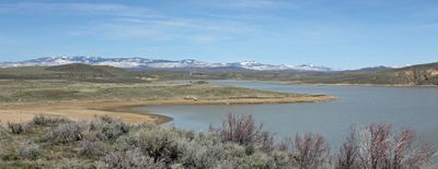
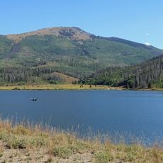
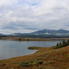
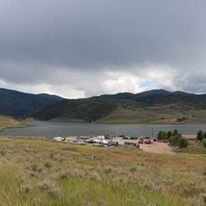
Elkhead Reservoir, body of water

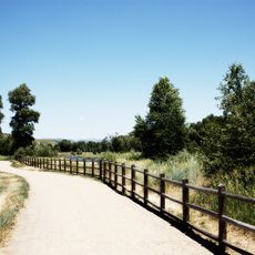
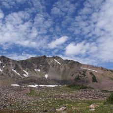
Elkhead Reservoir is a large lake in northwest Colorado surrounded by rolling hills covered with sagebrush and rocky cliffs. The water covers about 900 acres, with over 2,000 acres of land around it that includes trails, campgrounds, and picnic areas, all managed by Colorado Parks and Wildlife.

The dam was built in 1974 to provide water for the town of Craig and nearby power plants. Over time, it became a popular outdoor recreation and nature protection area, especially after upgrades in 2009 that added new roads, picnic spots, beaches, and camping facilities.

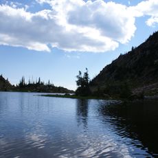
The reservoir takes its name from Elkhead Creek, the stream on which it was built. Locals and visitors alike come here to spend time in nature and observe wildlife in its natural setting. For many people, this place holds meaning as a spot for relaxation and for protecting the animals that live in the region.

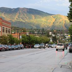
The area is open year-round and has two campgrounds with a total of 42 sites, some with electricity and others without. It is wise to download maps before you arrive and bring enough water and supplies from Craig, as cell service is spotty and on-site services are limited.

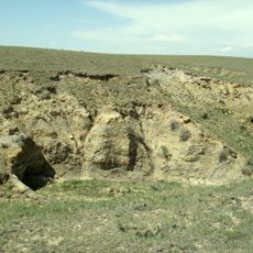
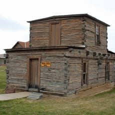
The area has a collection of old tools, tractors, and vehicles that display the history of life before modern technology and help visitors connect with the local past. Volunteers maintain these artifacts and share stories about early explorers and ranchers who built the region.

The community of curious travelers

AroundUs brings together thousands of curated places, local tips, and hidden gems, enriched daily by 60,000 contributors worldwide.

Start exploring
Location
GPS coordinates
40.57800,-107.37400
Latest update
February 9, 2026 07:46
Around this place
Fish Creek Falls
United States of America

Fish Creek Falls

52.1 km
Flat Top Mountain
United States of America

Flat Top Mountain

67.3 km
Laramie Formation
United States of America

Laramie Formation

32.9 km
Flat Tops Wilderness Area
United States of America

Flat Tops Wilderness Area

70.2 km
Pearl Lake State Park
United States of America

Pearl Lake State Park

46.9 km
Mount Werner
United States of America

Mount Werner

55.3 km
Steamboat Lake State Park
United States of America

Steamboat Lake State Park

43.9 km
Stagecoach State Park
United States of America

Stagecoach State Park

54.1 km
Mount Zirkel Wilderness
United States of America

Mount Zirkel Wilderness

60.4 km
Yampa River State Park
United States of America

Yampa River State Park

11 km
Mount Zirkel
United States of America

Mount Zirkel

66.5 km
Crawford House
United States of America

Crawford House

46.4 km
Elkhead State Park
United States of America

Elkhead State Park

2 km
Stagecoach Dam
United States of America

Stagecoach Dam

56.3 km
Jim Baker Cabin
United States of America

Jim Baker Cabin

50.3 km
Christian Science Society
United States of America

Christian Science Society

47 km
St. James Episcopal Church
United States of America

St. James Episcopal Church

75.4 km
Museum of Northwest Colorado
United States of America

Museum of Northwest Colorado

16.3 km
Chamber of Commerce Building (Steamboat Springs, Colorado)
United States of America

Chamber of Commerce Building (Steamboat Springs, Colorado)

46.3 km
First National Bank Building
United States of America

First National Bank Building

46.8 km
Vanatta Apartments
United States of America

Vanatta Apartments

16.1 km
First National Bank Building
United States of America

First National Bank Building

16.3 km
Hayden Rooming House
United States of America

Hayden Rooming House

13.7 km
Meeker Historic District
United States of America

Meeker Historic District

75.6 km
Meeker I.O.O.F. Lodge—Valentine Lodge No. 47
United States of America

Meeker I.O.O.F. Lodge—Valentine Lodge No. 47

75.5 km
Little Snake River Museum
United States of America

Little Snake River Museum

50.4 km
Chief Theatre
United States of America

Chief Theatre

46.7 km
Hahns Peak Lookout
United States of America

Hahns Peak Lookout

47.7 km
Show the full map
« Elkhead Reservoir - body of water » is provided by Around Us (aroundus.com). Images and texts are derived from Wikimedia project under a Creative Commons license. You are allowed to copy, distribute, and modify copies of this page, under the conditions set by the license, as long as this note is clearly visible.

Discover hidden gems everywhere you go!

From secret cafés to breathtaking viewpoints, skip the crowded tourist spots and find places that match your style. Our app makes it easy with voice search, smart filtering, route optimization, and insider tips from travelers worldwide. Download now for the complete mobile experience.

Around Us App Screenshot

A unique approach to discovering new places

Le Figaro

All the places worth exploring

France Info

A tailor-made excursion in just a few clicks

20 Minutes

Around Us
Travel Guide & Maps
Download

Send to your phone

QR Code
1

Open the camera app on your mobile.

2

Point at the QR code with your camera. A notification will appear.

3

Tap the notification to open the link.