Chest opened
+${chestReward.xp} XP
Explorer
NOUVEAU ×${chestReward.collectible.quantity}
tapez pour fermer

See the monuments around you in AR Open chests in the app

Around Us is built for your phone — point your camera at the streets and discover the monuments and places around you in augmented reality. Around Us is built for your phone — chests unlock when you walk, explore and capture nearby places.

•

Enable Location

We need your location to show you interesting places around you

Discover nearby places

Find interesting locations and hidden gems around you

Precise directions

Get accurate directions and distances to places

Your location is never shared with other users. It's only used when you tap the location button.

Ohiopyle High Bridge

Log in to your account

Start exploring — it's free

Trusted by 91,282 travelers worldwide

Continue with Google
Continue with Apple
or

We will send you a code to connect

By continuing, you accept our Terms and Conditions and our Privacy Policy

Check your inbox

We've sent a pincode in your inbox. Please enter the code below.

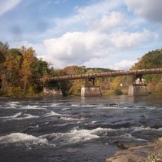
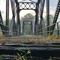
Ohiopyle High Bridge, Railroad footbridge in Ohiopyle State Park, United States.

Ohiopyle High Bridge is a former railroad span that stretches across the Youghiogheny River, connecting both sides of the state park with a deck girder structure. It now serves walkers and cyclists traveling along the Great Allegheny Passage trail system.

Built in 1912 for the Western Maryland Railway, this span once carried train traffic across the river. It was later decommissioned and converted into a public pedestrian and bicycle route.

The bridge serves as an observation point where visitors gather to watch kayakers and rafters navigate the class III and IV rapids below.

Access the bridge from the parking area near Route 381 by heading north along the Great Allegheny Passage trail. The span is open year-round to pedestrians and cyclists looking to cross the river safely.

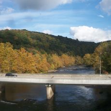
From the bridge's midpoint, you can see both the Railroad Rapids and the winding path of Youghiogheny River Gorge carved through Laurel Ridge. This vantage point reveals the dramatic topography shaped by the river's power over time.

The community of curious travelers

AroundUs brings together thousands of curated places, local tips, and hidden gems, enriched daily by 91,282 contributors worldwide.


Start exploring
Location
Official opening
1912
GPS coordinates
39.87560,-79.49410
Latest update
October 15, 2026 16:00
Around this place
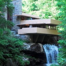
Fallingwater
United States of America

Fallingwater

2.5 mi
Nemacolin Woodlands Resort
United States of America

Nemacolin Woodlands Resort

5.8 mi
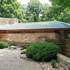
Kentuck Knob
United States of America

Kentuck Knob

1.4 mi
The 20th-Century Architecture of Frank Lloyd Wright
United States of America

The 20th-Century Architecture of Frank Lloyd Wright

2.5 mi
Ohiopyle State Park
United States of America

Ohiopyle State Park

4 mi
Laurel Ridge State Park
United States of America

Laurel Ridge State Park

34.6 mi
United States of America

Uniontown Speedway

11.5 mi
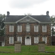
Isaac Meason House
United States of America

Isaac Meason House

9.4 mi
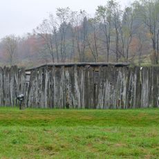
Fort Necessity
United States of America

Fort Necessity

6.6 mi
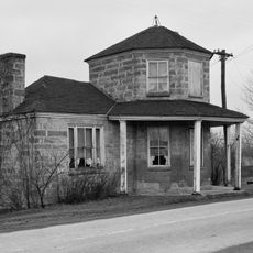
Petersburg Tollhouse
United States of America

Petersburg Tollhouse

12.3 mi
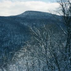
Sugarloaf Knob
United States of America

Sugarloaf Knob

3.4 mi
John S. Douglas House
United States of America

John S. Douglas House

12.3 mi
Lower Humbert Covered Bridge
United States of America

Lower Humbert Covered Bridge

9.4 mi
Wharton Furnace
United States of America

Wharton Furnace

8.4 mi
Ferncliff Peninsula Natural Area
United States of America

Ferncliff Peninsula Natural Area

0.6 mi
Hopwood-Miller Tavern
United States of America

Hopwood-Miller Tavern

11.6 mi
Carnegie Free Library
United States of America

Carnegie Free Library

10.9 mi
Ohiopyle Low Bridge
United States of America

Ohiopyle Low Bridge

0.3 mi
Colonial National Bank Building
United States of America

Colonial National Bank Building

11 mi
Cucumber Run
United States of America

Cucumber Run

3.8 mi
Dr. J.C. McClenathan House and Office
United States of America

Dr. J.C. McClenathan House and Office

11 mi
Downer Tavern
United States of America

Downer Tavern

6.9 mi
Ohiopyle Highway Bridge
United States of America

Ohiopyle Highway Bridge

0.3 mi
Connellsville Canteen
United States of America

Connellsville Canteen

11.1 mi
United States Post Office
United States of America

United States Post Office

11 mi
Connellsville P&WV bridge
United States of America

Connellsville P&WV bridge

11.6 mi
Youghiogheny River Lake
United States of America

Youghiogheny River Lake

10.5 mi
Youghiogheny River Lake
United States of America

Youghiogheny River Lake

8.5 mi
Show the full map
Reviews
Share your experience

No review yet

Discussions
Start a discussion...

No discussion yet

« Ohiopyle High Bridge - Railroad footbridge in Ohiopyle State Park, United States » is provided by Around Us (aroundus.com). Images and texts are derived from Wikimedia project under a Creative Commons license. You are allowed to copy, distribute, and modify copies of this page, under the conditions set by the license, as long as this note is clearly visible.

Discover hidden gems everywhere you go!

From secret cafés to breathtaking viewpoints, skip the crowded tourist spots and find places that match your style. Our app makes it easy with voice search, smart filtering, route optimization, and insider tips from travelers worldwide. Download now for the complete mobile experience.
Around Us App Screenshot
❝

A unique approach to discovering new places❞

— Le Figaro

❝

All the places worth exploring❞

— France Info

❝

A tailor-made excursion in just a few clicks❞

— 20 Minutes

Around Us
Travel Guide & Maps
Download

Send to your phone

QR Code
1

Open the camera app on your mobile.

2

Point at the QR code with your camera. A notification will appear.

3

Tap the notification to open the link.