Enable Location

We need your location to show you interesting places around you

Discover nearby places

Find interesting locations and hidden gems around you

Precise directions

Get accurate directions and distances to places

Your location is never shared with other users. It's only used when you tap the location button.

Fayette County

Log in to your account

Start exploring — it's free

Trusted by 61,832 travelers worldwide

Continue with Google
Continue with Apple
or

We will send you a code to connect

By continuing, you accept our Terms and Conditions and our Privacy Policy

Check your inbox

We've sent a pincode in your inbox. Please enter the code below.

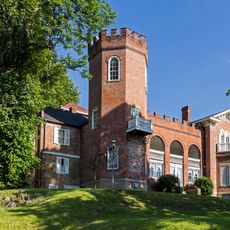
Fayette County, Administrative county in southwestern Pennsylvania, United States

Description

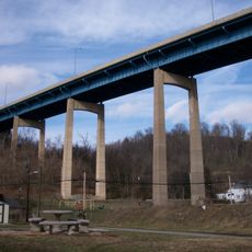
Fayette County is a county in southwestern Pennsylvania that spans across diverse terrain with varying landscapes throughout the region. The land transitions from rolling hills in the west to more mountainous areas toward the east.

History

The county was founded in 1783 from parts of neighboring Westmoreland County, shortly after American independence. It later became the center of the Whiskey Rebellion, a major civil uprising against federal taxation policies.

Culture

The county is named after the French general Lafayette, who fought in the American Revolution. This connection to the independence movement remains woven into local identity.

Practical

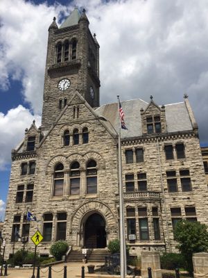
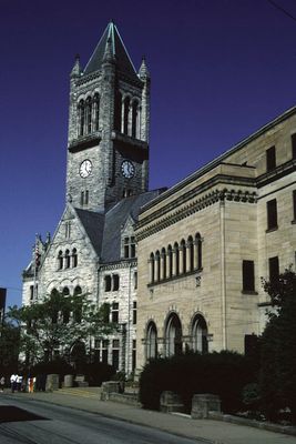
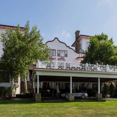
The county is administered from Uniontown, where main government offices are located and can be visited for local services. The area is best explored by car since communities are spread throughout the region.

Did you know?

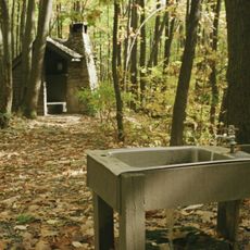
Fort Necessity here marks the site of George Washington's first military engagement during the French and Indian War. This moment proved crucial to Washington's later rise to leadership in American history.

Location
Inception
September 26, 1783
Capital city
Uniontown
Shares border with
Westmoreland County, Somerset County, Garrett County, Preston County, Monongalia County, Greene County, Washington County
GPS coordinates
39.92000,-79.65000
Latest update
December 14, 2025 18:23

AroundUs brings together thousands of curated places, local tips, and hidden gems, enriched daily by 60,000 contributors worldwide. Discover all places nearby (Pennsylvania).

Around this place
Fallingwater
United States of America

Fallingwater

15.6 km
Nemacolin Woodlands Resort
United States of America

Nemacolin Woodlands Resort

15.4 km
Kentuck Knob
United States of America

Kentuck Knob

12.4 km
The 20th-Century Architecture of Frank Lloyd Wright
United States of America

The 20th-Century Architecture of Frank Lloyd Wright

15.8 km
Ohiopyle State Park
United States of America

Ohiopyle State Park

20.4 km
Laurel Caverns
United States of America

Laurel Caverns

14.4 km
Bowman's Castle
United States of America

Bowman's Castle

23 km
West Overton
United States of America

West Overton

23 km
Laurel Ridge State Park
United States of America

Laurel Ridge State Park

24.3 km
Summit Hotel
United States of America

Summit Hotel

7.6 km
Dunlap's Creek Bridge
United States of America

Dunlap's Creek Bridge

23.2 km
Mount Saint Macrina
United States of America

Mount Saint Macrina

7.8 km
Quebec Run Wild Area
United States of America

Quebec Run Wild Area

18.2 km
United States of America

Jacob's Creek Bridge

23 km
United States of America

Cheat Canyon

29.2 km
United States of America

Mystic Rock

16.2 km
Searights Tollhouse, National Road
United States of America

Searights Tollhouse, National Road

12.7 km
Sugar Grove Petroglyphs
United States of America

Sugar Grove Petroglyphs

28.5 km
Isaac Meason House
United States of America

Isaac Meason House

2.4 km
Linden Hall at Saint James Park
United States of America

Linden Hall at Saint James Park

16.8 km
United States of America

Sheepskin Trail

7 km
Providence Quaker Cemetery and Chapel
United States of America

Providence Quaker Cemetery and Chapel

20.4 km
Brownsville Bridge
United States of America

Brownsville Bridge

23.4 km
Layton Bridge
United States of America

Layton Bridge

20 km
Penn-Craft Historic District
United States of America

Penn-Craft Historic District

22.8 km
United States of America

Great Crossings Bridge

28.4 km
Lane Bane Bridge
United States of America

Lane Bane Bridge

23.2 km
Francis Farm Petroglyphs
United States of America

Francis Farm Petroglyphs

18.9 km
Show the full map
« Fayette County - Administrative county in southwestern Pennsylvania, United States » is provided by Around Us (aroundus.com). Images and texts are derived from Wikimedia project under a Creative Commons license. You are allowed to copy, distribute, and modify copies of this page, under the conditions set by the license, as long as this note is clearly visible.

Discover hidden gems everywhere you go!

From secret cafés to breathtaking viewpoints, skip the crowded tourist spots and find places that match your style. Our app makes it easy with voice search, smart filtering, route optimization, and insider tips from travelers worldwide. Download now for the complete mobile experience.

Around Us App Screenshot

A unique approach to discovering new places

Le Figaro

All the places worth exploring

France Info

A tailor-made excursion in just a few clicks

20 Minutes

Around Us
Travel Guide & Maps
Download

Send to your phone

QR Code
1

Open the camera app on your mobile.

2

Point at the QR code with your camera. A notification will appear.

3

Tap the notification to open the link.