Enable Location

We need your location to show you interesting places around you

Discover nearby places

Find interesting locations and hidden gems around you

Precise directions

Get accurate directions and distances to places

Your location is never shared with other users. It's only used when you tap the location button.

Cincinnati Skywalk

Log in to your account

Start exploring — it's free

Trusted by 66,559 travelers worldwide

Continue with Google
Continue with Apple
or

We will send you a code to connect

By continuing, you accept our Terms and Conditions and our Privacy Policy

Check your inbox

We've sent a pincode in your inbox. Please enter the code below.

Cincinnati Skywalk
Discussion Reviews 1 Photos
6.8k Popularity

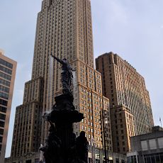
Cincinnati Skywalk, Pedestrian skyway system in Downtown Cincinnati, United States

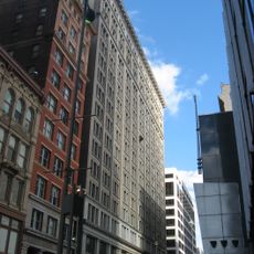
The Cincinnati Skywalk is a network of enclosed elevated walkways in downtown Cincinnati, Ohio, linking several office buildings, hotels, and a convention center above street level. The passages run mostly indoors, crossing between blocks at the second-floor level of the connected buildings.

Construction started in 1971 with federal urban renewal funding and expanded gradually over the following decades. After 2002, parts of the system were removed as the city shifted its focus back to encouraging activity at street level.

The walkways were built with the idea that keeping people off the streets would make downtown more appealing to shoppers and office workers. Today, the sections that remain open feel more like corridors inside private buildings than parts of a shared urban space.

The sections that are still open are generally accessible during normal business hours of the buildings they pass through, so many entrances close in the evening and on weekends. Carrying a map is helpful since the signage is uneven and not all connections are still intact.

Cincinnati's system was among the first of its kind in the United States and directly influenced similar projects in other cities, including Minneapolis. While Minneapolis expanded and maintained its version, Cincinnati moved in the opposite direction and began pulling its network apart.

The community of curious travelers

AroundUs brings together thousands of curated places, local tips, and hidden gems, enriched daily by 60,000 contributors worldwide.

Start exploring
Location
Inception
1971
Official opening
1971
GPS coordinates
39.10111,-84.51389
Latest update
March 3, 2026 10:10
Around this place
Carew Tower
United States of America

Carew Tower

67 m
Contemporary Arts Center
United States of America

Contemporary Arts Center

247 m
Fountain Square, Cincinnati
United States of America

Fountain Square, Cincinnati

135 m
Tyler Davidson Fountain
United States of America

Tyler Davidson Fountain

136 m
Ingalls Building
United States of America

Ingalls Building

150 m
PNC Tower
United States of America

PNC Tower

191 m
Terrace Plaza Hotel
United States of America

Terrace Plaza Hotel

112 m
Aronoff Center
United States of America

Aronoff Center

331 m
Fifth Third Center
United States of America

Fifth Third Center

201 m
Cincinnati Enquirer Building
United States of America

Cincinnati Enquirer Building

218 m
Scripps Center
United States of America

Scripps Center

355 m
United States of America

Mercantile Library of Cincinnati

241 m
Cincinnati and Suburban Telephone Company Building
United States of America

Cincinnati and Suburban Telephone Company Building

343 m
Bartlett Building
United States of America

Bartlett Building

225 m
21c Museum Hotel Cincinnati
United States of America

21c Museum Hotel Cincinnati

268 m
Fourth & Walnut Center
United States of America

Fourth & Walnut Center

297 m
Phoenix Building/Cincinnati Club
United States of America

Phoenix Building/Cincinnati Club

385 m
East Fourth Street Historic District
United States of America

East Fourth Street Historic District

325 m
John Church Company Building
United States of America

John Church Company Building

194 m
Statue of James A. Garfield
United States of America

Statue of James A. Garfield

372 m
Race Street Historic District
United States of America

Race Street Historic District

241 m
Sherith Israel Temple
United States of America

Sherith Israel Temple

278 m
United States of America

United States Custom House and Post Office

185 m
Hooper Building
United States of America

Hooper Building

200 m
Doctors' Building
United States of America

Doctors' Building

348 m
Textile Building
United States of America

Textile Building

292 m
Hilton Cincinnati Netherland Plaza
United States of America

Hilton Cincinnati Netherland Plaza

25 m
Macy's Building
United States of America

Macy's Building

249 m
Show the full map
Reviews
Share your experience

No review yet

Discussions
Start a discussion...

No discussion yet

« Cincinnati Skywalk - Pedestrian skyway system in Downtown Cincinnati, United States » is provided by Around Us (aroundus.com). Images and texts are derived from Wikimedia project under a Creative Commons license. You are allowed to copy, distribute, and modify copies of this page, under the conditions set by the license, as long as this note is clearly visible.

Discover hidden gems everywhere you go!

From secret cafés to breathtaking viewpoints, skip the crowded tourist spots and find places that match your style. Our app makes it easy with voice search, smart filtering, route optimization, and insider tips from travelers worldwide. Download now for the complete mobile experience.

Around Us App Screenshot

A unique approach to discovering new places

Le Figaro

All the places worth exploring

France Info

A tailor-made excursion in just a few clicks

20 Minutes

Around Us
Travel Guide & Maps
Download

Send to your phone

QR Code
1

Open the camera app on your mobile.

2

Point at the QR code with your camera. A notification will appear.

3

Tap the notification to open the link.