Bad Rock Canyon

Log in to your account

AroundUs is a community-driven map of interesting places, built by curious explorers like you. It grows with every review, story, and photo you share.
Connect to save your favorite spots, contribute locations, and create personalized routes.
By continuing, you accept our Terms and Conditions and our Privacy Policy
Add to collection
Map
Suggest a change
Share

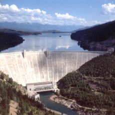
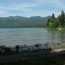
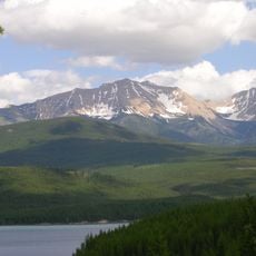
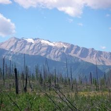
Bad Rock Canyon, River canyon near Columbia Falls, Montana, US

Bad Rock Canyon is a river gorge where the Flathead River flows through towering rock walls that rise dramatically on both sides. Highway 2 and railway tracks run alongside the water, making this a major transportation corridor through the mountains.

Native American tribes historically used this passage as a travel route and hunting trail crossing the Rocky Mountains. Today, this same corridor remains vital for modern transportation through the region.

The Montana Department of Transportation collaborates with Confederated Salish and Kootenai Tribes to preserve cultural resources during infrastructure developments.

Visitors can view the canyon from Highway 2, which runs directly alongside it and provides good vantage points. Several pullouts along the road offer safe spots to stop and observe the rock formations up close.

Specialized fences along the railway tracks include sensors to detect rockfall and stone movements from the canyon walls. This monitoring system helps protect trains that pass through regularly.

GPS coordinates: 48.38570,-114.10800

Latest update: December 8, 2025 21:04

Photos
Around this place
Show the full map
Hungry Horse Dam
United States of America

Hungry Horse Dam

8.5 km
Whitefish Lake State Park
United States of America

Whitefish Lake State Park

19.9 km
Charles E. Conrad Mansion
United States of America

Charles E. Conrad Mansion

25.5 km
Belton Chalets
United States of America

Belton Chalets

15.8 km
South Fork Flathead River
United States of America

South Fork Flathead River

64.5 km
Apgar Fire Lookout
United States of America

Apgar Fire Lookout

16.1 km
Stanton Glacier
United States of America

Stanton Glacier

25.2 km
Headquarters Historic District
United States of America

Headquarters Historic District

15.9 km
Huckleberry Fire Lookout
United States of America

Huckleberry Fire Lookout

24 km
Soldiers' Home Historic District
United States of America

Soldiers' Home Historic District

8.2 km
International Larix Arboretum
United States of America

International Larix Arboretum

3.7 km
West Entrance Station
United States of America

West Entrance Station

16.1 km
Nyack Ranger Station Historic District
United States of America

Nyack Ranger Station Historic District

23.8 km
First Presbyterian Church of Whitefish
United States of America

First Presbyterian Church of Whitefish

17 km
A. J. Dean House
United States of America

A. J. Dean House

25.6 km
Conrad Mansion
United States of America

Conrad Mansion

25.5 km
Ray E. Taylor House
United States of America

Ray E. Taylor House

17.1 km
Bruyer Granary
United States of America

Bruyer Granary

22.9 km
Glacier Distilling Company - The Whiskey Barn
United States of America

Glacier Distilling Company - The Whiskey Barn

6.2 km
Billsborough House
United States of America

Billsborough House

24.9 km
Fish Creek Bay Boathouse
United States of America

Fish Creek Bay Boathouse

20.7 km
Apgar Campground
United States of America

Apgar Campground

18 km
Pine Grove Pond Fishing Access Sign
United States of America

Pine Grove Pond Fishing Access Sign

20.1 km
Wanda Hollensteiner Art Gallery
United States of America

Wanda Hollensteiner Art Gallery

23.8 km
Apgar Visitor Center
United States of America

Apgar Visitor Center

17.7 km
Fish Creek Campground Amphitheater
United States of America

Fish Creek Campground Amphitheater

20.3 km
Fish Creek Campground
United States of America

Fish Creek Campground

20.2 km
Apgar Campground Amphitheater
United States of America

Apgar Campground Amphitheater

18.4 km
Show the full map
Reviews

Visited this place? Tap the stars to rate it and share your experience / photos with the community! Try now! You can cancel it anytime.

« Bad Rock Canyon - River canyon near Columbia Falls, Montana, US » is provided by Around Us (aroundus.com). Images and texts are derived from Wikimedia project under a Creative Commons license. You are allowed to copy, distribute, and modify copies of this page, under the conditions set by the license, as long as this note is clearly visible.

Discover hidden gems everywhere you go!

From secret cafés to breathtaking viewpoints, skip the crowded tourist spots and find places that match your style. Our app makes it easy with voice search, smart filtering, route optimization, and insider tips from travelers worldwide. Download now for the complete mobile experience.

Around Us App Screenshot

A unique approach to discovering new places

Le Figaro

All the places worth exploring

France Info

A tailor-made excursion in just a few clicks

20 Minutes