Chest opened
+${chestReward.xp} XP
Explorer
NOUVEAU ×${chestReward.collectible.quantity}
tapez pour fermer
Chest locked

Open chests in the app

Around Us is built for your phone — chests unlock when you walk, explore and capture nearby places.

Enable Location

We need your location to show you interesting places around you

Discover nearby places

Find interesting locations and hidden gems around you

Precise directions

Get accurate directions and distances to places

Your location is never shared with other users. It's only used when you tap the location button.

Log in to your account

Start exploring — it's free

Trusted by 72,888 travelers worldwide

Continue with Google
Continue with Apple
or

We will send you a code to connect

By continuing, you accept our Terms and Conditions and our Privacy Policy

Check your inbox

We've sent a pincode in your inbox. Please enter the code below.

LoCicero Triangle
Discussion Reviews Photo
1.6k Popularity

LoCicero Triangle, Public green space in Bellerose, Queens, United States.

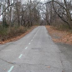
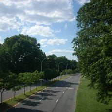
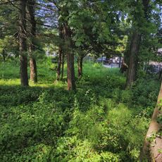
LoCicero Triangle is a small public green space in Bellerose, Queens, situated at the intersection of three major streets. The space includes benches, trees, and shrubs that provide shelter and seating for nearby residents.

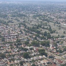
The triangle came into existence in 1939 when construction of the Cross Island Parkway cut through the existing street grid. This major road project left behind an unusable triangular parcel that was later developed as a public space.

The triangle is named after a neighborhood artist whose work appeared in the Metropolitan Museum of Art during his youth. Visitors can read the memorial plaque that honors this connection and tells the story of local creative talent.

The space is easily accessible from the surrounding streets and provides a quiet spot to sit despite nearby traffic. The benches and trees create a sheltered setting within this small public parcel.

The artist the space is named after served in Hawaii for several years during World War II, creating aerial maps for the US Army. His military service and artistic talent made him a notable figure whose legacy is honored in this small corner of Queens.

The community of curious travelers

AroundUs brings together thousands of curated places, local tips, and hidden gems, enriched daily by 60,000 contributors worldwide.

Start exploring
Location
GPS coordinates
40.73393,-73.72336
Latest update
December 14, 2025 14:27
Around this place
Long Island Motor Parkway
United States of America

Long Island Motor Parkway

3.1 km
Ohel
United States of America

Ohel

5.4 km
Alley Pond Park
United States of America

Alley Pond Park

3.4 km
Denton House
United States of America

Denton House

4.2 km
St. Paul's School
United States of America

St. Paul's School

6.5 km
Montefiore Cemetery
United States of America

Montefiore Cemetery

5.6 km
Cunningham Park
United States of America

Cunningham Park

3.8 km
Queens County Farm Museum
United States of America

Queens County Farm Museum

1.6 km
Valley Stream State Park
United States of America

Valley Stream State Park

6.6 km
Roy Wilkins Southern Queens Park
United States of America

Roy Wilkins Southern Queens Park

6.6 km
Ben Rebhuhn House
United States of America

Ben Rebhuhn House

6.1 km
Douglaston Park
United States of America

Douglaston Park

2.2 km
Douglaston Historic District
United States of America

Douglaston Historic District

5.2 km
Manhasset Viaduct
United States of America

Manhasset Viaduct

6.6 km
Cornelius Van Wyck House
United States of America

Cornelius Van Wyck House

5 km
Douglaston Hill Historic District
United States of America

Douglaston Hill Historic District

4.2 km
St. Vincent de Paul Malankara Catholic Cathedral Parish
United States of America

St. Vincent de Paul Malankara Catholic Cathedral Parish

3.5 km
Allen-Beville House
United States of America

Allen-Beville House

4.9 km
Jamaica First German Presbyterian Church
United States of America

Jamaica First German Presbyterian Church

5.7 km
Lawrence Cemetery
United States of America

Lawrence Cemetery

4.9 km
House at 18 Seventeenth Avenue
United States of America

House at 18 Seventeenth Avenue

6.4 km
House at 240 Sea Cliff Avenue
United States of America

House at 240 Sea Cliff Avenue

6.6 km
Bellerose Village Municipal Complex
United States of America

Bellerose Village Municipal Complex

1.4 km
Cornell Farmhouse
United States of America

Cornell Farmhouse

1.6 km
Church of St. Philip and St. James
United States of America

Church of St. Philip and St. James

2.8 km
North Shore Towers
United States of America

North Shore Towers

2.7 km
Glen Oaks Mini Water Park
United States of America

Glen Oaks Mini Water Park

1.9 km
Fresh Meadows Library
United States of America

Fresh Meadows Library

5.1 km
Show the full map
Reviews
Share your experience

No review yet

Discussions
Start a discussion...

No discussion yet

« LoCicero Triangle - Public green space in Bellerose, Queens, United States » is provided by Around Us (aroundus.com). Images and texts are derived from Wikimedia project under a Creative Commons license. You are allowed to copy, distribute, and modify copies of this page, under the conditions set by the license, as long as this note is clearly visible.

Discover hidden gems everywhere you go!

From secret cafés to breathtaking viewpoints, skip the crowded tourist spots and find places that match your style. Our app makes it easy with voice search, smart filtering, route optimization, and insider tips from travelers worldwide. Download now for the complete mobile experience.

Around Us App Screenshot

A unique approach to discovering new places

Le Figaro

All the places worth exploring

France Info

A tailor-made excursion in just a few clicks

20 Minutes

Around Us
Travel Guide & Maps
Download

Send to your phone

QR Code
1

Open the camera app on your mobile.

2

Point at the QR code with your camera. A notification will appear.

3

Tap the notification to open the link.