Chest opened
+${chestReward.xp} XP
Explorer
NOUVEAU ×${chestReward.collectible.quantity}
tapez pour fermer

See the monuments around you in AR Open chests in the app

Around Us is built for your phone — point your camera at the streets and discover the monuments and places around you in augmented reality. Around Us is built for your phone — chests unlock when you walk, explore and capture nearby places.

Enable Location

We need your location to show you interesting places around you

Discover nearby places

Find interesting locations and hidden gems around you

Precise directions

Get accurate directions and distances to places

Your location is never shared with other users. It's only used when you tap the location button.

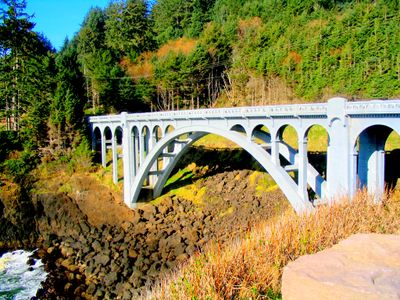
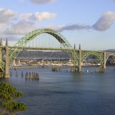
Rocky Creek Bridge

Log in to your account

Start exploring — it's free

Trusted by 85,655 travelers worldwide

Continue with Google
Continue with Apple
or

We will send you a code to connect

By continuing, you accept our Terms and Conditions and our Privacy Policy

Check your inbox

We've sent a pincode in your inbox. Please enter the code below.

Discussion Reviews 1 Photos
1.3k Popularity

Rocky Creek Bridge, Road bridge in Otter Rock, United States

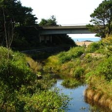
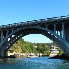
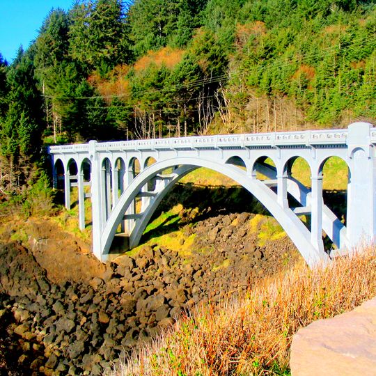
Rocky Creek Bridge is a concrete arch bridge with neoclassical design elements that crosses Rocky Creek. The structure features decorative railings and carries both vehicle and pedestrian traffic.

Construction began in 1926 under engineer Conde B. McCullough and was completed in 1927. The structure gained recognition on the National Register of Historic Places in 2005.

The bridge shows how Oregon engineers combined concrete construction with classical design details in the early 20th century. It sits along the Otter Crest Loop Road, a scenic route where drivers and walkers experience the coastal landscape together.

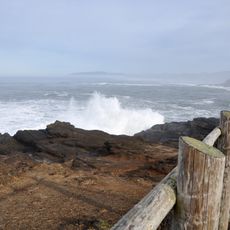
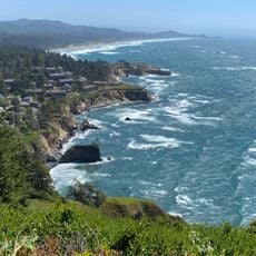
The bridge sits along Otter Crest Loop Road and offers views of the Pacific Ocean coast. Visitors should plan to come during clear weather for the best coastal views.

The bridge carries an alternate name, Ben Jones Bridge, honoring a legislator involved in establishing Lincoln County during an earlier era. This secondary name is often unknown to passing visitors despite its connection to local leadership history.

The community of curious travelers

AroundUs brings together thousands of curated places, local tips, and hidden gems, enriched daily by 60,000 contributors worldwide.
Start exploring
Location
Inception
1926
Official opening
1927
Architectural style
Neoclassical architecture
GPS coordinates
44.77833,-124.07167
Latest update
August 30, 2026 18:06
Around this place
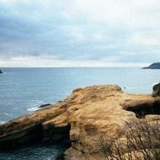
Devils Punch Bowl State Natural Area
United States of America

Devils Punch Bowl State Natural Area

2.2 mi
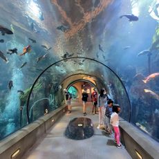
Oregon Coast Aquarium
United States of America

Oregon Coast Aquarium

11.2 mi
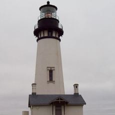
Yaquina Head Light
United States of America

Yaquina Head Light

7 mi
Yaquina Bay Bridge
United States of America

Yaquina Bay Bridge

10.8 mi
Beverly Beach State Park
United States of America

Beverly Beach State Park

3.4 mi
Devils Punchbowl State Natural Area
United States of America

Devils Punchbowl State Natural Area

2.2 mi
Whale Watching Center
United States of America

Whale Watching Center

2.2 mi
Yaquina Bay Light
United States of America

Yaquina Bay Light

10.7 mi
United States of America

Jumpoff Joe

9.2 mi
Boiler Bay State Scenic Viewpoint
United States of America

Boiler Bay State Scenic Viewpoint

3.4 mi
Siletz Bay National Wildlife Refuge
United States of America

Siletz Bay National Wildlife Refuge

9 mi
Agate Beach State Recreation Site
United States of America

Agate Beach State Recreation Site

8.3 mi
Devil's Punchbowl
United States of America

Devil's Punchbowl

2.2 mi
Yaquina Bay State Recreation Site
United States of America

Yaquina Bay State Recreation Site

10.7 mi
Otter Crest State Scenic Viewpoint
United States of America

Otter Crest State Scenic Viewpoint

1.2 mi
Rocky Creek State Scenic Viewpoint
United States of America

Rocky Creek State Scenic Viewpoint

0.2 mi
Fogarty Creek State Recreation Area
United States of America

Fogarty Creek State Recreation Area

4.6 mi
Gleneden Beach State Recreation Site
United States of America

Gleneden Beach State Recreation Site

7 mi
Depoe Bay Bridge
United States of America

Depoe Bay Bridge

2.3 mi
Sylvia Beach Hotel
United States of America

Sylvia Beach Hotel

9.7 mi
Oregon Undersea Gardens
United States of America

Oregon Undersea Gardens

10.2 mi
Shilo Inn
United States of America

Shilo Inn

10 mi
South Jetty
United States of America

South Jetty

11.2 mi
Charles and Theresa Roper House
United States of America

Charles and Theresa Roper House

10 mi
Whale Research EcoExcursions
United States of America

Whale Research EcoExcursions

2.2 mi
Nye Beach
United States of America

Nye Beach

9.4 mi
Newport Visual Arts Center
United States of America

Newport Visual Arts Center

9.7 mi
Nye Beach
United States of America

Nye Beach

9.4 mi
Show the full map
Reviews
Share your experience

No review yet

Discussions
Start a discussion...

No discussion yet

« Rocky Creek Bridge - Road bridge in Otter Rock, United States » is provided by Around Us (aroundus.com). Images and texts are derived from Wikimedia project under a Creative Commons license. You are allowed to copy, distribute, and modify copies of this page, under the conditions set by the license, as long as this note is clearly visible.

Discover hidden gems everywhere you go!

From secret cafés to breathtaking viewpoints, skip the crowded tourist spots and find places that match your style. Our app makes it easy with voice search, smart filtering, route optimization, and insider tips from travelers worldwide. Download now for the complete mobile experience.
Around Us App Screenshot

A unique approach to discovering new places

Le Figaro

All the places worth exploring

France Info

A tailor-made excursion in just a few clicks

20 Minutes

Around Us
Travel Guide & Maps
Download

Send to your phone

QR Code
1

Open the camera app on your mobile.

2

Point at the QR code with your camera. A notification will appear.

3

Tap the notification to open the link.