Enable Location

We need your location to show you interesting places around you

Discover nearby places

Find interesting locations and hidden gems around you

Precise directions

Get accurate directions and distances to places

Your location is never shared with other users. It's only used when you tap the location button.

Fogarty Creek State Recreation Area

Log in to your account

Start exploring — it's free

Trusted by 61,895 travelers worldwide

Continue with Google
Continue with Apple
or

We will send you a code to connect

By continuing, you accept our Terms and Conditions and our Privacy Policy

Check your inbox

We've sent a pincode in your inbox. Please enter the code below.

Fogarty Creek State Recreation Area

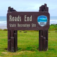
Fogarty Creek State Recreation Area, State recreation area in Lincoln County, United States.

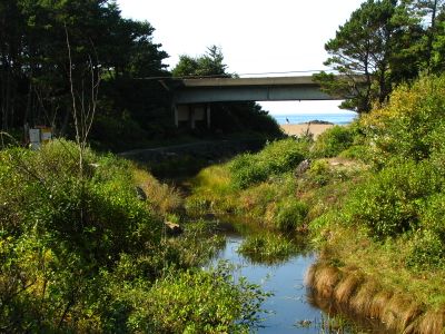
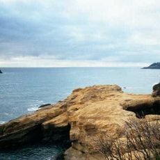
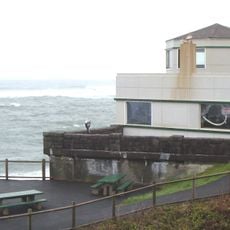
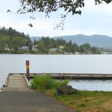
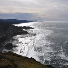
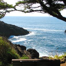
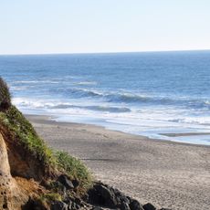
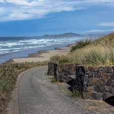
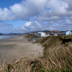
Fogarty Creek State Recreation Area is a coastal park between Lincoln City and Depoe Bay spanning around 165 acres along the Pacific Ocean. The grounds feature wooden footbridges, rocky cliffs, and covered picnic shelters throughout the property.

The park acquired its lands across several decades starting in the 1950s as Oregon expanded its public recreation system. Its name honors John Fogarty, an Irish immigrant who served as a judge in Lincoln County.

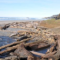
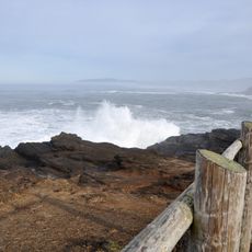
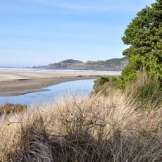
The park reflects Oregon's commitment to keeping beaches open to the public, a principle established through state law decades ago. Visitors experience this openness today when they walk freely along the coastline without barriers or restrictions.

Access the area through two entrances on Highway 101 without needing a parking pass. Picnic tables and covered shelters are scattered throughout, making visits comfortable regardless of weather.

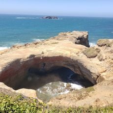
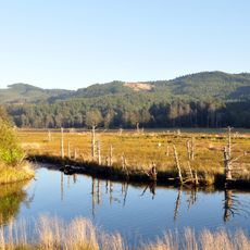
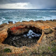
The creek flows into the Pacific and forms protected tide pools among natural rock formations. These pools let visitors closely observe marine creatures and experience coastal geology firsthand.

The community of curious travelers

AroundUs brings together thousands of curated places, local tips, and hidden gems, enriched daily by 60,000 contributors worldwide.

Start exploring
Location
GPS coordinates
44.84230,-124.04600
Latest update
December 13, 2025 12:21
Around this place
Devils Punch Bowl State Natural Area
United States of America

Devils Punch Bowl State Natural Area

10.8 km
Yaquina Head Light
United States of America

Yaquina Head Light

18.6 km
Beverly Beach State Park
United States of America

Beverly Beach State Park

12.6 km
Chinook Winds Casino
United States of America

Chinook Winds Casino

17.6 km
Whale Watching Center
United States of America

Whale Watching Center

3.8 km
Devils Punchbowl State Natural Area
United States of America

Devils Punchbowl State Natural Area

10.7 km
Yaquina Bay Light
United States of America

Yaquina Bay Light

24.3 km
United States of America

Jumpoff Joe

22 km
Boiler Bay State Scenic Viewpoint
United States of America

Boiler Bay State Scenic Viewpoint

2.2 km
Devil's Lake State Recreation Area
United States of America

Devil's Lake State Recreation Area

14.5 km
Siletz Bay National Wildlife Refuge
United States of America

Siletz Bay National Wildlife Refuge

7.1 km
Agate Beach State Recreation Site
United States of America

Agate Beach State Recreation Site

20.5 km
D River State Recreation Site
United States of America

D River State Recreation Site

14.1 km
Devil's Punchbowl
United States of America

Devil's Punchbowl

10.7 km
Otter Crest State Scenic Viewpoint
United States of America

Otter Crest State Scenic Viewpoint

9.3 km
Roads End State Recreation Site
United States of America

Roads End State Recreation Site

18.7 km
Rocky Creek State Scenic Viewpoint
United States of America

Rocky Creek State Scenic Viewpoint

7.1 km
Gleneden Beach State Recreation Site
United States of America

Gleneden Beach State Recreation Site

3.9 km
Depoe Bay Bridge
United States of America

Depoe Bay Bridge

3.8 km
Oregon Undersea Gardens
United States of America

Oregon Undersea Gardens

23.6 km
Drift Creek Bridge
United States of America

Drift Creek Bridge

21 km
Rocky Creek Bridge
United States of America

Rocky Creek Bridge

7.4 km
Charles and Theresa Roper House
United States of America

Charles and Theresa Roper House

23.3 km
Whale Research EcoExcursions
United States of America

Whale Research EcoExcursions

3.9 km
Nye Beach
United States of America

Nye Beach

22.2 km
Bijou Theatre
United States of America

Bijou Theatre

15.2 km
Newport Visual Arts Center
United States of America

Newport Visual Arts Center

22.7 km
Nye Beach
United States of America

Nye Beach

22.3 km
Show the full map
« Fogarty Creek State Recreation Area - State recreation area in Lincoln County, United States » is provided by Around Us (aroundus.com). Images and texts are derived from Wikimedia project under a Creative Commons license. You are allowed to copy, distribute, and modify copies of this page, under the conditions set by the license, as long as this note is clearly visible.

Discover hidden gems everywhere you go!

From secret cafés to breathtaking viewpoints, skip the crowded tourist spots and find places that match your style. Our app makes it easy with voice search, smart filtering, route optimization, and insider tips from travelers worldwide. Download now for the complete mobile experience.

Around Us App Screenshot

A unique approach to discovering new places

Le Figaro

All the places worth exploring

France Info

A tailor-made excursion in just a few clicks

20 Minutes

Around Us
Travel Guide & Maps
Download

Send to your phone

QR Code
1

Open the camera app on your mobile.

2

Point at the QR code with your camera. A notification will appear.

3

Tap the notification to open the link.