·

Enable Location

We need your location to show you interesting places around you

Discover nearby places

Find interesting locations and hidden gems around you

Precise directions

Get accurate directions and distances to places

Your location is never shared with other users. It's only used when you tap the location button.

Ojito Wilderness

Log in to your account

Start exploring — it's free

Trusted by 62,647 travelers worldwide

Continue with Google
Continue with Apple
or

We will send you a code to connect

By continuing, you accept our Terms and Conditions and our Privacy Policy

Check your inbox

We've sent a pincode in your inbox. Please enter the code below.

Ojito Wilderness

Ojito Wilderness, Protected wilderness area in Sandoval County, New Mexico.

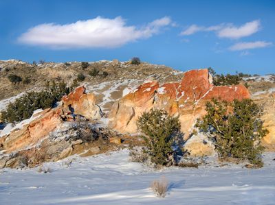
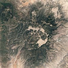
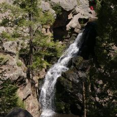
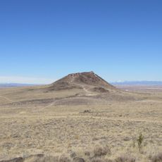
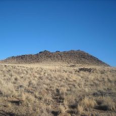
Ojito Wilderness is a protected area in New Mexico featuring steep mesas, rocky terraces, box canyons, and colorful sandstone formations across roughly 11,800 acres. The landscape displays diverse desert geology with striking rock structures throughout the terrain.

Congress designated this area as a wilderness in 2005, with portions transferred to the Pueblo of Zia Indian Reservation. This official protection has preserved the landscape for future use.

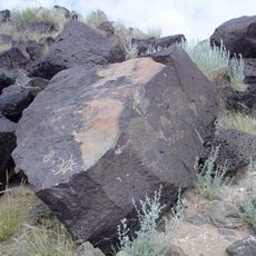
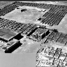
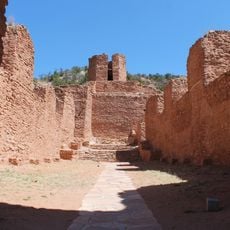
The area holds archaeological remains from different peoples who adapted to desert life over centuries. Visitors walking through the landscape can still spot traces of these earlier inhabitants today.

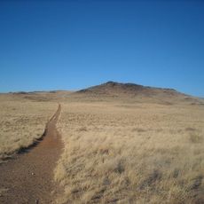
The area is reached via U.S. 550 and County Road 906 from Bernalillo, with two marked entry points available. Clear trailhead markers help visitors navigate the desert landscape safely.

Scientists found the skeleton of one of the largest dinosaurs, the Seismosaurus, preserved in rocks from the Jurassic period within this area. This paleontological site continues to attract researchers and visitors interested in ancient life.

The community of curious travelers

AroundUs brings together thousands of curated places, local tips, and hidden gems, enriched daily by 60,000 contributors worldwide.

Start exploring
Location
GPS coordinates
35.52994,-106.89933
Latest update
December 12, 2025 14:22
Around this place
Valles Caldera
United States of America

Valles Caldera

48.1 km
Petroglyph National Monument
United States of America

Petroglyph National Monument

45.6 km
Fenton Lake State Park
United States of America

Fenton Lake State Park

42.3 km
Coronado State Monument
United States of America

Coronado State Monument

38.2 km
United States of America

Redondo Peak

48.9 km
Rio Grande Nature Center State Park
United States of America

Rio Grande Nature Center State Park

48.7 km
Anderson-Abruzzo Albuquerque International Balloon Museum
United States of America

Anderson-Abruzzo Albuquerque International Balloon Museum

46.7 km
Jemez Historic Site
United States of America

Jemez Historic Site

33.6 km
Jemez Falls
United States of America

Jemez Falls

41.3 km
Vulcan
United States of America

Vulcan

44.8 km
Santa Ana Star Casino
United States of America

Santa Ana Star Casino

37.6 km
Black Volcano
United States of America

Black Volcano

45.7 km
JA volcano
United States of America

JA volcano

46.3 km
Our Lady of Sorrows Church
United States of America

Our Lady of Sorrows Church

39.9 km
San Ysidro Church
United States of America

San Ysidro Church

41.9 km
Our Lady of Mt. Carmel Church
United States of America

Our Lady of Mt. Carmel Church

47.6 km
Juan Antonio Garcia House
United States of America

Juan Antonio Garcia House

48.1 km
Juan Chavez House
United States of America

Juan Chavez House

47.4 km
Robert Dietz Farmhouse
United States of America

Robert Dietz Farmhouse

48.3 km
Barela–Bledsoe House
United States of America

Barela–Bledsoe House

48.4 km
Walatowa Visitor Center
United States of America

Walatowa Visitor Center

20.2 km
Roosevelt School
United States of America

Roosevelt School

40.4 km
Adrian Barela House
United States of America

Adrian Barela House

46.4 km
Felipe Romero House
United States of America

Felipe Romero House

48 km
Rumaldo Chavez House
United States of America

Rumaldo Chavez House

46.2 km
Bodhi Manda Zen Center
United States of America

Bodhi Manda Zen Center

33.1 km
Esther Bone Memorial Library
United States of America

Esther Bone Memorial Library

38.3 km
Petroglyph National Monument Visitor Center
United States of America

Petroglyph National Monument Visitor Center

46.8 km
Show the full map
« Ojito Wilderness - Protected wilderness area in Sandoval County, New Mexico » is provided by Around Us (aroundus.com). Images and texts are derived from Wikimedia project under a Creative Commons license. You are allowed to copy, distribute, and modify copies of this page, under the conditions set by the license, as long as this note is clearly visible.

Discover hidden gems everywhere you go!

From secret cafés to breathtaking viewpoints, skip the crowded tourist spots and find places that match your style. Our app makes it easy with voice search, smart filtering, route optimization, and insider tips from travelers worldwide. Download now for the complete mobile experience.

Around Us App Screenshot

A unique approach to discovering new places

Le Figaro

All the places worth exploring

France Info

A tailor-made excursion in just a few clicks

20 Minutes

Around Us
Travel Guide & Maps
Download

Send to your phone

QR Code
1

Open the camera app on your mobile.

2

Point at the QR code with your camera. A notification will appear.

3

Tap the notification to open the link.