Enable Location

We need your location to show you interesting places around you

Discover nearby places

Find interesting locations and hidden gems around you

Precise directions

Get accurate directions and distances to places

Your location is never shared with other users. It's only used when you tap the location button.

Fenton Lake State Park

Log in to your account

Start exploring — it's free

Trusted by 64,526 travelers worldwide

Continue with Google
Continue with Apple
or

We will send you a code to connect

By continuing, you accept our Terms and Conditions and our Privacy Policy

Check your inbox

We've sent a pincode in your inbox. Please enter the code below.

Fenton Lake State Park
Discussion Reviews 1 Photos
4.3k Popularity

Fenton Lake State Park, State park in Jemez Mountains, New Mexico, US.

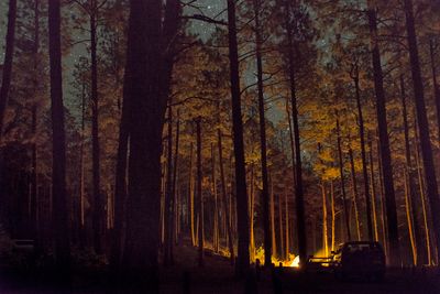
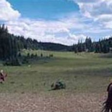
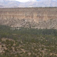
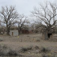
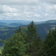
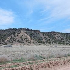
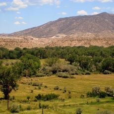
Fenton Lake State Park is a state park in the Jemez Mountains of New Mexico, built around a mountain lake sitting at roughly 7,650 feet (2,330 m) above sea level. Dense pine forest covers most of the land, with natural shorelines, wooded trails, and open areas for outdoor activities.

The park was established in 1984 by the Department of Game and Fish as a recreation area for people across the region. New facilities were added over the years as more visitors began coming to the mountains for outdoor activities.

The lake is a popular spot for trout fishing, drawing people who come for a quiet day on the water. Locals and visitors alike treat it as a place to slow down and spend time outdoors with family or friends.

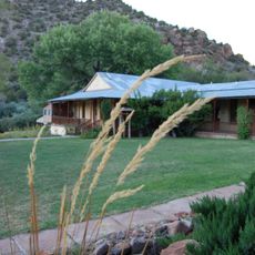
Mountain weather here can shift quickly, so it is worth bringing layers and rain gear even on a clear day. The park has camping areas, a boat launch, and trails that vary in difficulty, making it accessible for most visitors.

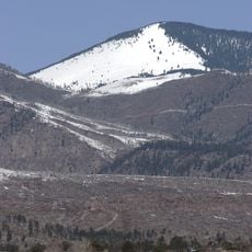
The Hal Baxter Memorial Trail turns into a cross-country skiing and biathlon training course in winter, used by athletes who come specifically for the high elevation and reliable snow. This makes the park one of the few places in New Mexico where competitive winter sports training takes place.

The community of curious travelers

AroundUs brings together thousands of curated places, local tips, and hidden gems, enriched daily by 60,000 contributors worldwide.

Start exploring
Location
Inception
1984
GPS coordinates
35.88250,-106.72600
Latest update
March 3, 2026 08:11
Around this place
Los Alamos National Laboratory
United States of America

Los Alamos National Laboratory

36.3 km
Valles Caldera
United States of America

Valles Caldera

14.5 km
Puye Cliff Dwellings
United States of America

Puye Cliff Dwellings

46.1 km
Georgia O'Keeffe Home and Studio
United States of America

Georgia O'Keeffe Home and Studio

51.7 km
Cerro Pedernal
United States of America

Cerro Pedernal

37.1 km
Pajarito Plateau
United States of America

Pajarito Plateau

38.6 km
Tsankawi
United States of America

Tsankawi

46.2 km
Bradbury Science Museum
United States of America

Bradbury Science Museum

38.5 km
Chicoma Mountain
United States of America

Chicoma Mountain

33.8 km
San Pedro Parks Wilderness
United States of America

San Pedro Parks Wilderness

24.8 km
United States of America

Redondo Peak

15 km
Bandelier Tuff
United States of America

Bandelier Tuff

38.8 km
Jemez Historic Site
United States of America

Jemez Historic Site

12.3 km
Jemez Falls
United States of America

Jemez Falls

13.9 km
Ojito Wilderness
United States of America

Ojito Wilderness

42.3 km
Los Alamos Historical Museum
United States of America

Los Alamos Historical Museum

38.2 km
Otowi Historic District
United States of America

Otowi Historic District

52.7 km
Mesa Public Library
United States of America

Mesa Public Library

38.1 km
Cerro Grande
United States of America

Cerro Grande

28.3 km
Ancha Formation
United States of America

Ancha Formation

51.7 km
Bandelier CCC Historic District
United States of America

Bandelier CCC Historic District

42.7 km
Walatowa Visitor Center
United States of America

Walatowa Visitor Center

26.4 km
Tsankawi Prehistoric Sites
United States of America

Tsankawi Prehistoric Sites

45.3 km
Frijoles Canyon Visitor Center
United States of America

Frijoles Canyon Visitor Center

42.7 km
Georgia O'keefe museum and home
United States of America

Georgia O'keefe museum and home

51.6 km
Bodhi Manda Zen Center
United States of America

Bodhi Manda Zen Center

12.6 km
Los Alamos VLBA station
United States of America

Los Alamos VLBA station

45 km
Omega Bridge
United States of America

Omega Bridge

36.5 km
Show the full map
Reviews
Share your experience

No review yet

Discussions
Start a discussion...

No discussion yet

« Fenton Lake State Park - State park in Jemez Mountains, New Mexico, US » is provided by Around Us (aroundus.com). Images and texts are derived from Wikimedia project under a Creative Commons license. You are allowed to copy, distribute, and modify copies of this page, under the conditions set by the license, as long as this note is clearly visible.

Discover hidden gems everywhere you go!

From secret cafés to breathtaking viewpoints, skip the crowded tourist spots and find places that match your style. Our app makes it easy with voice search, smart filtering, route optimization, and insider tips from travelers worldwide. Download now for the complete mobile experience.

Around Us App Screenshot

A unique approach to discovering new places

Le Figaro

All the places worth exploring

France Info

A tailor-made excursion in just a few clicks

20 Minutes

Around Us
Travel Guide & Maps
Download

Send to your phone

QR Code
1

Open the camera app on your mobile.

2

Point at the QR code with your camera. A notification will appear.

3

Tap the notification to open the link.