Chest opened
+${chestReward.xp} XP
Explorer
NOUVEAU ×${chestReward.collectible.quantity}
tapez pour fermer
Chest locked

Open chests in the app

Around Us is built for your phone — chests unlock when you walk, explore and capture nearby places.

Enable Location

We need your location to show you interesting places around you

Discover nearby places

Find interesting locations and hidden gems around you

Precise directions

Get accurate directions and distances to places

Your location is never shared with other users. It's only used when you tap the location button.

Canal Age

Log in to your account

Start exploring — it's free

Trusted by 72,891 travelers worldwide

Continue with Google
Continue with Apple
or

We will send you a code to connect

By continuing, you accept our Terms and Conditions and our Privacy Policy

Check your inbox

We've sent a pincode in your inbox. Please enter the code below.

Canal Age
Discussion Reviews 1 Photos
4.7k Popularity

Canal Age, Historical period in Eastern United States.

The Canal Age was a period from 1790 to 1855 when the eastern United States built artificial waterways to connect distant regions. These routes allowed boats to carry goods between ports and remote areas more easily than before.

The movement started around 1790 when the first canals were dug to connect rivers and improve trade routes. This phase peaked in the 1820s and 1830s as major projects were completed, before railroads gradually took over shipping duties.

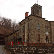
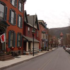
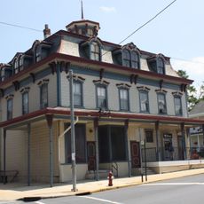
Workers from many countries gathered to build and operate the canals, creating diverse communities in rural areas. These settlements along the waterways became new towns where different traditions mixed together.

Many historic canal routes are now open to visitors as hiking paths or boat routes for exploration. When planning a visit, check which canals in your region remain navigable or are maintained as heritage sites.

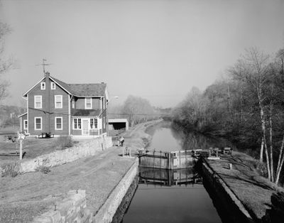
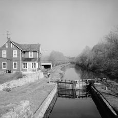
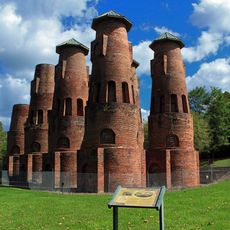
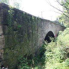
Many of these canals were built with lock systems to move boats across different elevation levels. This technical solution was groundbreaking and allowed waterways to bypass natural obstacles like waterfalls.

The community of curious travelers

AroundUs brings together thousands of curated places, local tips, and hidden gems, enriched daily by 60,000 contributors worldwide.

Start exploring
GPS coordinates
40.76917,-75.60361
Latest update
December 18, 2025 11:40
Around this place
Beltzville State Park
United States of America

Beltzville State Park

11 km
Lehigh Canal
United States of America

Lehigh Canal

0 m
Asa Packer Mansion
United States of America

Asa Packer Mansion

15.5 km
Lehigh Valley Zoo
United States of America

Lehigh Valley Zoo

12.5 km
Harry Packer Mansion
United States of America

Harry Packer Mansion

15.5 km
Lehigh Gap
United States of America

Lehigh Gap

925 m
Carbon County Jail
United States of America

Carbon County Jail

16 km
Coplay Cement Company Kilns
United States of America

Coplay Cement Company Kilns

13.8 km
Old Mauch Chunk Historic District
United States of America

Old Mauch Chunk Historic District

15.7 km
St. Mark's Episcopal Church
United States of America

St. Mark's Episcopal Church

15.5 km
Troxell-Steckel House
United States of America

Troxell-Steckel House

11.9 km
Lehigh Gap
United States of America

Lehigh Gap

925 m
Kreidersville Covered Bridge
United States of America

Kreidersville Covered Bridge

10.6 km
Little Gap Covered Bridge
United States of America

Little Gap Covered Bridge

9.7 km
Wehr Covered Bridge
United States of America

Wehr Covered Bridge

15.9 km
Manasses Guth Covered Bridge
United States of America

Manasses Guth Covered Bridge

16.2 km
Fireman's Drinking Fountain
United States of America

Fireman's Drinking Fountain

2.1 km
Dimmick Memorial Library
United States of America

Dimmick Memorial Library

15.6 km
Rex Covered Bridge
United States of America

Rex Covered Bridge

15 km
Geiger Covered Bridge
United States of America

Geiger Covered Bridge

13.8 km
Slatington Historic District
United States of America

Slatington Historic District

2.4 km
Schlicher Covered Bridge
United States of America

Schlicher Covered Bridge

12.1 km
Cold Spring Bridge
United States of America

Cold Spring Bridge

10.6 km
Vigilant Fire Company Firemen's Monument
United States of America

Vigilant Fire Company Firemen's Monument

3.4 km
Frantz's Bridge
United States of America

Frantz's Bridge

13.8 km
Bridge in Heidelberg Township
United States of America

Bridge in Heidelberg Township

11.8 km
Palmerton Historic District
United States of America

Palmerton Historic District

3.9 km
Shankweiler's Drive-In
United States of America

Shankweiler's Drive-In

13.8 km
Show the full map
Reviews
Share your experience

No review yet

Discussions
Start a discussion...

No discussion yet

« Canal Age - Historical period in Eastern United States » is provided by Around Us (aroundus.com). Images and texts are derived from Wikimedia project under a Creative Commons license. You are allowed to copy, distribute, and modify copies of this page, under the conditions set by the license, as long as this note is clearly visible.

Discover hidden gems everywhere you go!

From secret cafés to breathtaking viewpoints, skip the crowded tourist spots and find places that match your style. Our app makes it easy with voice search, smart filtering, route optimization, and insider tips from travelers worldwide. Download now for the complete mobile experience.

Around Us App Screenshot

A unique approach to discovering new places

Le Figaro

All the places worth exploring

France Info

A tailor-made excursion in just a few clicks

20 Minutes

Around Us
Travel Guide & Maps
Download

Send to your phone

QR Code
1

Open the camera app on your mobile.

2

Point at the QR code with your camera. A notification will appear.

3

Tap the notification to open the link.