Chest opened
+${chestReward.xp} XP
Explorer
NOUVEAU ×${chestReward.collectible.quantity}
tapez pour fermer
Chest locked

Open chests in the app

Around Us is built for your phone — chests unlock when you walk, explore and capture nearby places.

Enable Location

We need your location to show you interesting places around you

Discover nearby places

Find interesting locations and hidden gems around you

Precise directions

Get accurate directions and distances to places

Your location is never shared with other users. It's only used when you tap the location button.

Log in to your account

Start exploring — it's free

Trusted by 72,893 travelers worldwide

Continue with Google
Continue with Apple
or

We will send you a code to connect

By continuing, you accept our Terms and Conditions and our Privacy Policy

Check your inbox

We've sent a pincode in your inbox. Please enter the code below.

Deer Valley
Discussion Reviews Photo
9k Popularity

Deer Valley, Urban village in northwest Phoenix, United States

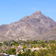
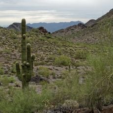
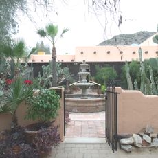
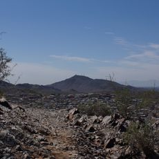
Deer Valley is an urban village in northwest Phoenix combining residential neighborhoods, commercial districts, and natural features including the Adobe Mountains and Hedgpeth Hills. The area brings together diverse spaces where office buildings, shops, and natural landscapes sit alongside one another.

The name first appeared on a 1921 United States General Land Office map, referring to the valley formed by Skunk Creek. The district later developed into a significant business and residential hub in the Phoenix region.

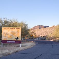
The Deer Valley Petroglyph Preserve holds rock carvings left by Native American communities and tells the story of who lived in this area long ago. Walking through the site today, visitors can see these ancient marks and understand how indigenous peoples connected with this land.

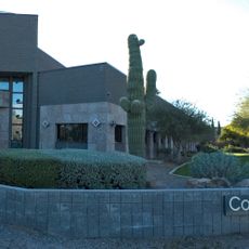
The district contains significant office space and is home to major employers across multiple industries. Visitors will find good road connections and access to local amenities including an airport and recreation facilities.

The local airport functions as one of the busiest general aviation facilities, with constant activity from private and commercial aircraft throughout the day. This creates an unusual blend of air traffic that shapes the character and rhythm of the neighborhood.

The community of curious travelers

AroundUs brings together thousands of curated places, local tips, and hidden gems, enriched daily by 60,000 contributors worldwide.

Start exploring
Location
GPS coordinates
33.66902,-112.11312
Latest update
December 10, 2025 15:59
Around this place
Piestewa Peak
United States of America

Piestewa Peak

16 km
Musical Instrument Museum
United States of America

Musical Instrument Museum

12.5 km
Wet'n'Wild Phoenix
United States of America

Wet'n'Wild Phoenix

4.5 km
Castles N' Coasters
United States of America

Castles N' Coasters

10.8 km
Phoenix Mountain Preserve
United States of America

Phoenix Mountain Preserve

12.6 km
Martin Auto Museum
United States of America

Martin Auto Museum

2.4 km
Phoenix Arizona Temple
United States of America

Phoenix Arizona Temple

6.4 km
Pioneer Living History Village
United States of America

Pioneer Living History Village

17 km
Deer Valley Petroglyph Preserve
United States of America

Deer Valley Petroglyph Preserve

3.1 km
Manistee Ranch
United States of America

Manistee Ranch

14.1 km
Desert Storm
United States of America

Desert Storm

10.8 km
Sahuaro Ranch
United States of America

Sahuaro Ranch

12.6 km
Congregation Beth Israel
United States of America

Congregation Beth Israel

15.7 km
Squaw Peak Inn
United States of America

Squaw Peak Inn

16.6 km
North Mountain Park
United States of America

North Mountain Park

10.1 km
Cathedral of Saints Simon and Jude
United States of America

Cathedral of Saints Simon and Jude

15.5 km
St. Stephen Cathedral
United States of America

St. Stephen Cathedral

13.9 km
AMF Peoria Lanes
United States of America

AMF Peoria Lanes

16.6 km
E. Payne Palmer House
United States of America

E. Payne Palmer House

16.5 km
Glendale Veterans War Memorial
United States of America

Glendale Veterans War Memorial

12.2 km
First Methodist Episcopal Church of Glendale
United States of America

First Methodist Episcopal Church of Glendale

15.8 km
Kinter K. Koontz House
United States of America

Kinter K. Koontz House

14.2 km
Floralcroft Historic District
United States of America

Floralcroft Historic District

15.6 km
Louis J. Bohn and Gertrude Lee House
United States of America

Louis J. Bohn and Gertrude Lee House

13.7 km
Ralph Converse House
United States of America

Ralph Converse House

15.5 km
Sonic
United States of America

Sonic

11.1 km
Harkins Christown
United States of America

Harkins Christown

16.7 km
Peoria Theatre
United States of America

Peoria Theatre

15.2 km
Show the full map
Reviews
Share your experience

No review yet

Discussions
Start a discussion...

No discussion yet

« Deer Valley - Urban village in northwest Phoenix, United States » is provided by Around Us (aroundus.com). Images and texts are derived from Wikimedia project under a Creative Commons license. You are allowed to copy, distribute, and modify copies of this page, under the conditions set by the license, as long as this note is clearly visible.

Discover hidden gems everywhere you go!

From secret cafés to breathtaking viewpoints, skip the crowded tourist spots and find places that match your style. Our app makes it easy with voice search, smart filtering, route optimization, and insider tips from travelers worldwide. Download now for the complete mobile experience.

Around Us App Screenshot

A unique approach to discovering new places

Le Figaro

All the places worth exploring

France Info

A tailor-made excursion in just a few clicks

20 Minutes

Around Us
Travel Guide & Maps
Download

Send to your phone

QR Code
1

Open the camera app on your mobile.

2

Point at the QR code with your camera. A notification will appear.

3

Tap the notification to open the link.