Richard K. Yancey Wildlife Management Area, Wildlife management area in Concordia Parish, Louisiana.
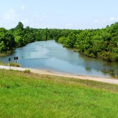
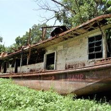
Richard K. Yancey Wildlife Management Area is a protected tract between the Mississippi and Red rivers featuring bottomland hardwood forests, lakes, and numerous bayous across level ground. The property contains a mosaic of habitats that support diverse wildlife populations throughout its expanse.
The area takes its name from Richard K. Yancey, who led Louisiana's wildlife management efforts from 1948 to 1979 and shaped stewardship practices for decades. Two separate management zones were combined to create this unified protected space.
Hunters and anglers shape the daily rhythm of the place, pursuing game and fish that sustain both recreation and local traditions. The landscape itself reflects generations of stewardship focused on maintaining wildlife habitat.
The area offers five primitive camping areas for overnight stays, with Shell Road providing water and year-round road access. Visitors should plan their visit around seasonal water levels and hunting or fishing seasons that affect site availability.
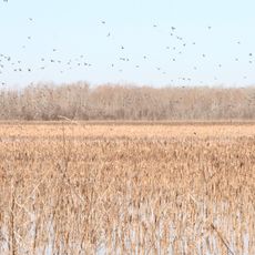
A greentree reservoir system floods annually to create feeding and resting conditions for waterfowl among buttonbush and cypress trees. This deliberate seasonal flooding is engineered to support the area's wildlife mission.
The community of curious travelers
AroundUs brings together thousands of curated places, local tips, and hidden gems, enriched daily by 60,000 contributors worldwide.