Enable Location

We need your location to show you interesting places around you

Discover nearby places

Find interesting locations and hidden gems around you

Precise directions

Get accurate directions and distances to places

Your location is never shared with other users. It's only used when you tap the location button.

Bedell Bridge State Park

Log in to your account

Start exploring — it's free

Trusted by 61,902 travelers worldwide

Continue with Google
Continue with Apple
or

We will send you a code to connect

By continuing, you accept our Terms and Conditions and our Privacy Policy

Check your inbox

We've sent a pincode in your inbox. Please enter the code below.

Bedell Bridge State Park

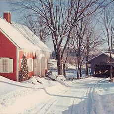
Bedell Bridge State Park, State park along Connecticut River in Haverhill, United States.

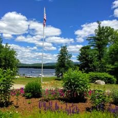
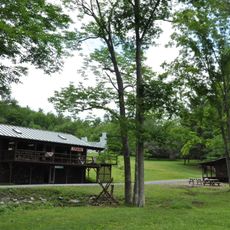
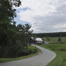
Bedell Bridge State Park is a recreational area along the Connecticut River in Haverhill with space for outdoor activities and river access. The park provides year-round opportunities to spend time by the water and explore the riverside landscape.

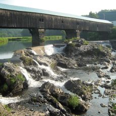
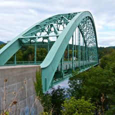
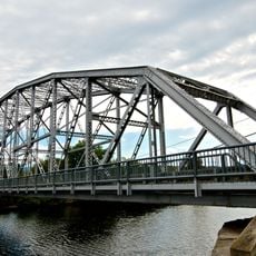
Five different bridges crossed the Connecticut River at this location between 1805 and 1979, connecting New Hampshire and Vermont. The final one was a covered bridge that ranked among the longest of its kind in North America.

The preservation efforts of local residents resulted in raising $250,000 for bridge reconstruction in 1978, demonstrating the community's dedication to historical structures.

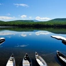
The park has a public boat launch providing access to the river for water activities. Visitors should check local guidelines to ensure they use the facilities responsibly.

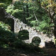
Old stone piers still rise from the Connecticut River, marking where the covered bridge once stood. These remains are reminders of the more than a century the bridge spanned the valley before high winds destroyed it.

The community of curious travelers

AroundUs brings together thousands of curated places, local tips, and hidden gems, enriched daily by 60,000 contributors worldwide.

Start exploring
Location
GPS coordinates
44.04500,-72.07300
Latest update
December 6, 2025 17:47
Hidden sites in New Hampshire between white mountains and ancient forests

New Hampshire reveals a land where the White Mountains have shaped the skyline for millennia. Between northern coniferous forests and southeastern Atlantic coasts, this New England state features waterfalls cascading over granite, glacial passes carved 15,000 years ago, and industrial villages...

Around this place
Bath Covered Bridge
United States of America

Bath Covered Bridge

16 km
Camp Walt Whitman
United States of America

Camp Walt Whitman

13.4 km
Lake Tarleton
United States of America

Lake Tarleton

11.7 km
Wells River Bridge
United States of America

Wells River Bridge

12.4 km
Haverhill-Bath Covered Bridge
United States of America

Haverhill-Bath Covered Bridge

12.5 km
Bedell Covered Bridge
United States of America

Bedell Covered Bridge

98 m
Morey Memorial Bridge
United States of America

Morey Memorial Bridge

16.3 km
Ranger Bridge
United States of America

Ranger Bridge

12.4 km
Piermont Bridge
United States of America

Piermont Bridge

8.1 km
United States of America

Lake Tarleton State Park

10.4 km
Lanakila Camp
United States of America

Lanakila Camp

13.3 km
Swiftwater Covered Bridge
United States of America

Swiftwater Covered Bridge

13.9 km
Oxbow Historic District
United States of America

Oxbow Historic District

5.9 km
Daniel Carr House
United States of America

Daniel Carr House

9 km
Haverhill Corner Historic District
United States of America

Haverhill Corner Historic District

1.7 km
Wildwood Hall
United States of America

Wildwood Hall

2.2 km
Bridge 22
United States of America

Bridge 22

7.8 km
Newbury Town House
United States of America

Newbury Town House

8 km
West Newbury Village Historic District
United States of America

West Newbury Village Historic District

4.6 km
Fairlee Town Hall
United States of America

Fairlee Town Hall

16.2 km
Woodsville Opera House
United States of America

Woodsville Opera House

12.3 km
South Newbury Village Historic District
United States of America

South Newbury Village Historic District

1.1 km
Bayley Historic District
United States of America

Bayley Historic District

5 km
Elwin Chase House
United States of America

Elwin Chase House

15.7 km
Sawyer-Medlicott House
United States of America

Sawyer-Medlicott House

7.9 km
Wells River Village Historic District
United States of America

Wells River Village Historic District

12.1 km
Orford-Fairlee Covered Bridge
United States of America

Orford-Fairlee Covered Bridge

16.2 km
Newbury Village Historic District
United States of America

Newbury Village Historic District

3.8 km
Show the full map
« Bedell Bridge State Park - State park along Connecticut River in Haverhill, United States » is provided by Around Us (aroundus.com). Images and texts are derived from Wikimedia project under a Creative Commons license. You are allowed to copy, distribute, and modify copies of this page, under the conditions set by the license, as long as this note is clearly visible.

Discover hidden gems everywhere you go!

From secret cafés to breathtaking viewpoints, skip the crowded tourist spots and find places that match your style. Our app makes it easy with voice search, smart filtering, route optimization, and insider tips from travelers worldwide. Download now for the complete mobile experience.

Around Us App Screenshot

A unique approach to discovering new places

Le Figaro

All the places worth exploring

France Info

A tailor-made excursion in just a few clicks

20 Minutes

Around Us
Travel Guide & Maps
Download

Send to your phone

QR Code
1

Open the camera app on your mobile.

2

Point at the QR code with your camera. A notification will appear.

3

Tap the notification to open the link.