Enable Location

We need your location to show you interesting places around you

Discover nearby places

Find interesting locations and hidden gems around you

Precise directions

Get accurate directions and distances to places

Your location is never shared with other users. It's only used when you tap the location button.

Log in to your account

Start exploring — it's free

Trusted by 63,065 travelers worldwide

Continue with Google
Continue with Apple
or

We will send you a code to connect

By continuing, you accept our Terms and Conditions and our Privacy Policy

Check your inbox

We've sent a pincode in your inbox. Please enter the code below.

Wildwood Falls
Discussion Reviews Photo
1.6k Popularity

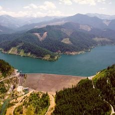
Wildwood Falls, Waterfall in Umpqua National Forest, Oregon.

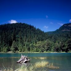
Wildwood Falls is a waterfall in Umpqua National Forest where the Row River drops approximately 20 feet over basalt cliffs, splitting into multiple streams before pooling in a deep basin. The water flows between rocky formations and creates a natural swimming area below the main cascade.

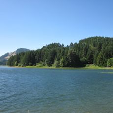
The waterfall has long served as a natural landmark in the region, offering recreation for generations after the Umpqua National Forest was established. Over time, the area developed into an established local recreation spot with organized public access.

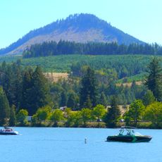
The site draws local swimmers and visitors who use the deep basin for recreation during warmer months, with people diving from nearby rocky outcrops. This natural swimming hole has become a gathering spot for the surrounding community seeking refreshment in the water.

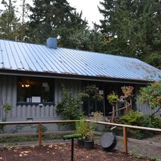
The site is reachable from Cottage Grove by heading east on Row River Road and turning at the local signs for Wildwood Falls Park. Access is best during warmer months, and the area offers basic facilities for visitors near the parking area.

The water remains relatively cool year-round, reaching only about 70 to 75 degrees Fahrenheit (21 to 24 Celsius) during summer months, making it a natural cooling spot on hot days. This steady temperature is maintained by the depth of the basin and the shaded rock formations surrounding it.

The community of curious travelers

AroundUs brings together thousands of curated places, local tips, and hidden gems, enriched daily by 60,000 contributors worldwide.

Start exploring
Location
GPS coordinates
43.69985,-122.81895
Latest update
December 14, 2025 14:26
Around this place
Cascades Raptor Center
United States of America

Cascades Raptor Center

38.3 km
Dexter Reservoir
United States of America

Dexter Reservoir

24.9 km
Dorena Reservoir
United States of America

Dorena Reservoir

14.6 km
Lookout Point Lake
United States of America

Lookout Point Lake

23.1 km
Row River National Recreation Trail
United States of America

Row River National Recreation Trail

22 km
Bohemia Mountain
United States of America

Bohemia Mountain

19.1 km
Mount Pisgah Arboretum
United States of America

Mount Pisgah Arboretum

36.7 km
Elijah Bristow State Park
United States of America

Elijah Bristow State Park

24.6 km
Hills Creek Reservoir
United States of America

Hills Creek Reservoir

31.8 km
Dexter State Recreation Site
United States of America

Dexter State Recreation Site

24.3 km
Lowell State Recreation Site
United States of America

Lowell State Recreation Site

24.8 km
Jasper State Recreation Site
United States of America

Jasper State Recreation Site

32.2 km
Charles and Anna Drain House
United States of America

Charles and Anna Drain House

39.9 km
Office Bridge
United States of America

Office Bridge

26.8 km
Lowell Bridge
United States of America

Lowell Bridge

23.6 km
Chambers Covered Bridge
United States of America

Chambers Covered Bridge

22.6 km
Musick Guard Station
United States of America

Musick Guard Station

19.6 km
Mosby Creek Bridge
United States of America

Mosby Creek Bridge

17.3 km
Currin Bridge
United States of America

Currin Bridge

17.6 km
Centennial Covered Bridge
United States of America

Centennial Covered Bridge

22.5 km
Pengra Bridge
United States of America

Pengra Bridge

29.7 km
Parvin Bridge
United States of America

Parvin Bridge

22.2 km
Dorena Bridge
United States of America

Dorena Bridge

6.8 km
Unity Bridge
United States of America

Unity Bridge

27.6 km
Stewart Bridge
United States of America

Stewart Bridge

15.9 km
Lowell Grange
United States of America

Lowell Grange

24.8 km
Methodist Episcopal Church of Goshen
United States of America

Methodist Episcopal Church of Goshen

36.4 km
Horace J. and Ann S. Shinn Cottage
United States of America

Horace J. and Ann S. Shinn Cottage

23 km
Show the full map
Reviews
Share your experience

No review yet

Discussions
Start a discussion...

No discussion yet

« Wildwood Falls - Waterfall in Umpqua National Forest, Oregon » is provided by Around Us (aroundus.com). Images and texts are derived from Wikimedia project under a Creative Commons license. You are allowed to copy, distribute, and modify copies of this page, under the conditions set by the license, as long as this note is clearly visible.

Discover hidden gems everywhere you go!

From secret cafés to breathtaking viewpoints, skip the crowded tourist spots and find places that match your style. Our app makes it easy with voice search, smart filtering, route optimization, and insider tips from travelers worldwide. Download now for the complete mobile experience.

Around Us App Screenshot

A unique approach to discovering new places

Le Figaro

All the places worth exploring

France Info

A tailor-made excursion in just a few clicks

20 Minutes

Around Us
Travel Guide & Maps
Download

Send to your phone

QR Code
1

Open the camera app on your mobile.

2

Point at the QR code with your camera. A notification will appear.

3

Tap the notification to open the link.