Chest opened
+${chestReward.xp} XP
Explorer
NOUVEAU ×${chestReward.collectible.quantity}
tapez pour fermer
Chest locked

Open chests in the app

Around Us is built for your phone — chests unlock when you walk, explore and capture nearby places.

Enable Location

We need your location to show you interesting places around you

Discover nearby places

Find interesting locations and hidden gems around you

Precise directions

Get accurate directions and distances to places

Your location is never shared with other users. It's only used when you tap the location button.

Pampa del Tamarugal

Log in to your account

Start exploring — it's free

Trusted by 73,008 travelers worldwide

Continue with Google
Continue with Apple
or

We will send you a code to connect

By continuing, you accept our Terms and Conditions and our Privacy Policy

Check your inbox

We've sent a pincode in your inbox. Please enter the code below.

Pampa del Tamarugal
Discussion Reviews 1 Photos
13.3k Popularity

Pampa del Tamarugal, Vast plain and endorheic basin in Tarapacá Region, Chile.

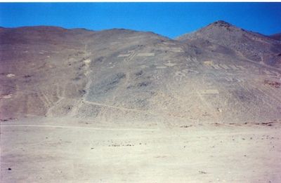
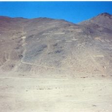
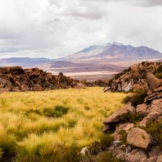
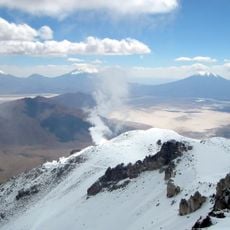
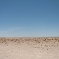
The Pampa del Tamarugal is a vast plain and endorheic basin in the Tarapacá Region, stretching between the Coastal Range and the western slopes of the Andes. This high-altitude terrain sits at roughly 900 meters elevation and displays sparse vegetation typical of this arid highland.

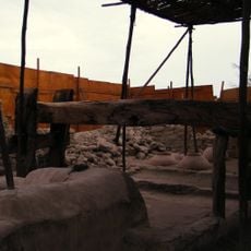
The area formed from ancient inland lakes that left behind salt deposits and created substantial reserves of nitrate and iodine. These valuable minerals have been extracted since colonial times and shaped the region's economic past.

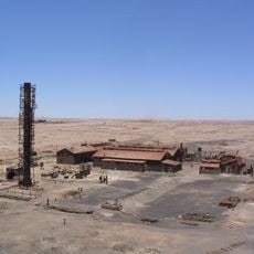
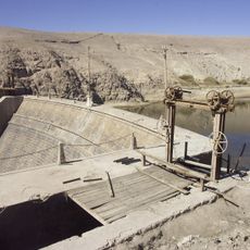
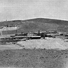
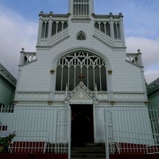
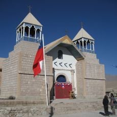
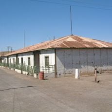
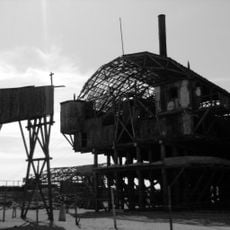
The Humberstone and Santa Laura Saltpeter Works showcase the industrial heritage of northern Chile through preserved mining installations. These sites tell the story of when the region was a major center for salt and mineral extraction.

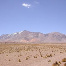
The region experiences extreme temperature swings between intense heat and cold, with around 250 clear days each year. Visitors should prepare for very dry conditions and strong sun exposure.

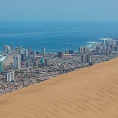
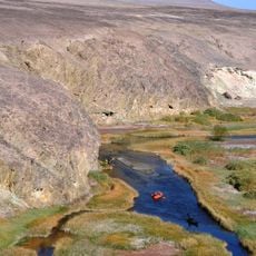
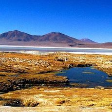
Underground water reserves beneath the plain supply drinking water to the city of Iquique and enable cultivation of vegetables, fruits, and native tamarugo trees. This hidden water system makes farming possible in this extreme desert environment.

The community of curious travelers

AroundUs brings together thousands of curated places, local tips, and hidden gems, enriched daily by 60,000 contributors worldwide.

Start exploring
Location
Elevation above the sea
894 m
GPS coordinates
-21.12679,-69.44691
Latest update
December 7, 2025 20:40
Reviews
Share your experience

No review yet

Discussions
Start a discussion...

No discussion yet

« Pampa del Tamarugal - Vast plain and endorheic basin in Tarapacá Region, Chile » is provided by Around Us (aroundus.com). Images and texts are derived from Wikimedia project under a Creative Commons license. You are allowed to copy, distribute, and modify copies of this page, under the conditions set by the license, as long as this note is clearly visible.

Discover hidden gems everywhere you go!

From secret cafés to breathtaking viewpoints, skip the crowded tourist spots and find places that match your style. Our app makes it easy with voice search, smart filtering, route optimization, and insider tips from travelers worldwide. Download now for the complete mobile experience.

Around Us App Screenshot

A unique approach to discovering new places

Le Figaro

All the places worth exploring

France Info

A tailor-made excursion in just a few clicks

20 Minutes

Around Us
Travel Guide & Maps
Download

Send to your phone

QR Code
1

Open the camera app on your mobile.

2

Point at the QR code with your camera. A notification will appear.

3

Tap the notification to open the link.