Enable Location

We need your location to show you interesting places around you

Discover nearby places

Find interesting locations and hidden gems around you

Precise directions

Get accurate directions and distances to places

Your location is never shared with other users. It's only used when you tap the location button.

Log in to your account

Start exploring — it's free

Trusted by 61,994 travelers worldwide

Continue with Google
Continue with Apple
or

We will send you a code to connect

By continuing, you accept our Terms and Conditions and our Privacy Policy

Check your inbox

We've sent a pincode in your inbox. Please enter the code below.

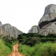
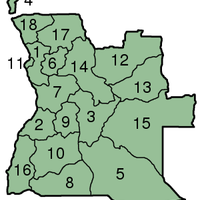
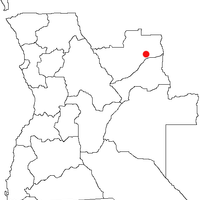
Lunda Norte Province, Administrative province in northeastern Angola

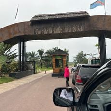
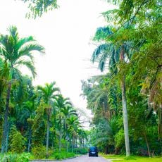
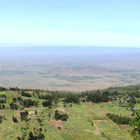
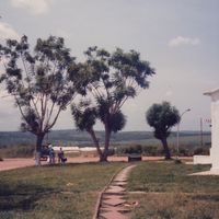
Lunda Norte is a province in northeastern Angola containing ten municipalities with Dundo as its administrative center. The region covers thousands of square kilometers and borders the Democratic Republic of Congo.

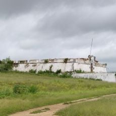
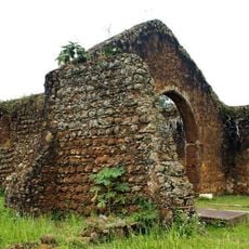
The region developed from the Lunda Kingdom, which flourished in the 16th century as a confederation of states. It became a separate province in 1978 after splitting from the original Lunda territory.

The Tchokwe people inhabit this province and transmit their traditions through ceremonies and gatherings held in community spaces. These practices shape daily life and connections among local communities.

Flights connect Dundo and Lucapa airports to the capital, while road travel passes through other provinces and requires extended time. Visitors should plan ahead as infrastructure is limited and arrangements may need advance booking.

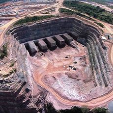
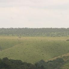
The Cuango River valley holds substantial diamond deposits and represents Angola's most productive mining region. This resource has long shaped economic activity and human movement across the area.

The community of curious travelers

AroundUs brings together thousands of curated places, local tips, and hidden gems, enriched daily by 60,000 contributors worldwide.

Start exploring
Location
Capital city
Dundo
Shares border with
Lunda Sul Province, Malanje Province
GPS coordinates
-8.28333,19.60000
Latest update
December 22, 2025 12:24
Around this place
Martyrs' stadium
Congo, Democratic Republic of the

Martyrs' stadium

647.2 km
Stade Tata Raphaël
Congo, Democratic Republic of the

Stade Tata Raphaël

645.6 km
Palace of the Nation
Congo, Democratic Republic of the

Palace of the Nation

651.7 km
Tour de l'Échangeur de Limete
Congo, Democratic Republic of the

Tour de l'Échangeur de Limete

641 km
Nsele Valley Park
Congo, Democratic Republic of the

Nsele Valley Park

627.4 km
National Museum of the Democratic Republic of Congo
Congo, Democratic Republic of the

National Museum of the Democratic Republic of Congo

647.7 km
Kalandula Falls
Angola

Kalandula Falls

405.8 km
Palais du Peuple
Congo, Democratic Republic of the

Palais du Peuple

647.6 km
Congo, Democratic Republic of the

Palais de Marbre

649.5 km
Pedras Negras de Pungo Andongo
Angola

Pedras Negras de Pungo Andongo

467.5 km
Laúca Dam
Angola

Laúca Dam

518.1 km
Central Market, Kinshasa

Central Market, Kinshasa

648.5 km
Kisantu Botanical garden
Congo, Democratic Republic of the

Kisantu Botanical garden

610.9 km
Angola

Cangandala National Park

355.9 km
Massangano Fort
Angola

Massangano Fort

606.4 km
Zambia

Chavuma Falls

633.1 km
Zongo Falls
Congo, Democratic Republic of the

Zongo Falls

649.4 km
Angola

Cameia National Park

460.3 km
Mont Mangengenge
Congo, Democratic Republic of the

Mont Mangengenge

621.7 km
Cathedral of the Holy Saviour of Congo
Angola

Cathedral of the Holy Saviour of Congo

632.5 km
Congo, Democratic Republic of the

National Museum of Kinshasa

652.2 km
Kinshasa botanical garden
Congo, Democratic Republic of the

Kinshasa botanical garden

648.8 km
Congo, Democratic Republic of the

Mont Ngafula

644.4 km
Stade 24 Novembre
Congo, Democratic Republic of the

Stade 24 Novembre

647.6 km
Fortress of Muxima
Angola

Fortress of Muxima

635.4 km
National Library of the Democratic Republic of Congo
Congo, Democratic Republic of the

National Library of the Democratic Republic of Congo

651.4 km
Our Lady of Seven Sorrows Cathedral, Kisantu
Congo, Democratic Republic of the

Our Lady of Seven Sorrows Cathedral, Kisantu

610.7 km
Domaine et réserve de Bombo-Lumene
Congo, Democratic Republic of the

Domaine et réserve de Bombo-Lumene

558.3 km
Show the full map
« Lunda Norte Province - Administrative province in northeastern Angola » is provided by Around Us (aroundus.com). Images and texts are derived from Wikimedia project under a Creative Commons license. You are allowed to copy, distribute, and modify copies of this page, under the conditions set by the license, as long as this note is clearly visible.

Discover hidden gems everywhere you go!

From secret cafés to breathtaking viewpoints, skip the crowded tourist spots and find places that match your style. Our app makes it easy with voice search, smart filtering, route optimization, and insider tips from travelers worldwide. Download now for the complete mobile experience.

Around Us App Screenshot

A unique approach to discovering new places

Le Figaro

All the places worth exploring

France Info

A tailor-made excursion in just a few clicks

20 Minutes

Around Us
Travel Guide & Maps
Download

Send to your phone

QR Code
1

Open the camera app on your mobile.

2

Point at the QR code with your camera. A notification will appear.

3

Tap the notification to open the link.