Cerro Manquehue, Mountain summit in Santiago Metropolitan Region, Chile
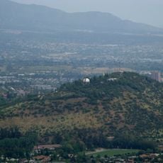
Cerro Manquehue is a massif and the highest summit of the Cordón de Manquehue, rising to 1,638 metres between the communes of Huechuraba, Lo Barnechea and Vitacura in Santiago. Its broad, roughly triangular peak shows pale grey and white rock with patches of snow along the crest, while the lower slopes are blue-grey. The mountain is the eroded root of a stratovolcano active about 20 to 16 million years ago.
The mountain was named by Mapuche communities who inhabited the region before European arrival. The name refers to condors, birds the indigenous people would have observed soaring above this elevated terrain.
The name Manquehue comes from Mapudungun Mañkewe, meaning 'place of condors'. On clear days Andean condors, tencas and turcas can be seen on the summit and slopes. The hill also marks the boundary between the communes of Huechuraba, Lo Barnechea and Vitacura.
The summit stands at 1,638 m, about 900 m above the surrounding terrain, on the border of Huechuraba, Lo Barnechea and Vitacura. Access is from the Santa María de Manquehue neighbourhood on the south slope and La Dehesa on the north slope. The sclerophyll forest is fragile and only one percent of this forest type survives in central Chile, so stay on the paths.
The summit is not volcanic rock: Cerro Manquehue is the eroded root of a stratovolcano active about 20 to 16 million years ago, and only its roots remain. At its base, construction of the El Mercurio newspaper facilities between 1988 and 1990 uncovered 36 individuals of the Llolleo culture with grave goods, mostly pottery, plus grinding stones and flakes of andesitic basalt, quartz, jasper and obsidian.
The community of curious travelers
AroundUs brings together thousands of curated places, local tips, and hidden gems, enriched daily by 94,113 contributors worldwide.