Enable Location

We need your location to show you interesting places around you

Discover nearby places

Find interesting locations and hidden gems around you

Precise directions

Get accurate directions and distances to places

Your location is never shared with other users. It's only used when you tap the location button.

Log in to your account

Start exploring — it's free

Trusted by 61,972 travelers worldwide

Continue with Google
Continue with Apple
or

We will send you a code to connect

By continuing, you accept our Terms and Conditions and our Privacy Policy

Check your inbox

We've sent a pincode in your inbox. Please enter the code below.

Palpa Province, Administrative province in Ica Department, Peru

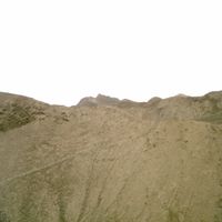
Palpa Province is an administrative area in Ica Department covering approximately 1,200 square kilometers of dry terrain with valleys and river systems. The region divides into five districts, each with its own local administration and geographic character.

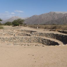
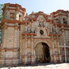
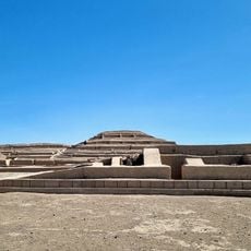
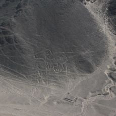
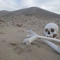
Established in 1963, the province occupies territory with deep roots in human habitation stretching back thousands of years. Several archaeological sites such as Pinchango Alto contain structures from the Late Intermediate Period overlooking the Rio Grande.

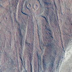
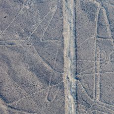
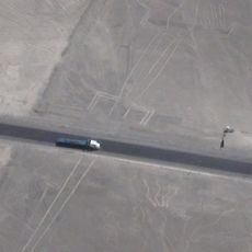
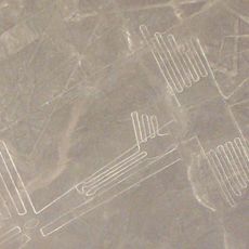
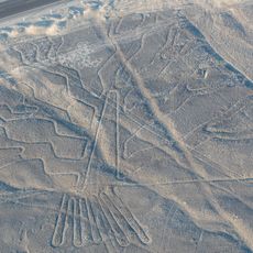
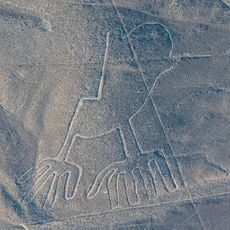
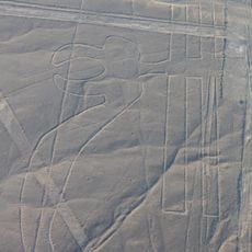
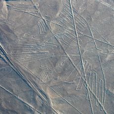
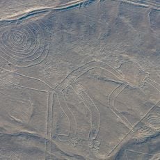
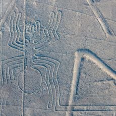
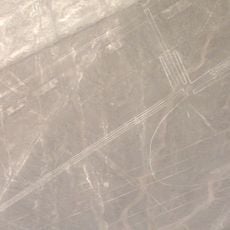
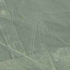
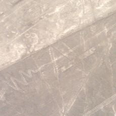
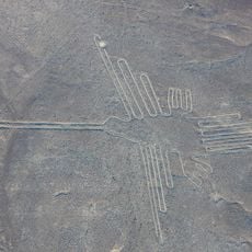
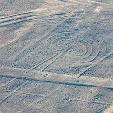
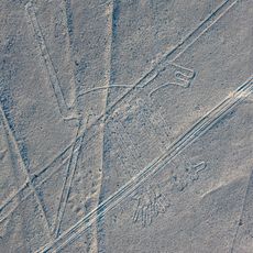
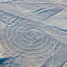
The province contains geoglyphs etched into the earth by the ancient Nazca people, reflecting their distinctive artistic approach to marking the landscape. These ground patterns remain visible across the valleys and plateaus today.

The area is accessible through routes connecting the five districts across the valleys and river plains. Exploring the region takes time due to distances between settlements and the rugged terrain throughout the province.

Pernil Alto shows evidence of human settlements from the Archaic Period, making it one of the earliest inhabited sites in the area. Excavations at this location reveal how early peoples adapted to living in the dry terrain.

The community of curious travelers

AroundUs brings together thousands of curated places, local tips, and hidden gems, enriched daily by 60,000 contributors worldwide.

Start exploring
Location
Capital city
Palpa
Shares border with
Ica Province, Nasca Province, Lucanas Province, Huaytará Province
GPS coordinates
-14.53403,-75.18496
Latest update
December 7, 2025 20:46
« Palpa Province - Administrative province in Ica Department, Peru » is provided by Around Us (aroundus.com). Images and texts are derived from Wikimedia project under a Creative Commons license. You are allowed to copy, distribute, and modify copies of this page, under the conditions set by the license, as long as this note is clearly visible.

Discover hidden gems everywhere you go!

From secret cafés to breathtaking viewpoints, skip the crowded tourist spots and find places that match your style. Our app makes it easy with voice search, smart filtering, route optimization, and insider tips from travelers worldwide. Download now for the complete mobile experience.

Around Us App Screenshot

A unique approach to discovering new places

Le Figaro

All the places worth exploring

France Info

A tailor-made excursion in just a few clicks

20 Minutes

Around Us
Travel Guide & Maps
Download

Send to your phone

QR Code
1

Open the camera app on your mobile.

2

Point at the QR code with your camera. A notification will appear.

3

Tap the notification to open the link.