Enable Location

We need your location to show you interesting places around you

Discover nearby places

Find interesting locations and hidden gems around you

Precise directions

Get accurate directions and distances to places

Your location is never shared with other users. It's only used when you tap the location button.

Santa Anita

Log in to your account

Start exploring — it's free

Trusted by 61,477 travelers worldwide

Continue with Google
Continue with Apple
or

We will send you a code to connect

By continuing, you accept our Terms and Conditions and our Privacy Policy

Check your inbox

We've sent a pincode in your inbox. Please enter the code below.

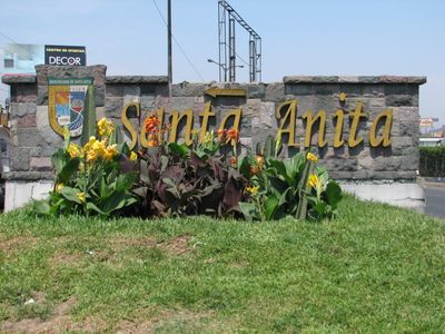
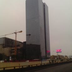
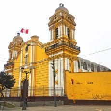
Santa Anita, Administrative district in eastern Lima, Peru

Description

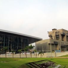
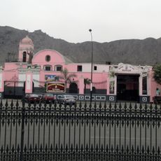
Santa Anita is an administrative district in eastern Lima that features extensive residential neighborhoods and the Mercado Mayorista, a major wholesale market serving the region. The district spans varied terrain and is defined by geographical features including the Río Surco waterway.

History

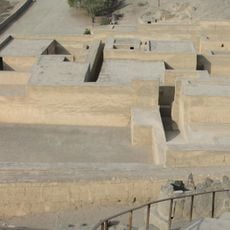
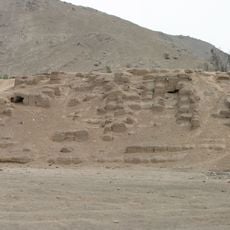
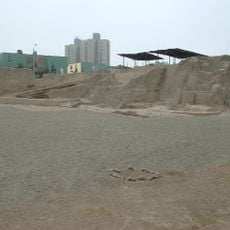
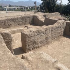
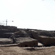
The district was created in 1989 through administrative reorganization that separated portions from the former districts of Ate and El Agustino. The area had been inhabited since pre-Hispanic times, as evidenced by archaeological remains still visible today.

Culture

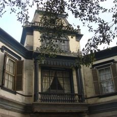
The Huaca Perales pyramid, built from adobe bricks during the Huancho period, remains a key archaeological reminder of early settlement in the area. The structure reflects the ancient craftsmanship and construction skills of the people who lived here before European arrival.

Practical

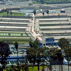
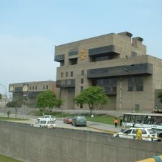
The Mercado Mayorista serves as the district's commercial hub, where vendors supply restaurants and shops throughout Lima with bulk goods. The campus of Universidad Particular San Martín de Porres provides educational access to students from Santa Anita and neighboring areas.

Did you know?

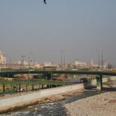
The Río Surco, an ancient irrigation canal that once supplied water to farmland, marks the western boundary of the district and flows toward Santiago de Surco. This waterway played a crucial role in early agriculture and settlement patterns throughout the area.

Location
Elevation above the sea
240 m
Shares border with
Ate District, El Agustino District
GPS coordinates
-12.04306,-76.95833
Latest update
December 20, 2025 16:08

AroundUs brings together thousands of curated places, local tips, and hidden gems, enriched daily by 60,000 contributors worldwide. Discover all places nearby (Lima province).

« Santa Anita - Administrative district in eastern Lima, Peru » is provided by Around Us (aroundus.com). Images and texts are derived from Wikimedia project under a Creative Commons license. You are allowed to copy, distribute, and modify copies of this page, under the conditions set by the license, as long as this note is clearly visible.

Discover hidden gems everywhere you go!

From secret cafés to breathtaking viewpoints, skip the crowded tourist spots and find places that match your style. Our app makes it easy with voice search, smart filtering, route optimization, and insider tips from travelers worldwide. Download now for the complete mobile experience.

Around Us App Screenshot

A unique approach to discovering new places

Le Figaro

All the places worth exploring

France Info

A tailor-made excursion in just a few clicks

20 Minutes

Around Us
Travel Guide & Maps
Download

Send to your phone

QR Code
1

Open the camera app on your mobile.

2

Point at the QR code with your camera. A notification will appear.

3

Tap the notification to open the link.