Huaytapallana Regional Conservation Area, Regional conservation area in Province of Concepción, Peru.
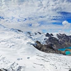
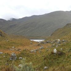
Huaytapallana Regional Conservation Area covers the central part of the Cordillera Huaytapallana in Junín, Peru, from about 4,600 to 5,768 metres above sea level. Its highest point is the Nevado Huaytapallana, given as 5,557 metres in one source. The 22,406.52-hectare area holds pajonal grassland, puna turf, bofedales, lakes and high-mountain ecosystems, drained west by the Shullcas and Achamayo, north by the Tulumayo and southeast by the Pariahuanca.
The area was officially designated as a protection zone in 2011 by the Junín Regional Government to safeguard local biodiversity. This formal recognition allowed the mountain ecosystems and their water resources to be managed for long-term preservation.
The name Huaytapallana comes from Quechua: wayta, flower, and pallana, to gather, so it reads as a place where flowers are collected. The area is managed jointly by the Junín Regional Government and its jefatura, with support from local municipalities, campesino communities, SERNANP, ALA Mantaro and the Universidad Nacional del Centro.
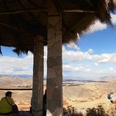
Multiple hiking trails are accessible to visitors, with some paths leading to viewpoints offering mountain vistas. Prepare for high altitude and changing weather by bringing appropriate gear and plenty of water.
Six mountain lakes including Chuspicocha and Lazo Huntay serve as the water sources for this protected land and feed into the broader Sullcas River system. These lakes support specialized high-altitude species adapted to cold mountain conditions.
The community of curious travelers
AroundUs brings together thousands of curated places, local tips, and hidden gems, enriched daily by 92,683 contributors worldwide.