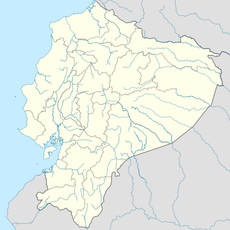
Bolívar Canton, Administrative canton in Manabí Province, Ecuador
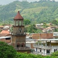
Bolívar Canton is an administrative region in northeastern Manabí Province covering about 537 square kilometers. It consists of Calceta as the urban center alongside the rural parishes of Quiroga and Membrillo.
The region began to develop in the late 1600s when settlers moved into the area to escape droughts affecting neighboring regions. This migration established the foundation for the canton's growth over time.
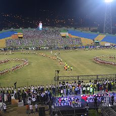
Residents celebrate their canton's founding every October and honor Calceta's patron saint each August with local festivals. These traditions shape community life and connect people to their local identity.
The area sits at about 29 meters elevation and relies on the Carrizal-Chone Irrigation System for agriculture, supporting crops like corn and rice. Visitors exploring rural areas should expect tropical conditions and extensive farmland.
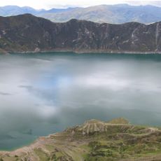
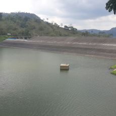
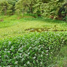
The La Esperanza Reservoir sits within the canton and serves as a water source for daily use and local fishing activities. This body of water plays an important role in the area's everyday water supply.
Location: Manabí Province
Elevation above the sea: 29 m
GPS coordinates: -0.84194,-80.16194
Latest update: December 8, 2025 13:43
Quilotoa
140.8 km
Machalilla National Park
109.4 km
Park Samanes
143.4 km
Parque Histórico de Guayaquil
148.7 km
Illinizas Ecological Reserve
121.9 km
National Unity Bridge
150.5 km
Mache-Chindul Ecological Reserve
144 km
Terminal Terrestre de Guayaquil
148.3 km
Malecón del Salado
152.6 km
Reserva marina El Pelado
140.1 km
Estadio Reales Tamarindos
39.8 km
Monumento al Sagrado Corazón
152.2 km
Poza Honda
31.2 km
Jardín botánico de Guayaquil
140.7 km
Museo Antropologico y de Arte Contemporaneo
152.8 km
Botanical garden of Portoviejo
39.3 km
Museo Municipal de la Música Popular Julio Jaramillo
152.6 km
Teatro Sánchez Aguilar
148.4 km
Cárcel Municipal de Guayaquil
152.6 km
Jardín botánico La Carolina
128.2 km
Our Lady of Mercy Cathedral, Babahoyo
127.5 km
Capilla del Cerro Santa Ana
152.4 km
Velero Bridge
152.7 km
Catedral de San Jacinto
149 km
Sarapullo River
148.3 km
Montañita Beach
127.8 km
Visited this place? Tap the stars to rate it and share your experience / photos with the community! Try now! You can cancel it anytime.
Discover hidden gems everywhere you go!
From secret cafés to breathtaking viewpoints, skip the crowded tourist spots and find places that match your style. Our app makes it easy with voice search, smart filtering, route optimization, and insider tips from travelers worldwide. Download now for the complete mobile experience.
A unique approach to discovering new places❞
— Le Figaro
All the places worth exploring❞
— France Info
A tailor-made excursion in just a few clicks❞
— 20 Minutes