Enable Location

We need your location to show you interesting places around you

Discover nearby places

Find interesting locations and hidden gems around you

Precise directions

Get accurate directions and distances to places

Your location is never shared with other users. It's only used when you tap the location button.

Villa Dolores Airport

Log in to your account

Start exploring — it's free

Trusted by 62,868 travelers worldwide

Continue with Google
Continue with Apple
or

We will send you a code to connect

By continuing, you accept our Terms and Conditions and our Privacy Policy

Check your inbox

We've sent a pincode in your inbox. Please enter the code below.

Villa Dolores Airport

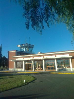
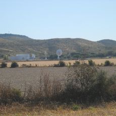
Villa Dolores Airport, Regional airport in Villa Dolores, Argentina.

Villa Dolores Airport is a regional aviation facility in Córdoba Province with two runways made of different materials. The longer runway is paved with asphalt, while the shorter one uses grass surface to accommodate smaller aircraft.

The airport was established to support the region's aviation connectivity and has served both military and civilian flight operations since its creation. Its development reflected growing transportation needs of surrounding communities over the decades.

This transportation hub connects the residents of Villa Dolores with major urban centers, enabling family reunions and community gatherings throughout the year.

The airport is equipped with navigation aids to support safe approaches for different aircraft types. Visitors should note that some landing areas have geographic features that affect flight operations.

One of the runways has a 150-meter displaced threshold at its eastern end to account for the rolling terrain of the area. This adjustment shows how infrastructure was adapted to natural landscape to ensure safe flight operations.

The community of curious travelers

AroundUs brings together thousands of curated places, local tips, and hidden gems, enriched daily by 60,000 contributors worldwide.

Start exploring
Elevation above the sea
563 m
GPS coordinates
-31.94530,-65.14640
Latest update
December 14, 2025 16:41
Around this place
Show the full map
« Villa Dolores Airport - Regional airport in Villa Dolores, Argentina » is provided by Around Us (aroundus.com). Images and texts are derived from Wikimedia project under a Creative Commons license. You are allowed to copy, distribute, and modify copies of this page, under the conditions set by the license, as long as this note is clearly visible.

Discover hidden gems everywhere you go!

From secret cafés to breathtaking viewpoints, skip the crowded tourist spots and find places that match your style. Our app makes it easy with voice search, smart filtering, route optimization, and insider tips from travelers worldwide. Download now for the complete mobile experience.

Around Us App Screenshot

A unique approach to discovering new places

Le Figaro

All the places worth exploring

France Info

A tailor-made excursion in just a few clicks

20 Minutes

Around Us
Travel Guide & Maps
Download

Send to your phone

QR Code
1

Open the camera app on your mobile.

2

Point at the QR code with your camera. A notification will appear.

3

Tap the notification to open the link.