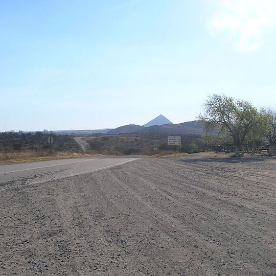
Pocho volcanic field, Volcanic field in Córdoba Province, Argentina
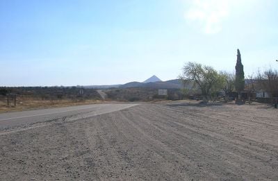
Pocho volcanic field is a group of about ten extinct volcanic cones at the southern end of the Sierras de Guasapampa, in the Valle de Traslasierra of Córdoba Province. Its main peaks are La Ciénaga or Boroa at 1,300 m, Poca at 1,600 m and Yerba Buena at 1,760 m. The photograph shows a pale, bare cone rising above darker brownish-gray lower flanks and rounded hills.
The field formed during the late Miocene, about 4.7 ± 0.3 million years ago, in two volcanic cycles. Progressive shallowing of the subducting Nazca Plate pushed activity 500 km from the Andes into the Sierras de Córdoba, along the Ojo de Agua Lineament. Eruptions were not very violent; craters once reached 3,000 m and the chain may have held a dozen volcanoes.
The name Pocho comes from the department of Pocho, which contains the peaks La Ciénaga or Boroa, Poca and Yerba Buena. The volcanic products are scattered across the Pampa de Pocho and can be seen along the provincial route 28, which links Las Palmas, Taninga and Salsacate with La Rioja province.
Access is via provincial route 28, which links the towns of Las Palmas, Taninga and Salsacate and continues toward La Rioja province; the field lies about 140 km west of Córdoba city. Volcanic products are visible along stretches of this road, so much can be seen without leaving the vehicle. The terrain is open highland with little shade.
The field lies over 600 km from the Chile-Peru trench, far beyond the 200-300 km where subduction volcanoes normally appear. Geophysical studies show the Nazca Plate dives beneath South America almost horizontally here, between 27° and 33° south, lifting the Córdoba region; elsewhere in Argentina the slab dips 30-45°.
The community of curious travelers
AroundUs brings together thousands of curated places, local tips, and hidden gems, enriched daily by 93,807 contributors worldwide.