Pampa de Achala

Log in to your account

AroundUs is a community-driven map of interesting places, built by curious explorers like you. It grows with every review, story, and photo you share.
Connect to save your favorite spots, contribute locations, and create personalized routes.
By continuing, you accept our Terms and Conditions and our Privacy Policy

Pampa de Achala

Add to collection
Map
Suggest a change
Share

Pampa de Achala, Nature reserve in Córdoba Province, Argentina.

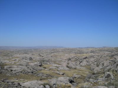
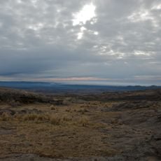
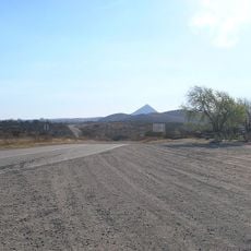
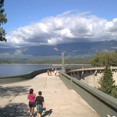
Pampa de Achala is a nature reserve in Córdoba Province covering over 146,000 hectares of highland terrain above 1,500 meters elevation. The landscape features mountain ranges with steep cliffs, open grasslands, and numerous streams that shape the rugged topography.

This territory was originally inhabited by the Comechingones people, who maintained a deep connection to the highland region. In 1996, Quebrada del Condorito National Park was established to protect the natural environment and wildlife of the area.

The name comes from Quechua language meaning "plain," reflecting how the indigenous Comechingones people understood this high-altitude landscape. Walking through the reserve today, you see how this traditional connection to the land continues to shape how people experience these mountains.

Access is best achieved via hiking trails that depart from various starting points in the region and traverse different elevations. Visitors should prepare for changeable weather conditions and bring sturdy footwear and plenty of water.

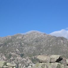
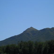
The area contains two of the province's highest mountain peaks: Cerro Champaquí at 2,790 meters and the Los Gigantes massif at 2,374 meters. These summits serve as distinctive landmarks and offer hikers sweeping views of the surrounding highlands.

Location: Pedanía Santa Rosa

Operator: Provincia de Córdoba

GPS coordinates: -31.68565,-64.80775

Latest update: December 7, 2025 20:41

Photos
Around this place
Show the full map
San Roque
Argentina

San Roque

46.9 km
Mount Champaquí
Argentina

Mount Champaquí

35.7 km
Quebrada del Condorito National Park
Argentina

Quebrada del Condorito National Park

13.5 km
La Perla Córdoba
Argentina

La Perla Córdoba

52.3 km
Cerro Pan de Azúcar
Argentina

Cerro Pan de Azúcar

61.9 km
Jesuit Block and Estancias of Córdoba
Argentina

Jesuit Block and Estancias of Córdoba

35.4 km
Rocsen Multifaceted Museum
Argentina

Rocsen Multifaceted Museum

18.9 km
Estancia Jesuitica Alta Gracia
Argentina

Estancia Jesuitica Alta Gracia

35.5 km
Pocho volcanic field
Argentina

Pocho volcanic field

59.9 km
Museo Casa del Che Guevara
Argentina

Museo Casa del Che Guevara

34.9 km
Governor Jose Manuel de la Sota Bridge
Argentina

Governor Jose Manuel de la Sota Bridge

49.1 km
Museo Usina Molet (MUM)
Argentina

Museo Usina Molet (MUM)

51.1 km
Teófilo Tabanera Space Center
Argentina

Teófilo Tabanera Space Center

36.9 km
La Viña Dam
Argentina

La Viña Dam

29.8 km
Villa Dolores Airport
Argentina

Villa Dolores Airport

43.1 km
Museum of the Bells
Argentina

Museum of the Bells

19.7 km
Mining School of José de la Quintana Senador Luis Carnevale
Argentina

Mining School of José de la Quintana Senador Luis Carnevale

39.6 km
Serpentario Machaqway
Argentina

Serpentario Machaqway

36.3 km
Argentina Air Force Museum
Argentina

Argentina Air Force Museum

58.4 km
Biblioteca Popular Almafuerte
Argentina

Biblioteca Popular Almafuerte

49.4 km
Popular Library and Cultural Center Dumesnil
Argentina

Popular Library and Cultural Center Dumesnil

60.5 km
Biblioteca Popular Mariano Moreno
Argentina

Biblioteca Popular Mariano Moreno

58.6 km
Museo Manuel De Falla
Argentina

Museo Manuel De Falla

35.9 km
Reducción de Alta Gracia
Argentina

Reducción de Alta Gracia

35.5 km
La iglesia y sacristía; la casa vivienda (hoy llamada Casa del Virrey), el obraje, el mirador o miramar, el tajamar y las ruinas de lo que fueron el viejo molino y batanes de la Estancia Jesuítica de Alta Gracia.
Argentina

La iglesia y sacristía; la casa vivienda (hoy llamada Casa del Virrey), el obraje, el mirador o miramar, el tajamar y las ruinas de lo que fueron el viejo molino y batanes de la Estancia Jesuítica de Alta Gracia.

35.5 km
Capilla, Colegio y C.de Ejer.Esp.de Cura Brochero
Argentina

Capilla, Colegio y C.de Ejer.Esp.de Cura Brochero

20.1 km
Museo de Arte Religioso Santa Rosa de Lima
Argentina

Museo de Arte Religioso Santa Rosa de Lima

49.3 km
Horno La Primera Argentina
Argentina

Horno La Primera Argentina

53.9 km
Show the full map
Reviews

Visited this place? Tap the stars to rate it and share your experience / photos with the community! Try now! You can cancel it anytime.

« Pampa de Achala - Nature reserve in Córdoba Province, Argentina » is provided by Around Us (aroundus.com). Images and texts are derived from Wikimedia project under a Creative Commons license. You are allowed to copy, distribute, and modify copies of this page, under the conditions set by the license, as long as this note is clearly visible.

Discover hidden gems everywhere you go!

From secret cafés to breathtaking viewpoints, skip the crowded tourist spots and find places that match your style. Our app makes it easy with voice search, smart filtering, route optimization, and insider tips from travelers worldwide. Download now for the complete mobile experience.

Around Us App Screenshot

A unique approach to discovering new places

Le Figaro

All the places worth exploring

France Info

A tailor-made excursion in just a few clicks

20 Minutes