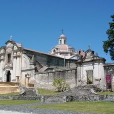
Embalse, Lakeside municipality in Calamuchita Department, Argentina
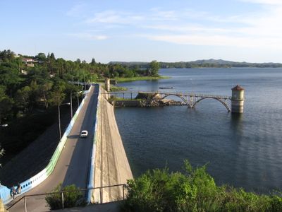
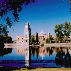
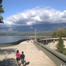
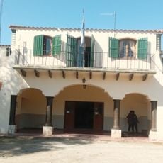
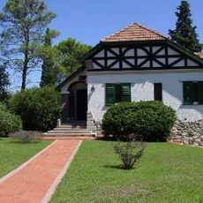
Embalse is a municipality that stretches along the shores of a large lake in the Calamuchita Valley, situated at about 623 meters elevation. The town spreads across relatively flat terrain surrounded by forested hills, connecting residential areas with local services and public spaces.
The municipality was established in 1911 and grew from a small settlement into an important administrative center in Córdoba Province. Its development was supported by its strategic location on the lake and proximity to other valley towns.
The annual Vuelta a la Sierrita cycling competition brings together 1,500 participants through the streets and surrounding areas of Embalse.
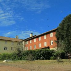
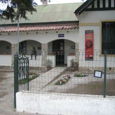
Visitors will find basic amenities like shops, restaurants, and public squares distributed throughout the municipality. Most places are accessible on foot or by car, with local information points available to help with questions.
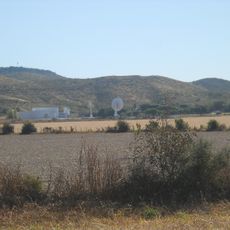
A nuclear power plant is operated nearby, one of only two active facilities of its kind in the country, giving the region economic significance. This facility shapes local development and draws skilled workers to the area.
Location: Calamuchita Department
Inception: 1911
Elevation above the sea: 623 m
Website: http://embalse.gov.ar/municipalidad
GPS coordinates: -32.18333,-64.41667
Latest update: December 20, 2025 16:08
Mount Champaquí
53.6 km
Quebrada del Condorito National Park
62.2 km
La Perla Córdoba
83.8 km
Jesuit Block and Estancias of Córdoba
58.7 km
Rocsen Multifaceted Museum
66.5 km
Pampa de Achala
66.6 km
Unidad Turística Embalse
2.8 km
Estancia Jesuitica Alta Gracia
58.5 km
Museo Casa del Che Guevara
59.5 km
Autódromo Oscar Cabalén
67.9 km
Museo Palacio Dionisi
86.7 km
Teófilo Tabanera Space Center
73.5 km
Capilla de Tegua
52.4 km
La Viña Dam
67.9 km
Museum of the Bells
75.5 km
Mining School of José de la Quintana Senador Luis Carnevale
42.2 km
Serpentario Machaqway
65.1 km
Argentina Air Force Museum
84.6 km
Estacion de Tren, Almafuerte, Cordoba
15.7 km
Museo del Libro
57.4 km
Pasos Malos
54.6 km
Casa señorial
86.7 km
Biblioteca Popular Almafuerte
17.5 km
Museo Manuel De Falla
58.9 km
Reducción de Alta Gracia
58.5 km
La iglesia y sacristía; la casa vivienda (hoy llamada Casa del Virrey), el obraje, el mirador o miramar, el tajamar y las ruinas de lo que fueron el viejo molino y batanes de la Estancia Jesuítica de Alta Gracia.
58.5 km
Capilla del Rosario de Piedra Blanca
58.9 km
Capilla, Colegio y C.de Ejer.Esp.de Cura Brochero
77.9 kmVisited this place? Tap the stars to rate it and share your experience / photos with the community! Try now! You can cancel it anytime.
Discover hidden gems everywhere you go!
From secret cafés to breathtaking viewpoints, skip the crowded tourist spots and find places that match your style. Our app makes it easy with voice search, smart filtering, route optimization, and insider tips from travelers worldwide. Download now for the complete mobile experience.
A unique approach to discovering new places❞
— Le Figaro
All the places worth exploring❞
— France Info
A tailor-made excursion in just a few clicks❞
— 20 Minutes