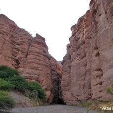
Cañón del Pilaya, Canyon at the border of Chuquisaca and Tarija departments, Bolivia
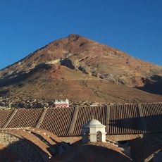
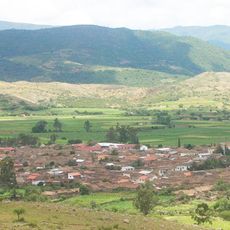
Cañón del Pilaya is a deep valley on the border between Chuquisaca and Tarija departments in Bolivia. Steep limestone cliffs form the canyon walls, revealing multiple geological layers across kilometers of landscape.
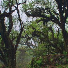
The canyon was carved over millions of years by the Camblaya and Pilaya rivers flowing through sedimentary rock. This extended process of erosion shaped the deep valley visible today.
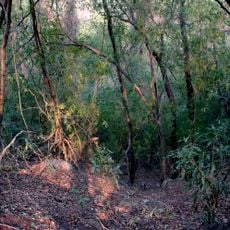
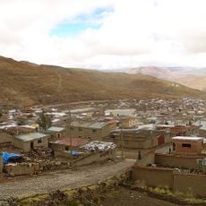
The farming communities around the canyon grow crops on stepped terraces built into the steep slopes, using methods passed down through families. These agricultural practices show how people have adapted their daily work to the demanding terrain.
Visitors should arrange local guides from San Lorenzo or Culpina municipalities to explore the area safely. Trails are not consistently marked and facilities are sparse, so careful planning beforehand helps ensure a better visit.
The valley ranks among the deepest in the world, with rock walls that display a mosaic of different geological periods stacked one atop another. These layered formations tell the story of the region's geological development.
Location: Chuquisaca Department
Location: Tarija Department
GPS coordinates: -21.09598,-64.83922
Latest update: December 9, 2025 12:23
Cerro Rico
189.9 km
National Mint of Bolivia
193.1 km
Baritú National Park
167.2 km
Tariquía Flora and Fauna National Reserve
111.7 km
La Glorieta castle
228.4 km
Reserva de biosfera de Yungas
212.6 km
Uyuni Railway Scrap Yard
218.9 km
Cathedral Basilica of Our Lady of Peace, Potosí
193 km
Cordillera de Sama Biological Reserve
57.7 km
La Recoleta Monastery
231.3 km
Estadio Víctor Agustín Ugarte
194.4 km
Casa Dorada, Tarija
49.8 km
San Lorenzo Church, Potosí
193.3 km
Aguaragüe Integrated Management Natural Area
136.2 km
Iñao National Park and Integrated Management Natural Area
209.3 km
Tarija Cathedral
49.8 km
Antonio José de Sucre Bridge
197 km
Torre de la Compañía
193.1 km
Potosí mountain range
177.7 km
Devil´s bridge
219.8 km
Pari Urqu
197.8 km
Cerro Lípes
230.6 km
Bolivian National Observatory at Tarija
60 km
Kunturiri
198.2 km
Camataqui Municipality
47.4 km
Floresta (Santa Cruz)
224 km
Magical
99.9 km
Saint Theresa Museum
193.2 kmVisited this place? Tap the stars to rate it and share your experience / photos with the community! Try now! You can cancel it anytime.
Discover hidden gems everywhere you go!
From secret cafés to breathtaking viewpoints, skip the crowded tourist spots and find places that match your style. Our app makes it easy with voice search, smart filtering, route optimization, and insider tips from travelers worldwide. Download now for the complete mobile experience.
A unique approach to discovering new places❞
— Le Figaro
All the places worth exploring❞
— France Info
A tailor-made excursion in just a few clicks❞
— 20 Minutes