Santa Bárbara, Colonial municipality in Minas Gerais, Brazil.
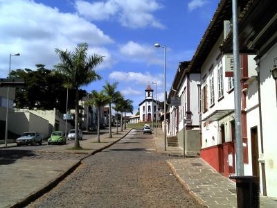
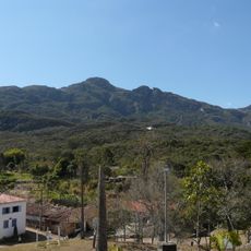
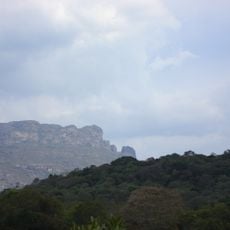
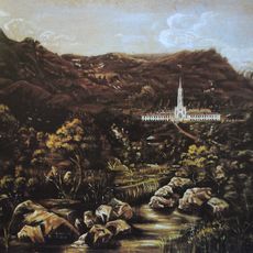
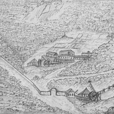
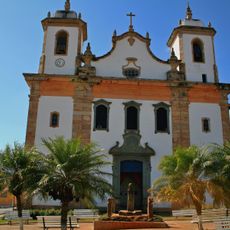
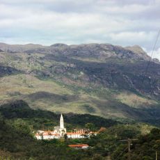
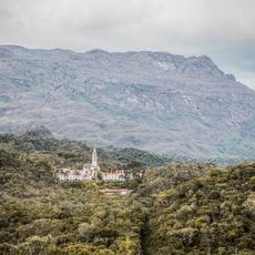
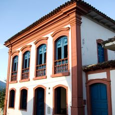
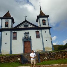
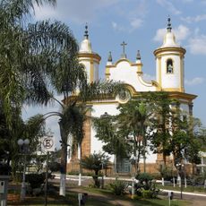
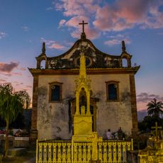
Santa Bárbara is a municipality in Minas Gerais situated at the base of Serra do Caraça, featuring colonial-era churches with terracotta tile roofs and residential homes spread across rolling terrain. The town layout reflects its origins as a mining settlement, with a central church and houses organized around open spaces and gardens.
The settlement began in 1704 as a hamlet along a crucial route connecting Rio de Janeiro to the northern mining regions. Its founding and early growth depended directly on access to iron and gold deposits in the surrounding territory.
The town's identity is rooted in its mining heritage, visible in how residents have organized their lives around the extraction industries that shaped daily routines for generations. Local crafts and production methods reflect centuries of experience working the land and its resources.
The municipality sits in a mountainous area where the drier months offer the most comfortable visiting conditions. Local facilities and services operate on a smaller scale typical of rural towns, so flexible planning around opening hours and availability is helpful.
The town is the birthplace of Afonso Pena, who became Brazil's sixth President and shaped national policies of his era. This connection to a significant political figure remains part of the local story.
Location: Minas Gerais
Inception: 1704
Elevation above the sea: 732 m
Shares border with: Alvinópolis, Itabirito, Mariana, Caeté, Ouro Preto, Barão de Cocais, São Gonçalo do Rio Abaixo, Catas Altas
GPS coordinates: -19.95889,-43.41500
Latest update: December 6, 2025 22:07
Caraça
21.4 km
Serra da Piedade
31.3 km
Serra do Gandarela National Park
29.7 km
Shrine of Our Lady of Piety
31.2 km
Historic Town of Ouro Preto
46.9 km
Colégio do Caraça
17.2 km
Gongo Soco
19.2 km
Parish Church of Our Lady of Good Success
27.6 km
Frei Rosário Astronomical Observatory
31.6 km
Pico do Sol
17.3 km
RPPN Sanctuary of Caraça
17.3 km
Arquivo Eclesiástico da Arquidiocese de Mariana
46.6 km
Museu Regional de Caeté
27.6 km
Andorinhas Falls
46.3 km
Igreja Matriz de São Bartolomeu
43.1 km
Igreja MatrIz de Nossa Senhora de Nazaré (Santa Rita Durão)
24.9 km
Igreja Matriz de São João Batista
7.7 km
Igreja de Nossa Senhora do Rosário
27.9 km
Capela de Santana
46.5 km
Igreja Matriz de Nossa Senhora da Conceição
34.9 km
Igreja Matriz de Nossa Senhora de Nazaré
29.8 km
Frei Rosário Astronomical Observatory 60cm telescope
31.6 km
Parish Church of Saint Antony (Glaura)
44.6 km
Bicame de Pedra
10.2 km
Casa no Largo do Rosário
191 m
Catas Altas Historial Centre
12.9 km
Santuário do Caraça
17.3 km
Pelourinho do Poder
27.6 kmVisited this place? Tap the stars to rate it and share your experience / photos with the community! Try now! You can cancel it anytime.
Discover hidden gems everywhere you go!
From secret cafés to breathtaking viewpoints, skip the crowded tourist spots and find places that match your style. Our app makes it easy with voice search, smart filtering, route optimization, and insider tips from travelers worldwide. Download now for the complete mobile experience.
A unique approach to discovering new places❞
— Le Figaro
All the places worth exploring❞
— France Info
A tailor-made excursion in just a few clicks❞
— 20 Minutes