Jaru, Administrative division in Rondônia, Brazil
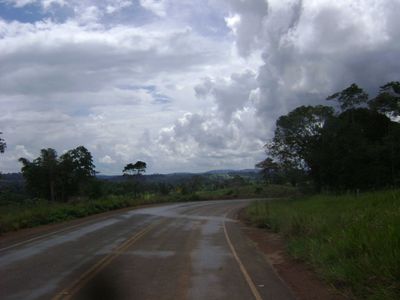
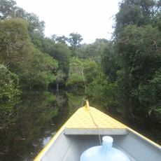
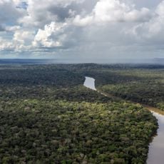
Jaru is an administrative division in Rondônia, located in the western Amazon region of Brazil. The territory lies across flat to gently rolling land crossed by rivers and covered largely with forest.
The region was originally home to the Jarus people who lived along the river valleys. Modern settlement began when a telegraph line was established here in 1912, marking the first steps of permanent colonization.
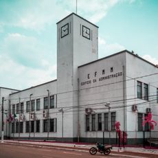
The town reflects both indigenous roots and the wave of Brazilian settlers who arrived during the 1970s colonization efforts. These two influences shape how people live and use the spaces around them today.
To explore the area, it helps to have your own transportation since distances between points can be long. The local infrastructure is basic but functional for visitors moving around the municipality.
The name comes from the indigenous Jarus people who controlled vast lands along the Rio Jaru before colonial times. Choosing to keep their name honors the original inhabitants in a way that few other places in the region do.
GPS coordinates: -10.43183,-62.47877
Latest update: December 7, 2025 19:26
Madeira-Mamoré Railroad
242.7 km
Fort Prince of Beira
307.1 km
Noel Kempff Mercado National Park
458.6 km
Pacaás Novos National Park
131.9 km
Catarata Arco Iris
408.4 kmUrubichá
511.7 km
Serra Ricardo Franco State Park
520 km
Campos Amazônicos National Park
297.3 kmRíos Blanco y Negro Wildlife Reserve
480.7 km
Mapinguari National Park
300.6 km
Casarabe culture
539.8 km
Bajo Paraguá Municipal Protected Area
461.2 km
Ituxi Extractive Reserve
412.1 km
Rio Cautário Federal Extractive Reserve
245.3 km
Aquariquara Extractive Reserve
87.7 km
Association of Machadinho Rubber Tappers
123.8 km
Iquiri National Forest
456.9 km
Lago do Cuniã Extractive Reserve
261.4 km
Federico Ahlfeld Falls
404.6 km
Rio Cautário State Extractive Reserve
267.5 km
Rio Ouro Preto Extractive Reserve
245.4 kmIsla Cumprida
299.3 km
Madeira-Mamoré Railroad, rail yard
242.9 km
Castanheira do Estádio Aluízio Pinheiro Ferreira
243.8 km
Capela de Santo Antônio de Pádua
241.9 km
Três Caixas d'Água
243.1 km
Indigenous Territory Tenharim do Igarapé Preto
242.8 km
Prédio da Administração Central da EFMM
242.9 kmVisited this place? Tap the stars to rate it and share your experience / photos with the community! Try now! You can cancel it anytime.
Discover hidden gems everywhere you go!
From secret cafés to breathtaking viewpoints, skip the crowded tourist spots and find places that match your style. Our app makes it easy with voice search, smart filtering, route optimization, and insider tips from travelers worldwide. Download now for the complete mobile experience.
A unique approach to discovering new places❞
— Le Figaro
All the places worth exploring❞
— France Info
A tailor-made excursion in just a few clicks❞
— 20 Minutes