Serra Ricardo Franco State Park, State park in Mato Grosso, Brazil
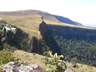
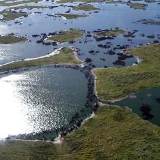
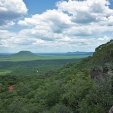
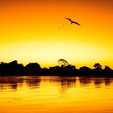
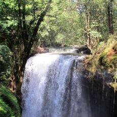
Serra Ricardo Franco State Park spans a plateau in Mato Grosso where cerrado grasslands gradually transition into Amazon rainforest. The protected area covers more than 158,000 hectares and contains numerous waterfalls and natural water sources throughout its territory.
The protected area was established in 1997 through a government decree to safeguard the region's natural resources and water systems. This official designation made it a key part of Brazil's broader conservation efforts in the region.
The park shares a border with Bolivia's Noel Kempff Mercado National Park, forming an international conservation zone. This cross-border arrangement allows diverse South American ecosystems to thrive and move naturally across the landscape.
Visitors can access the Namorados waterfall trail, which features marked paths and natural pools. The remaining park areas require permits and are managed for conservation purposes, so plan to focus on the accessible sections.
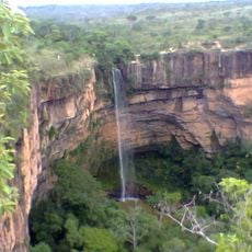
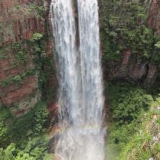
The Jatoba waterfall plunges 248 meters, making it the highest waterfall in the state. This dramatic cascade remains largely unknown to casual visitors since it sits in a less accessible area of the park.
GPS coordinates: -14.58198,-60.28119
Latest update: December 13, 2025 12:24
Pantanal
432.4 km
Arena Pantaloneta
461.4 km
Noel Kempff Mercado National Park
72.5 km
Chiquitania
381.7 km
Jesuit Missions of Chiquitos
304.2 km
Estádio José Fragelli
461.4 km
Mãe Bonifácia State Park
462.4 km
Immaculate Conception Cathedral, Concepción
254.7 km
Parque nacional Histórico Santa Cruz La Vieja
369.6 km
Catarata Arco Iris
114.5 km
Catarata Véu da Noiva
436.1 km
Urubichá
296.3 km
Santuario Mariano de la Torre
396.5 km
Marco do Jauru
323.7 km
Cachoeira do Jatobá
43.5 km
Ríos Blanco y Negro Wildlife Reserve
239.7 km
Igreja de Nossa Senhora da Guia
461.5 km
Casarabe culture
453.2 km
Cathedral of St. Louis of France
323.8 km
Bajo Paraguá Municipal Protected Area
150.7 km
San Matías Integrated Management Natural Area
369.5 km
Taiamã Ecological Station
390.4 km
Federico Ahlfeld Falls
118.7 km
Ruins of the Church of the Holy Trinity
59.1 km
Isla Cumprida
275.8 km
Municipio Montero
441.3 km
Misión de San José
366.6 km
Cachoeira do Funil
435.9 kmVisited this place? Tap the stars to rate it and share your experience / photos with the community! Try now! You can cancel it anytime.
Discover hidden gems everywhere you go!
From secret cafés to breathtaking viewpoints, skip the crowded tourist spots and find places that match your style. Our app makes it easy with voice search, smart filtering, route optimization, and insider tips from travelers worldwide. Download now for the complete mobile experience.
A unique approach to discovering new places❞
— Le Figaro
All the places worth exploring❞
— France Info
A tailor-made excursion in just a few clicks❞
— 20 Minutes