Sobradinho, Administrative division with hydroelectric dam in Bahia, Brazil
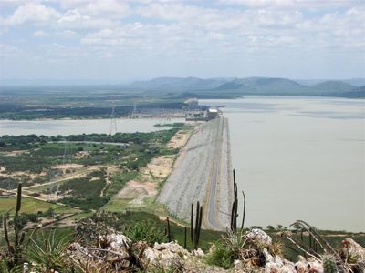
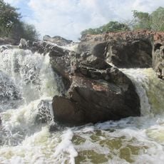
Sobradinho is a municipality in Bahia that spreads along the São Francisco River and is defined by a major hydroelectric dam. The reservoir created by the dam shapes the landscape and influences how the region functions.
The creation of this municipality became closely tied to the construction of the major dam that fundamentally transformed the area. The formation of the reservoir led to significant changes in how the region was settled and developed.
People here maintain deep ties to the river and its waters through daily activities and traditions. Agricultural practices and ways of life are closely linked to the reservoir that shapes the region.
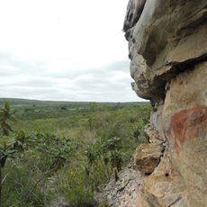
The location offers direct access to the reservoir and sits at an elevation that is easy to navigate for visitors. Proximity to the water makes it straightforward to explore the area and understand how the reservoir shapes daily life here.
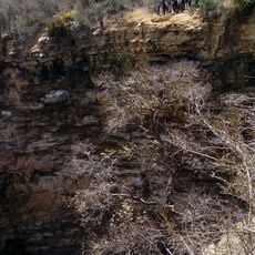
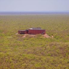
The reservoir system here ranks among the largest artificial lakes and spans across multiple administrative boundaries. This scale has made the region an important hub for electricity generation and water supply across northern Brazil.
Location: Bahia
Elevation above the sea: 394 m
Shares border with: Casa Nova
GPS coordinates: -9.45500,-40.82278
Latest update: December 7, 2025 19:26
Serra da Capivara National Park
209.2 km
Bendegó meteorite
186.5 km
Sobradinho Reservoir
78.6 km
Pedra Furada
202.4 km
Ponte Presidente Dutra
35.4 km
Museu do Homem Americano
211.6 km
Toca da Tira Peia
183.1 km
Museu do Sertão
36.3 km
Canudos State Park
197 km
Cachoeira Véu de Noiva
212 km
Parish Church of Santo Antonio of Jacobina
195.4 km
Monumento Natural Cachoeira do Ferro Doido
242.4 km
Sete Passagens State Park
217.7 km
Cachoeira do Inferno
260.4 km
Hotel e Parque Aquático Fiesta Park
195.1 km
Morro do Chapéu State Park
220.4 km
Senhora Sant'Ana Parish
198.2 km
Museum of American Man
211.6 km
Igreja de Nossa Senhora da Conceição (Jacobina)
195.3 km
Conjunto Arquitetônico, Urbanístico, Natural e Paisagístico da Serra do Monte Santo
195.7 km
Fundação Museu Regional Do São Francisco
35.5 km
Morrão
241.6 km
Capivara-Confusões Ecological Corridor
249.2 km
Serra Branca / Raso da Catarina Environmental Protection Area
252.7 km
Lapa dos Brejões
185.8 km
Buraco do Possidônio
248.8 km
Cathedral of Our Lord of the Good End, Senhor do Bonfim
131.8 km
Museu da Natureza
201 kmVisited this place? Tap the stars to rate it and share your experience / photos with the community! Try now! You can cancel it anytime.
Discover hidden gems everywhere you go!
From secret cafés to breathtaking viewpoints, skip the crowded tourist spots and find places that match your style. Our app makes it easy with voice search, smart filtering, route optimization, and insider tips from travelers worldwide. Download now for the complete mobile experience.
A unique approach to discovering new places❞
— Le Figaro
All the places worth exploring❞
— France Info
A tailor-made excursion in just a few clicks❞
— 20 Minutes