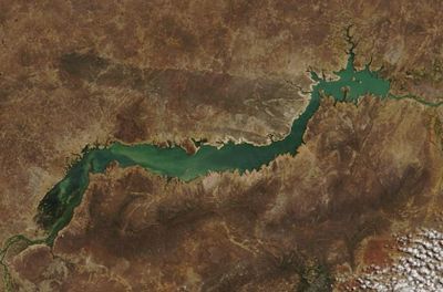
Sobradinho Reservoir, Hydroelectric reservoir in Bahia, Brazil.
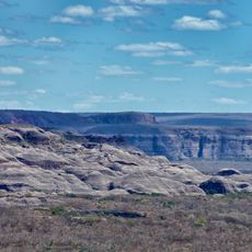
Sobradinho Reservoir spreads across a wide area in the interior of Bahia, forming one of the largest artificial bodies of water in Brazil. Its shores wind through hilly terrain and valleys, while the water rests calmly between dry banks.
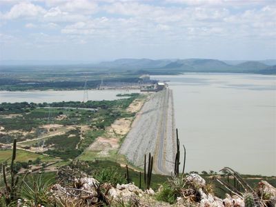
Work on the dam began in the early 1970s to generate electricity for the northeast. Filling the reservoir took several years and permanently altered the landscape.
The transformation reshaped how communities along the river depend on water and land for their livelihoods. Fishermen today adapt their methods to the altered conditions of the reservoir, while former agricultural lands now rest beneath the surface.
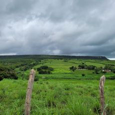
Access to the shore area is available at several points where roads reach the water. The area is wide and open, so bringing a hat and water is advisable, especially during the hot months.
The regulation of the river allows downstream communities to rely on a consistent water flow throughout the year. This control also influences agricultural cycles in distant areas along the river.
Location: Sobradinho
Location: Bahia
Inception: 1982
Elevation above the sea: 385 m
GPS coordinates: -9.67222,-41.50417
Latest update: December 5, 2025 22:29
Serra da Capivara National Park
160.4 km
Chapada do Araripe
291.2 km
Bendegó meteorite
250.9 km
Pedra Furada
148.4 km
Ponte Presidente Dutra
113.7 km
Serra das Confusões National Park
237.7 km
Museu do Homem Americano
149.4 km
Toca da Tira Peia
134 km
Museu do Sertão
114.7 km
Canudos State Park
265.9 km
Cachoeira Véu de Noiva
214.9 km
Parish Church of Santo Antonio of Jacobina
200.4 km
Monumento Natural Cachoeira do Ferro Doido
224.3 km
Sete Passagens State Park
219.1 km
Hotel e Parque Aquático Fiesta Park
199.1 km
Morro do Chapéu State Park
191.9 km
Senhora Sant'Ana Parish
246 km
Instituto Ponte Nova
293.5 km
Museum of American Man
149.5 km
Igreja de Nossa Senhora da Conceição (Jacobina)
200.1 km
Conjunto Arquitetônico, Urbanístico, Natural e Paisagístico da Serra do Monte Santo
252 km
Fundação Museu Regional Do São Francisco
113.4 km
Morrão
216.2 km
Capivara-Confusões Ecological Corridor
195.4 km
Lapa dos Brejões
149.4 km
Buraco do Possidônio
221.3 km
Quilombo Igarité
242.7 km
Cathedral of Our Lord of the Good End, Senhor do Bonfim
168.9 kmVisited this place? Tap the stars to rate it and share your experience / photos with the community! Try now! You can cancel it anytime.
Discover hidden gems everywhere you go!
From secret cafés to breathtaking viewpoints, skip the crowded tourist spots and find places that match your style. Our app makes it easy with voice search, smart filtering, route optimization, and insider tips from travelers worldwide. Download now for the complete mobile experience.
A unique approach to discovering new places❞
— Le Figaro
All the places worth exploring❞
— France Info
A tailor-made excursion in just a few clicks❞
— 20 Minutes