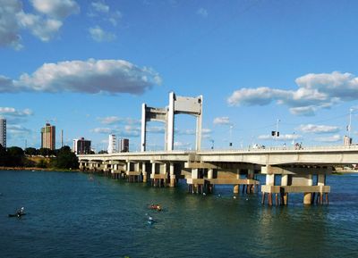
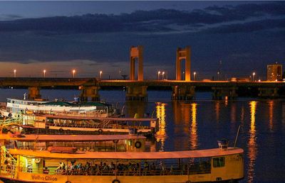
Ponte Presidente Dutra, Road bridge between Juazeiro and Petrolina, Brazil.
Ponte Presidente Dutra is a road bridge that crosses the São Francisco River and connects Juazeiro in Bahia to Petrolina in Pernambuco. The structure spans roughly 800 meters and carries several tens of thousands of vehicles daily.
The structure was built in the 1950s and became the second prestressed concrete bridge in Brazil, designed by French engineer Eugéne Freyssinet. The structural calculations were performed in France, showing an important engineering partnership between nations.
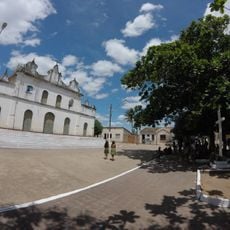
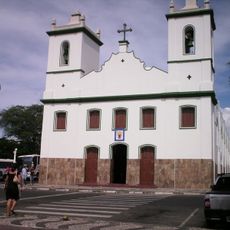
The bridge connects two states and enables the movement of goods and people between the communities on either side of the river. It serves as a daily crossing point that shapes how residents live and work across the divide.
The bridge provides continuous access between the two cities and is passable at all hours. It is wise to expect slower movement during morning and evening rush times, so choosing a flexible crossing time can make the journey more pleasant.
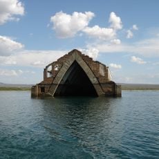
When completed, the bridge featured a central section that could be raised to allow river vessels to pass, including the cargo ship Fernandes da Cunha. This movable section was later deactivated as river traffic declined.
Location: Juazeiro
Location: Petrolina
GPS coordinates: -9.40520,-40.50430
Latest update: December 8, 2025 19:52
Serra da Capivara National Park
239.5 km
Chapada do Araripe
226.9 km
Bendegó meteorite
157.7 km
Sobradinho Reservoir
113.7 km
Pedra Furada
234 km
Museu do Homem Americano
244.9 km
Toca da Tira Peia
213.9 km
Floresta Nacional do Araripe-Apodi
245 km
Estádio Cornélio de Barros
212.4 km
Museu do Sertão
1.4 km
Canudos State Park
165.5 km
Igreja de Nossa Senhora do Rosário
230.9 km
Cachoeira Véu de Noiva
214.6 km
Parish Church of Santo Antonio of Jacobina
197.9 km
Sete Passagens State Park
220.8 km
Cachoeira do Inferno
240 km
Hotel e Parque Aquático Fiesta Park
198 km
Morro do Chapéu State Park
236 km
Senhora Sant'Ana Parish
178.6 km
Museum of American Man
244.9 km
Igreja de Nossa Senhora da Conceição (Jacobina)
197.8 km
Conjunto Arquitetônico, Urbanístico, Natural e Paisagístico da Serra do Monte Santo
171.5 km
Fundação Museu Regional Do São Francisco
3.3 km
Serra Branca / Raso da Catarina Environmental Protection Area
220.2 km
Lapa dos Brejões
205.8 km
Igreja Matriz do Senhor da Ascensão
248.1 km
Old Petrolandia Church
249.7 km
Cathedral of Our Lord of the Good End, Senhor do Bonfim
122.4 kmVisited this place? Tap the stars to rate it and share your experience / photos with the community! Try now! You can cancel it anytime.
Discover hidden gems everywhere you go!
From secret cafés to breathtaking viewpoints, skip the crowded tourist spots and find places that match your style. Our app makes it easy with voice search, smart filtering, route optimization, and insider tips from travelers worldwide. Download now for the complete mobile experience.
A unique approach to discovering new places❞
— Le Figaro
All the places worth exploring❞
— France Info
A tailor-made excursion in just a few clicks❞
— 20 Minutes