Itupiranga, Municipality in Sudeste Paraense, Brazil.
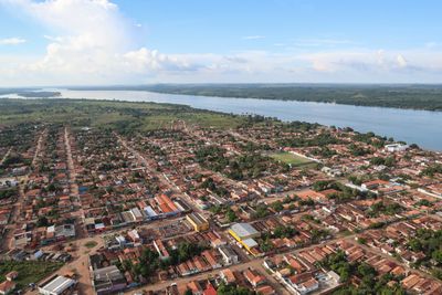
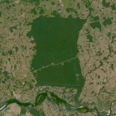
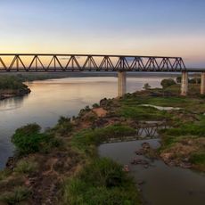
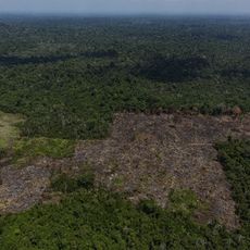
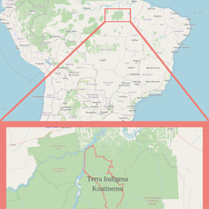
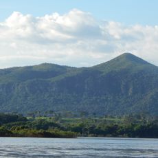
Itupiranga is a municipality located in southeastern Pará state in northern Brazil, situated at an elevation of about 153 meters. The area covers roughly 7,880 square kilometers and is characterized by Amazon river basin geography.
The region evolved from early settlements into an established municipality, marking a key step in the administrative expansion of the Brazilian Amazon. This process shaped the development of local infrastructure and communities.
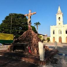
The region reflects indigenous roots and Portuguese colonial heritage visible in everyday customs and local celebrations. You can observe this cultural blend in how residents interact and maintain their traditions throughout the year.
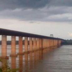
The municipality is accessible by established road connections and offers basic services for visitors and residents. It helps to use local guides to better understand the different areas and points of interest.
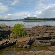
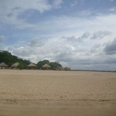
The municipality encompasses several islands in the Amazon River, including Ilha do Agostinho and Ilha da Fazenda, which form part of the local landscape. These islands add their own character and expand the diversity of the area.
Location: Pará
Elevation above the sea: 153 m
Shares border with: Jacundá, Marabá, Nova Ipixuna, Novo Repartimento
GPS coordinates: -5.13500,-49.32694
Latest update: December 10, 2025 15:55
Chapada das Mesas National Park
318.9 km
Marabá Combined Bridge
34 km
Pedra Caida
297.8 km
Carajás National Forest
139.2 km
Pau do Presidente
382.8 km
Estádio Municipal Zinho de Oliveira
31.9 km
Caxiuanã National Forest
439.6 km
Monumento das Castanheiras Mortas
105.9 km
Kayapó Indigenous Territory
399.2 km
Terra Indígena Mãe Maria
44.6 km
Gurupi Biological Reserve
324.4 km
Serra do Pardo National Park
404.7 km
Ponte Juscelino Kubitschek de Oliveira
260.6 kmApyterewa Indigenous Territory
307.2 km
Puente Ferroviario de Estreito MA
260.5 km
São Geraldo do Araguaia Environmental Protection Area
163 km
Parakanã Indigenous Territory
100.5 km
Trincheira/Bacajá Indigenous Territory
240.9 km
Tapirapé Biological Reserve
151.1 km
Terra Indígena Koatinemo
340.6 km
Our Lady of the Conception Cathedral, Abaetetuba
382.9 km
Serra dos Martírios/Andorinhas State Park
142.5 km
Biblioteca Pública Municipal Orlando Lima Lobo
31.8 km
Cajàzeira River
32.1 km
Rio Xingu Extractive Reserve
387.4 km
Quilombo Moju-miri
383 km
Terra Indígena Barreirinha
228.7 km
Catedral Nossa Senhora da Fátima, Imperatriz
208.8 kmVisited this place? Tap the stars to rate it and share your experience / photos with the community! Try now! You can cancel it anytime.
Discover hidden gems everywhere you go!
From secret cafés to breathtaking viewpoints, skip the crowded tourist spots and find places that match your style. Our app makes it easy with voice search, smart filtering, route optimization, and insider tips from travelers worldwide. Download now for the complete mobile experience.
A unique approach to discovering new places❞
— Le Figaro
All the places worth exploring❞
— France Info
A tailor-made excursion in just a few clicks❞
— 20 Minutes