Enable Location

We need your location to show you interesting places around you

Discover nearby places

Find interesting locations and hidden gems around you

Precise directions

Get accurate directions and distances to places

Your location is never shared with other users. It's only used when you tap the location button.

Pixley ka Seme District Municipality

Log in to your account

Start exploring — it's free

Trusted by 63,045 travelers worldwide

Continue with Google
Continue with Apple
or

We will send you a code to connect

By continuing, you accept our Terms and Conditions and our Privacy Policy

Check your inbox

We've sent a pincode in your inbox. Please enter the code below.

Discussion Reviews 1 Photos
10.8k Popularity

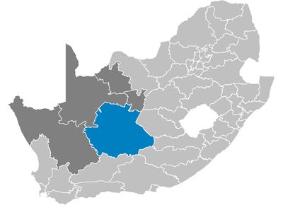
Pixley ka Seme District Municipality, District municipality in Northern Cape, South Africa

Pixley ka Seme is a district municipality in southeastern Northern Cape, spanning a large area across the province. The territory divides into eight local municipalities, with De Aar serving as the main administrative center for the entire district.

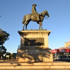
The municipality was established in 2000 and named after Pixley ka Isaka Seme, founder of the African National Congress. This naming honors a pivotal figure in South African history.

The population of 186,351 residents represents diverse communities, with Afrikaans speakers comprising 77 percent of the district's inhabitants.

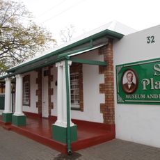
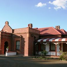
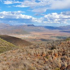
The district sits at varying elevations across different areas and seasons. Access and services are centered around De Aar, where visitors can find main facilities and information points.

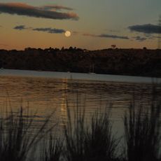
Two large dams, Vanderkloof and Gariep, define the district's borders and shape the water landscape. These structures serve as landmarks that many visitors initially overlook.

The community of curious travelers

AroundUs brings together thousands of curated places, local tips, and hidden gems, enriched daily by 60,000 contributors worldwide.

Start exploring
Location
Inception
December 5, 2000
Capital city
De Aar
Elevation above the sea
1,073 m
Shares border with
Namakwa District Municipality, ZF Mgcawu District Municipality, Frances Baard District Municipality, Xhariep District Municipality, Joe Gqabi District Municipality, Chris Hani District Municipality, Sarah Baartman District Municipality, Central Karoo District Municipality
GPS coordinates
-30.50000,23.50000
Latest update
December 8, 2025 13:44
Reviews
Share your experience

No review yet

Discussions
Start a discussion...

No discussion yet

« Pixley ka Seme District Municipality - District municipality in Northern Cape, South Africa » is provided by Around Us (aroundus.com). Images and texts are derived from Wikimedia project under a Creative Commons license. You are allowed to copy, distribute, and modify copies of this page, under the conditions set by the license, as long as this note is clearly visible.

Discover hidden gems everywhere you go!

From secret cafés to breathtaking viewpoints, skip the crowded tourist spots and find places that match your style. Our app makes it easy with voice search, smart filtering, route optimization, and insider tips from travelers worldwide. Download now for the complete mobile experience.

Around Us App Screenshot

A unique approach to discovering new places

Le Figaro

All the places worth exploring

France Info

A tailor-made excursion in just a few clicks

20 Minutes

Around Us
Travel Guide & Maps
Download

Send to your phone

QR Code
1

Open the camera app on your mobile.

2

Point at the QR code with your camera. A notification will appear.

3

Tap the notification to open the link.