Enable Location

We need your location to show you interesting places around you

Discover nearby places

Find interesting locations and hidden gems around you

Precise directions

Get accurate directions and distances to places

Your location is never shared with other users. It's only used when you tap the location button.

Mount Gorongosa

Log in to your account

Start exploring — it's free

Trusted by 63,416 travelers worldwide

Continue with Google
Continue with Apple
or

We will send you a code to connect

By continuing, you accept our Terms and Conditions and our Privacy Policy

Check your inbox

We've sent a pincode in your inbox. Please enter the code below.

Mount Gorongosa
Discussion Reviews 1 Photos 1 Collections
3.1k Popularity

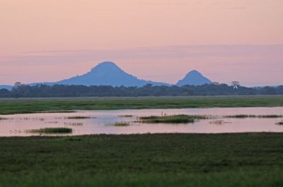
Mount Gorongosa, Mountain in Sofala Province, Mozambique

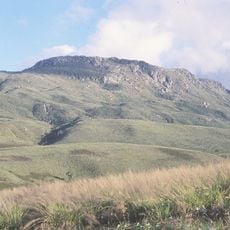
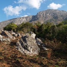
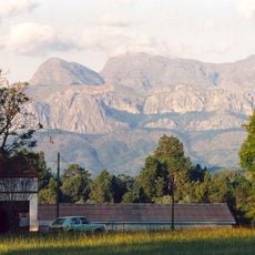
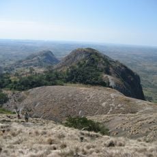
Mount Gorongosa is a major mountain formation in Sofala Province with three distinct peaks, the tallest being Gogogo located in the southwestern section. The massif rises above 1,800 meters and dominates the landscape of central Mozambique.

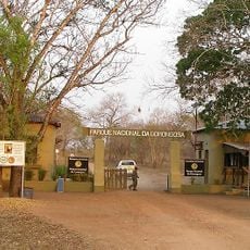
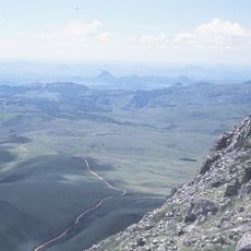
The mountain's upper zones above 700 meters gained protection in 2010 when Mozambique incorporated them into Gorongosa National Park. This conservation effort marked a shift in how the region manages its natural resources.

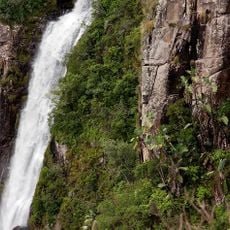
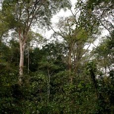
Local guides share their expertise about the mountain's biodiversity while leading visitors through various ecological zones from grasslands to montane forests.

The southern and eastern slopes receive more rainfall than the northern and western sides, creating varied hiking conditions throughout the year. Choose your climbing route based on these weather patterns and your preference for drier or wetter terrain.

The mountain contains granite formations dating from the Late Jurassic period and displays distinct ecosystems ranging from miombo woodlands to ericaceous heathlands. This geological variety makes it a place of interest for those curious about how ancient rock types shape the life found on the slopes.

The community of curious travelers

AroundUs brings together thousands of curated places, local tips, and hidden gems, enriched daily by 60,000 contributors worldwide.

Start exploring
Location
Elevation above the sea
1,863 m
GPS coordinates
-18.40389,34.10875
Latest update
December 6, 2025 17:43
Photo spots in Mozambique

Mozambique stretches along the Indian Ocean coast for 1,500 miles (2,400 kilometers) and presents photographers with diverse subjects. The coastal region includes archipelagos such as Bazaruto and Quirimbas with white sand beaches and coral reefs. Along the shore sit historic structures like Macuti...

Reviews
Share your experience

No review yet

Discussions
Start a discussion...

No discussion yet

« Mount Gorongosa - Mountain in Sofala Province, Mozambique » is provided by Around Us (aroundus.com). Images and texts are derived from Wikimedia project under a Creative Commons license. You are allowed to copy, distribute, and modify copies of this page, under the conditions set by the license, as long as this note is clearly visible.

Discover hidden gems everywhere you go!

From secret cafés to breathtaking viewpoints, skip the crowded tourist spots and find places that match your style. Our app makes it easy with voice search, smart filtering, route optimization, and insider tips from travelers worldwide. Download now for the complete mobile experience.

Around Us App Screenshot

A unique approach to discovering new places

Le Figaro

All the places worth exploring

France Info

A tailor-made excursion in just a few clicks

20 Minutes

Around Us
Travel Guide & Maps
Download

Send to your phone

QR Code
1

Open the camera app on your mobile.

2

Point at the QR code with your camera. A notification will appear.

3

Tap the notification to open the link.