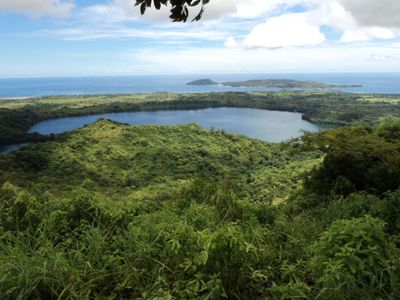
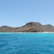
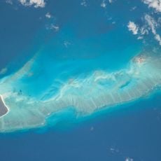
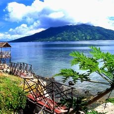
Nosy Sakatia, Island in northwest Madagascar
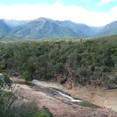
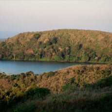
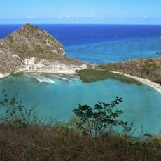
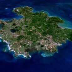
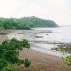
Nosy Sakatia is an island off the coast of Nosy Be in northwest Madagascar, surrounded by coral reefs that protect its waters. The island has a narrow, elongated shape and features shallow areas near the shore along with vegetation in its interior.
The island once served as a refuge for people escaping from forced labor on mainland plantations during colonial times. This history gives the place special meaning in Madagascar's past.
Residents here practice fishing as their main livelihood and grow vanilla, coffee, and orchids on small plots of land. These everyday activities shape daily life on the island and reflect the deep connection between the people and their environment.
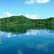
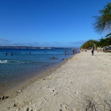
The island sits about 10 minutes away by boat from Nosy Be and can be visited year-round. Visitors should bring proper footwear for rocky shores and pack water and sun protection for snorkeling trips.
The waters around the island serve as a feeding ground for green sea turtles that visitors can observe while snorkeling in shallow areas. These creatures come regularly to the coastal zones to feed, making the place a natural spot for watching this vulnerable species.
GPS coordinates: -13.30055,48.16329
Latest update: December 6, 2025 19:01
Madagascar features natural landscapes ranging from the baobab avenues near Morondava to the limestone formations of the Tsingy and coastal areas with coral reefs. The country's national parks protect tropical rainforests inhabited by lemurs, along with geological features including crater lakes and...
Maromokotro
118.5 km
Marojejy National Park
208 km
Rainforests of the Atsinanana
210.5 km
Amber Mountain National Park
133.2 km
Red Tsingy
162.4 km
Lokobe Reserve
20.1 kmMayotte Marine Natural Park
301.4 km
Tsaratanana Reserve
104.6 kmMarine natural park of Glorioso Islands
213.5 km
Musée de Mayotte
320.4 km
Réserve naturelle nationale de l'archipel des Glorieuses
213.4 km
Résidence du gouverneur
320.5 km
Mont Passot
7.5 km
Plage de Moya
316.3 km
Нусі-Бе (вулкан)
34.7 km
St. Michael's Church, Dzaoudzi
320.6 km
Cascade d'Antomboka
133.5 kmRéserve naturelle nationale de l'îlot Mbouzi
322.4 km
Humbert Falls
211.8 km
Fanambana Bridge
199.4 km
Antaninaomby
28.4 km
Barracks of Petite Terre (Dzaoudzi, Mayotte)
320.5 km
Ramena Beach
173.4 km
Tanikely Lighthouse
21.7 km
Cap Miné Lighthouse
176.6 km
Hamouro Beach
322.9 km
Anjohibe Cave
285.1 km
LemuriaLand
16.5 kmVisited this place? Tap the stars to rate it and share your experience / photos with the community! Try now! You can cancel it anytime.
Discover hidden gems everywhere you go!
From secret cafés to breathtaking viewpoints, skip the crowded tourist spots and find places that match your style. Our app makes it easy with voice search, smart filtering, route optimization, and insider tips from travelers worldwide. Download now for the complete mobile experience.
A unique approach to discovering new places❞
— Le Figaro
All the places worth exploring❞
— France Info
A tailor-made excursion in just a few clicks❞
— 20 Minutes