Enable Location

We need your location to show you interesting places around you

Discover nearby places

Find interesting locations and hidden gems around you

Precise directions

Get accurate directions and distances to places

Your location is never shared with other users. It's only used when you tap the location button.

Doigt de Sainte-Anne

Log in to your account

Save your favorite places
Create custom travel routes
Rate and review places
Access the full interactive map
Continue with Google
Continue with Apple
Continue with email
By continuing, you accept our Terms and Conditions and our Privacy Policy
Create an account

Doigt de Sainte-Anne

Add to collection
Map
Suggest a change
Share

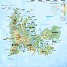
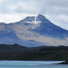
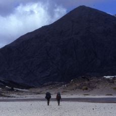
Doigt de Sainte-Anne, Volcanic plug in Gallieni Peninsula, Kerguelen Islands, France

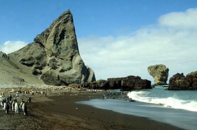
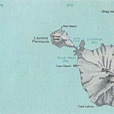
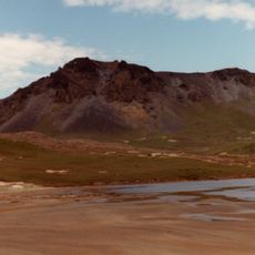
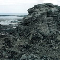
The Doigt de Sainte-Anne is a volcanic plug on Gallieni Peninsula in the Kerguelen Islands that rises approximately 235 meters above Larose Bay. The slender monolith is composed of light-colored trachyte rock and displays a distinctive tilt shaped by geological processes.

The formation received its name in 1908 from explorer Raymond Rallier du Baty, replacing an earlier designation on historical maps. This renaming was part of French efforts to establish official geographic nomenclature for the remote island region.

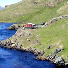
French scientists maintain research stations near this geological formation, conducting studies on volcanic processes and environmental patterns in the Southern Indian Ocean.

Access requires permission from French authorities and travel by specially equipped vessels designed for Southern Ocean conditions. Visitors should expect extreme weather and limited accessibility windows due to the remote location.

This formation stands alongside the Kerguelen Arch as one of only two major natural landmarks marking the islands. The two structures provide rare visual reference points across an otherwise flat and sparse landscape in the southern Indian Ocean.

Location: Kerguelen Islands

Elevation above the sea: 235 m

Made from material: trachyte

Part of: Gallieni Peninsula

GPS coordinates: -49.59450,69.38410

Latest update: December 14, 2025 20:24

Photos
Reviews

Visited this place? Tap the stars to rate it and share your experience / photos with the community! Try now! You can cancel it anytime.

« Doigt de Sainte-Anne - Volcanic plug in Gallieni Peninsula, Kerguelen Islands, France » is provided by Around Us (aroundus.com). Images and texts are derived from Wikimedia project under a Creative Commons license. You are allowed to copy, distribute, and modify copies of this page, under the conditions set by the license, as long as this note is clearly visible.

Discover hidden gems everywhere you go!

From secret cafés to breathtaking viewpoints, skip the crowded tourist spots and find places that match your style. Our app makes it easy with voice search, smart filtering, route optimization, and insider tips from travelers worldwide. Download now for the complete mobile experience.

Around Us App Screenshot

A unique approach to discovering new places

Le Figaro

All the places worth exploring

France Info

A tailor-made excursion in just a few clicks

20 Minutes